


234 Things to do near Fountain Park Trail
first prev 3 4 5 6 7 8 9 10 11 12 next lastShowing results within 50 miles Distance miles of 17001 N Panorama Dr, Fountain Hills, AZ 85268, USA City, Zip, or Address

Desert Tortoise
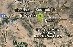
Phoenix, Arizona
23.9 miles NWAt just over a mile long, Desert Tortoise is a doubletrack connector to the Valle Verde Trail. Very good hiking area with a good range of difficulty levels. Starts with a short climb from the...
Hike, Mountain Bike
Dixie Mountain Loop Trail
Phoenix, Arizona
23.9 miles NWThe main loop trail at Phoenix's Sonoran Preserve provides plenty of options for either a short walk or a longer hike. The elevation gain is accumulated through small ups-and-downs along the...
Hike, Horseback, Mountain Bike
Hawk's Nest/Desert Tortoise/Dixie Mountain Loop
Phoenix, Arizona
23.9 miles NWA nice moderate trail through great desert scenery crossing creeks and twisting and turning around the hills. Provides a loop opportunity between Hawk's Nest Trail, Valle Verde Trail,...
Hike, Horseback, Mountain Bike
Union Peak Loop
Phoenix, Arizona
23.9 miles NWHike near Phoenix, Arizona
Hike
Sonoran Trail
Phoenix, Arizona
23.9 miles NWThe Sonora Trail is smooth, but hilly, and has a 10-12 mile loop course that is well marked at intersections. This ride is suitable for many levels, but beginners should have good...
Mountain Bike
Secret, Tech & K
Gold Canyon, Arizona
24.2 miles SEFrom the parking lot start riding the main trail by the sign. Ride about 30 feet and then take the single track trail to the right. This is called the Horse Trail and leads to all of...
Mountain Bike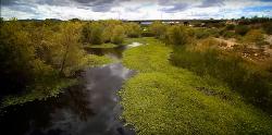
Rio Salado Habitat Restoration Area
Phoenix, Arizona
24.2 miles SWHike near Phoenix, Arizona
Hike 23.0 mi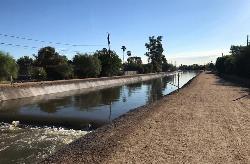
Grand Canal Trail
Phoenix, Arizona
24.4 miles WThe Grand Canal Trail is a 23-mile long system of paved and unpaved trails located in Glendale, Phoenix and Tempe that travels through...
Hike 2.3 mi
Hidden Valley Trail Via Mormon Trail
Phoenix, Arizona
24.7 miles SWHidden Valley Trail via Mormon Trail is a 2-4 mile hike, depending on the route you choose to take and how much additional exploring you do. This hike offers a natural rock tunnel, petroglyphs,...
Hike, Mountain Bike
Bobcat Trail - Sonoran Preserve
Phoenix, Arizona
24.9 miles NWBobcat Trail is a short, easy trail, often used for connecting to other bigger trails in the Sonoran Desert Preserve. This is a 2 mile out-and back trail. There isn't much of a parking...
Hike
Tower Road - Sonoran Preserve
Phoenix, Arizona
25.0 miles NWShort and steep (.6 mile each way) out and back asphalt road to the radio tower.
Hike
Sidewinder-Ocotillo-West Loop
Phoenix, Arizona
25.0 miles NWThis loop starts at Carefree Hwy and 7th Ave, be aware there is limited parking at the trailhead. The Ocotillo part of the trail is relatively flat and the Sidewinder part has some good...
Hike, Horseback, Mountain Bike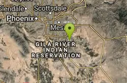
Marbella Vineyards
Gilbert, Arizona
25.1 miles SShort straight shots over grass with few trees to baskets surrounding a subdivision neighborhood park. Undefined tees. Reverse to make 18. Private (No Fee)
Disc Golf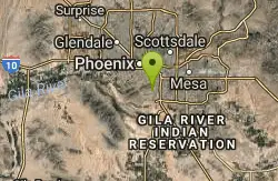
Old Man Trail
Phoenix, Arizona
25.3 miles SWRanger Office Phone: (602) 262-7393 Hours for all trailhead areas and entrances: 5 a.m. to 7 p.m. (entrance gates close). Trails remain open until 11 p.m.
Hike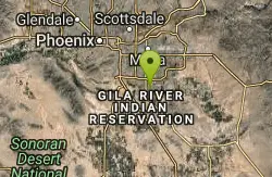
Paseo Vista Recreation Area
Chandler, Arizona
25.6 miles SMulti-use park on a former land fill site. 11 holes have dual tees and 1 hole has 2 baskets. Mostly wide open with some OB. Features 2 concrete culvert mandos through pipe. Multiple berms and a...
Disc Golf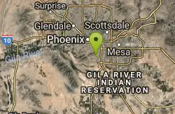
Corona Loop
Phoenix, Arizona
25.8 miles SWThis is a good hike, take plenty of water and a map or gps would be a very good ideal. I went up the day after we got over a inch of rain so lot of places were washed out. i looked like...
Hike 5.4 mi
Denton Trail #69
Tonto Basin, Arizona
26.0 miles NEFrom FR 421, the trail climbs steadily up the east face of the mountain. Some sections are quite steep. The trail eventually tops out at 5,760 feet elevation and then descends to Big Pine Flat for...
Hike, Mountain Bike
Sycamore Trail #68
Tonto Basin, Arizona
26.1 miles NEFrom FR 421, the trail climbs steadily through lower Sonoran Desert and riparian vegetation up the arroyo formed by Sycamore Creek. It turns northward and continues to climb along a...
Mountain Bike
Corona de Loma Trail
Phoenix, Arizona
26.2 miles SWquick climb to the top of Buena Vista lookout. Great view of the east vally
Hike
Deem Hill
Phoenix, Arizona
26.2 miles WThe trail starts out going north around the mountain then heads uphill and gives you some good inclines with switch backs. Total incline is approximately 650'. The trail is rocky and...
Mountain Bike


