


85 Things to do near Eastside Trail
first prev 1 2 3 4 5 next lastShowing results within 50 miles Distance miles of Forest Rd 297, Horseshoe Bend, ID 83629, USA City, Zip, or Address
Mahalo
Horseshoe Bend, Idaho
0.3 miles NENew trail in the Boise area connecting Bogus Basin/Shafer Butte trails to other Ridge to Rivers Trails (that is, this trail bypasses some of Ridge Road). Singletrack with good flow and...
Mountain Bike
Elk Meadows
Horseshoe Bend, Idaho
0.7 miles Nride east up behind Pioneer Lodge past the tennis courts on your left. the double track becomes more defined
Mountain Bike
Stack Rock Loop
Boise, Idaho
0.9 miles SRide the single track trail Entrance Exam until you hit Stack Rock Loop. The loops begins with a steep uphill on a wide trail. Near the top the trail is once again single track as the...
Mountain Bike
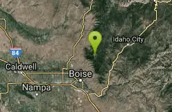
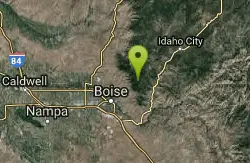
East Side Trail
Boise, Idaho
1.7 miles SWOnce we park we take a truck to the top of Bogus Basin Ski Resort and we take The East Side trail down from the resort to the Hard Guy Parking Area.While this one is mostly downhill...
Mountain Bike
Eagleson Road
Boise, Idaho
4.6 miles SETwisty somewhat steep 2-track trail with a few whoops and sharp off-camber turn about 3 miles long between Boise Ridge Rd. and Crocked Summit. Good for practicing riding skills.
Atv/motorcycle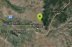
Bogus Basin - Pioneer
Boise, Idaho
6.1 miles SWClosed during ski season. Two 9-hole loops. Trees and beautiful views. Wear jeans and boots. PLEASE pack out litter. Camp at Shafer Butte. Bathrooms at Pioneer Lodge. Public (No Fee)
Disc Golf
Bogus Basin - Simplot
Boise, Idaho
6.1 miles SWBeginner friendly 9 hole course at main lodge of Bogus Basin Ski Resort. Public (No Fee)
Disc Golf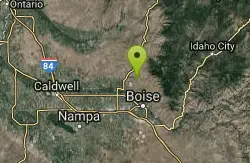
Hidden Springs
Boise, Idaho
7.6 miles WA small network of three trails: Redtail Trail, Lookout Loop Trail, and Current Creek Trail. Singletrack that wind through hills and along new development in the Dry Creek valley....
Mountain Bike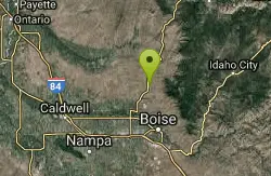
Spring Valley
Boise, Idaho
7.8 miles WNice trail in scenic drainage of Spring Creek in Avimore trail network. Smooth singletrack with some rocky technical spots.
Mountain Bike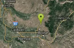
Coyote Run
Boise, Idaho
7.8 miles WDusty dry single track, mixed with some double track at the top.
Mountain Bike
Corrals
Boise, Idaho
7.9 miles SWA generally wide trail, sometimes part of an old road, that connects over to Bob's, Scotts, or 8th Street, and is a necessary start to access Hard Guy. Less used that Hulls Gulch or...
Mountain Bike
8th Street Motorcycle Trail
Boise, Idaho
7.9 miles SThis is steep, rocky and sandy. You must be able to control your bike in sand. The motorcycles cut this trail up fairly good for the first half. Second half is more of what you would...
Mountain Bike
Polecat Gulch
Garden City, Idaho
8.1 miles SWSmall network with one larger loop (Polecat Loop) and two connector trails (Doe Ridge, Quick Draw) inbetween. Nice singletrack that winds around the Polecat Gulch Area. A few sandy...
Mountain Bike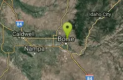
Simplot Hill
Boise, Idaho
8.7 miles SWLength: ~500-600ft Slope: ~45-50°
Sled
Corral Loop
Boise, Idaho
9.0 miles SWTrail is easy double track with gradual climb. Continue on main trail until it curves left up a steep hill. Stay on obvious track to the right. Continues until you come to an old run...
Mountain Bike
Orchard / 5 Mile / Watchman
Boise, Idaho
9.0 miles SOrchard Gulch, 5 mile Gulch, and Watchman are three interconnected trails in the upper foothills off Rocky Canyon Rd above the Military Reserve system and above Three Bears. Good...
Mountain Bike
Crest Line To Lower Hull's Gulch
Boise, Idaho
9.1 miles SWTrial is a nice loop that starts at Crestline and comes back around on Lower Hull's
Mountain Bike
Hillside to the Hollow
Boise, Idaho
9.6 miles SWOpen space in the central foothills with multi-use trails.
Mountain Bike
Seaman's Gulch
Garden City, Idaho
9.7 miles SWFrom the parking lot, head south and either turn left at the water tank for a short and somewhat steep climb to the ridge, or follow the trail along the road for a longer, more gradual...
Mountain Bike
Kestrel, Crestline, Red Cliffs and Chickadee Ridge
Boise, Idaho
9.9 miles SWFrom Camelsback Park ride up to Kestrel. Once at the top of the little climb you make a left on Crestline Trail and continue up to the junction with Red Cliffs where you turn left...
Mountain Bike


