


93 Things to do near Devil Dog Loop #117
first prev 1 2 3 4 5 next lastShowing results within 50 miles Distance miles of Forest Service Rd 108, Williams, AZ 86046, USA City, Zip, or Address
Stage Station Loop
Williams, Arizona
6.6 miles SThis is a pleasant ride over rolling terrain along a primitive road that winds through ponderosa pine forests, pinyon and juniper stands and open grasslands. The scenery consists of...
Mountain Bike
Sunflower Flat
Williams, Arizona
12.8 miles SEThis ride is actually two rides in one. The first follows a secondary road through flat open forest country with a short detour to one of the best views on the forest. The second traces...
Mountain Bike
Round Mountain Loop
Williams, Arizona
16.6 miles SEThis ride follows a little used forest road that passes through virtually every type of ponderosa pine habitat that one could find on the south Kaibab. The scenery here is diverse....
Mountain Bike
Coxcomb Mountain Bike Trail
Williams, Arizona
16.9 miles NEThe Coxcombs Loop follows a sparsely traveled road that climbs and dips over rolling terrain. The hills are all of moderate length and gradient, and the road surface is fairly smooth....
Mountain Bike
Sycamore Rim Trail
Parks, Arizona
17.1 miles EMost people come to this ride for the view of Sycamore Canyon at the overlook, but the scenery along the way is worth the trip, too. The ride starts out in a ponderosa pine forest where...
Mountain Bike
Spring Valley Loop
Williams, Arizona
20.5 miles NEThe Spring Valley Loop offers a ride on remote roads and trails with good views and abundant wildlife. Since the route serves as a cross country ski trail in winter, it offers the fat...
Mountain Bike
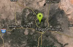
Pumpkin Trail to Bulls Basin Trail Loop
Flagstaff, Arizona
25.1 miles NEHike
Kendrick Peak Trail
Flagstaff, Arizona
25.1 miles NEHike
Sycamore Canyon
Sedona, Arizona
25.8 miles SEA very pleasant 3.5 mile round trip hike down into a canyon and along a perennial stream to several swimming holes. Bathing suits: May be optional at farther...
Swim
Barn Burner Course
Flagstaff, Arizona
29.4 miles ENice fast smooth trail with some good climbing and a few technical sections.
Mountain Bike
Slate Mountain Trail
Flagstaff, Arizona
31.1 miles NEDirections from Flagstaff: Drive 35 miles north on US 180 to FR 191. Turn west 2 miles to the trailhead on the right side of the road. US 180 is paved. FR 191 is graveled and suitable...
Hike
Arizona Trail: Flagstaff
Flagstaff, Arizona
32.4 miles ELeaving the back of Buffalo Park, stay right on the MT Elden Trail System. Any combination of this network of trails will get you over to the east side where you pick up the AZT and follow that to...
Mountain Bike
Cockscomb Trail
Sedona, Arizona
32.4 miles SEAs with most trails in Sedona, a recreation pass is required to park your car at the trailhead. There is a kiosk at a nearby parking area. From the Cockscomb trailhead, ride to the left...
Mountain Bike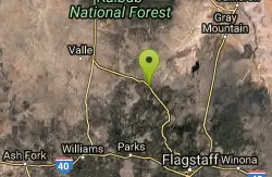
Red Mountain Trail
Flagstaff, Arizona
32.5 miles NEHike
Arizona Snowbowl
Flagstaff, Arizona
32.9 miles EPremier course nestled below the summit of the majestic Humphreys Peak. Starts and finishes at the Agassiz Lodge (9500'), with a practice basket just outside the Lodge. Map at website. Public...
Disc Golf
Dawa Loop
Sedona, Arizona
33.2 miles SESometimes you are traveling with kids or neophyte mountain bikers and are wondering where to take them. The following route describes a fun and fairly easy practice trail. Can't...
Mountain Bike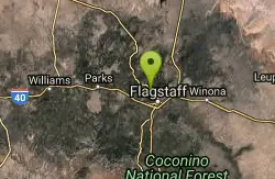
Fort Valley Trail System
Flagstaff, Arizona
33.3 miles ELocated at the base of the San Francisco Peaks, the Fort Valley Trail System was designed primarily for connecting popular mountain biking trails. This system is a multi-use trail to be...
Mountain Bike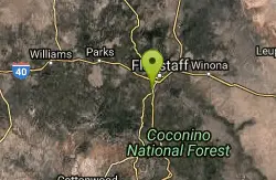
Soldiers Loop / Fairgrounds trails
Flagstaff, Arizona
33.4 miles ESoldiers Loop makes a loop around the park with moderate ups and downs and not really any tech to worry about. Bridge Trail cuts through the center of the loop and has more more tech...
Mountain Bike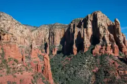
Brins Mesa Trail
Sedona, Arizona
33.5 miles SEBrins Mesa Trail is located in the Coconino National Forest just at the edge of the town of Sedona. This trail will provide picturesque views of the gorgeous, geological landscape. Brins...
Hike 1.0 mi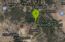
Harding Springs Trail
Sedona, Arizona
33.9 miles SEHarding Springs Trail is a beautiful hiking trail in Sedona, Arizona. This trail was originally one of several that provided a way for cattlemen to drive their stock in and out of Oak Creek...
Hike


