104 Things to do near Sky Rim Trail to Sheep Mountain
first prev 1 2 3 4 5 6 next lastShowing results within 50 miles Distance miles of 85QC2VPP+48 City, Zip, or Address

Daly Creek
Gallatin Gateway, Montana
1.5 miles NWDaly Creek Trail is a 5.2 mile out and back trail located near Gallatin Gateway, Montana and is good for all skill levels. The trail is primarily used for hiking and is accessible from May until...
Hike
Little Wapiti
Gallatin Gateway, Montana
8.2 miles WThe climb is partially double track. The descent is narrow, at times rocky, singletrack. Gorgeous views. At 9,000 plus feet...wolf tracks, too.
Mountain Bike
Buck Ridge
Gallatin Gateway, Montana
12.8 miles NWThis is a ride you do for the scenery rather than the singletrack. It is an out-and-back on about 8 miles of doubletrack/atv trail. Most of the ride give you fantastic views of the...
Mountain Bike
Cabin Creek
West Yellowstone, Montana
16.0 miles SWStarts out as a nice, buff trail. After a mile or two, there are a lot of tough creek crossings and when I rode it in 2010 there were a lot of trees down. This was from a recent...
Mountain Bike
Ousel Falls
Big Sky, Montana
17.9 miles NWI rode this everyday before work! There is a bathroom at the top of the trail and people, horses and bikes are allowed on this double-wide packed trail. This is a great trail for any...
Mountain Bike
Ousel Falls
Gallatin Gateway, Montana
18.0 miles NWOusel Falls Park Trail is a 1.7 mile out and back trail located near Big Sky, Montana that features a waterfall. The trail is primarily used for hiking and is accessible from May until October.
Hike, Rock Climb, Swim
Bighorn Ridge
Big Sky, Montana
18.6 miles NWShort but challenging with lots of fun shots. Fairly open on the front 9, fairly wooded on the back 9. Support Big Sky Community Park. Public (No Fee)
Disc Golf 3.8 mi
Abandoned Railroad Bed Bike Trail
Gardiner, Montana
19.5 miles EThe Abandoned Railroad Bed Bike Trail, otherwise known as Shortline Trail, is a easily accessible bike trail found just inside the North Entrance of Yellowstone National Park. This bike trail follows...
Mountain Bike 7.8 mi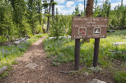
Osprey Falls Trail
Mammoth Hot Springs, Yellowstone National Park
20.2 miles EOsprey Falls Trail is an 8 mile out and back trail near Mammoth Hot Springs that provides hikers with a variety of stunning views, including ravines and a waterfall. Hikers begin this hike...
Hike 8.4 mi
Bunsen Peak Loop Bike Trail
Yellowstone National Park, Wyoming
20.2 miles EBunsen Peak Loop Bike Trail is a challenging trail that follows several service roads around Bunsen Peak. This 10 mile loop has a total elevation change of 1,120 feet, with several miles of the trail...
Mountain Bike 4.0 mi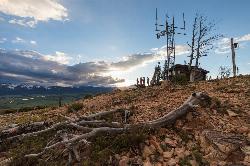
Bunsen Peak Trail
Mammoth Hot Springs, Yellowstone National Park
20.2 miles EBunsen Peak Trail is a 4.6 mile hike to the peak of Mount Bunsen. This is an out and back trail and is considered moderately difficult because of the 1,300 foot climb in elevation. ...
Hike 2.0 mi
Snow Pass Trail
Yellowstone National Park Wyoming
20.3 miles ESnow Pass Trail is a beautiful day hike for visitors to Yellowstone looking to escape the crowds. Located a half mile south of the Mammoth Hot Springs Upper Terraces. Parking is available at a...
Backpack, Hike 8.1 mi
Sepulcher Mountain Trail
Mammoth Hot Springs, Yellowstone National Park
20.5 miles ESepulcher Mountain Trail is an 11 mile loop trail from Mammoth Hot Springs to the peak of Sepulcher Mountain. This is a challenging hike with a 3,500 foot ascent to the 9,652 foot peak. The...
Hike 5.3 mi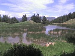
Beaver Ponds Trail
Mammoth, Yellowstone National Park
20.5 miles EBeaver Ponds Trail is a wonderful short hike accessible from Mammoth Hot Springs. The trail forms a loop between the two trailheads available at Mammoth Hot Springs. The loop is just over 5 miles...
Hike 0.1-5.2 mi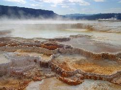
Mammoth Hot Springs
Mammoth, Yellowstone National Park
20.5 miles EMammoth Hot Springs is a unique sight in Yellowstone National Park. The soft limestone in this area allowed the water to form colorful terraces. The extremely hot running water is clear and smooth,...
Camp, Hike 7.9 mi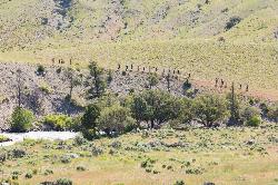
Rescue Creek Trail
Mammoth Hot Springs, Yellowstone National Park
20.6 miles ERescue Creek Trail is an 8 mile hike that crosses the Montana/Wyoming boarder. This double trail makes for a leisurely hike through beautiful hills and colorful yellow green grasslands. This trail,...
Hike
Mammoth/Gardiner Back Road
Mammoth Hot Springs, Yellowstone National Park
20.6 miles EThe only road open in Yellowstone National Park is Highway 89 at Gardiner, Montana to park Headquarters at Mammoth Hot Springs and from Mammoth Hot Springs to Silver Gate and Cooke City, Montana.
Hike, Mountain Bike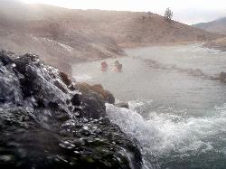
Boiling River
North Entrance, Yellowstone National Park
20.9 miles EThe Boiling River is created where a large hot spring enters the Gardner River, allowing the hot and cool waters to mix into a temperature comfortable enough to bathe in. The natural hot tub makes a...
Hot Springs, Swim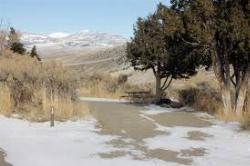
Mammoth Hot Springs Campground
Mammoth Hot Springs, Yellowstone National Park
20.9 miles EMammoth Hot Springs Campground is the only campground in Yellowstone that is open to campers year-round. Campsites cannot be reserved and are available on a first come first served basis. It is...
Camp 4.0 mi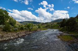
Lava Creek Trail
Mammoth Hot Springs, Yellowstone National Park
21.0 miles ELava Creek Trail is a 4.2 mile hike where hikers can enjoy walking along the scenic Lava Creek. The trail passes Undine Falls and the Gardner River. Undine Falls is a beautiful 60 foot...
Hike


