


235 Things to do near Camelback Mountain
first prev 3 4 5 6 7 8 9 10 11 12 next lastShowing results within 50 miles Distance miles of 5700 N Echo Canyon Dr, Phoenix, AZ 85018, USA City, Zip, or Address
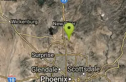
Tower Road - Sonoran Preserve
Phoenix, Arizona
20.2 miles NShort and steep (.6 mile each way) out and back asphalt road to the radio tower.
Hike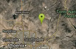
Granite Mountain Loop
Scottsdale, Arizona
20.2 miles NEThis is a multi-use trail with hikers and equestrians, but for the most part it is not well-traveled. Much of the trail is single-track and the west side of Granite Mountain has a...
Mountain Bike
Chandler Skatepark
Chandler, Arizona
20.5 miles SChandler, an outdoor 33,000-square-foot park, has been reported to be the best skatepark in Arizona. Designed by SITE Systems Design Group, it features ledges, two bowls, banks, quarterpipes,...
Skateboard
Pass Mountain
Mesa, Arizona
20.6 miles EMultiple loop options and trails with various degrees of difficulty. Beginners/novices will enjoy Moonrock and Blevins trails while experts will enjoy Pass Mt and the Cat Peaks loops. I...
Mountain Bike
Buckhorn Campground Nature Trail
Apache Junction, Arizona
20.6 miles ECamp and Hike near Apache Junction, Arizona
Camp, Hike
Paseo Vista Recreation Area
Chandler, Arizona
20.8 miles SEMulti-use park on a former land fill site. 11 holes have dual tees and 1 hole has 2 baskets. Mostly wide open with some OB. Features 2 concrete culvert mandos through pipe. Multiple berms and a...
Disc Golf 1.5 mi
Moon Rock Loop
Apache Junction, Arizona
21.0 miles ELocated within the larger Usery Mountain Regional Park, the Moon Rock loop is a fast and smooth trail that adds 1.3 miles to the more famous Blevins Trail. Although the Moon Rock loop is not known as...
Hike, Horseback, Mountain Bike 1.7 mi
Levee Trail
Mesa, Arizona
21.0 miles ELocated within the Usery Mountain Regional Park, the Levee trail is named so because it mostly follows the top of levee, running parallel to a large section of the channel trail and a Phoenix...
Hike, Horseback, Mountain Bike
Usery Mountain Regional Park
Mesa, Arizona
21.1 miles EThere are many miles of two-way single-track trails in the park at several levels of difficulty. The Pass Mountain Trail should challenge intermediate to advanced riders. The Cat Peaks...
Mountain Bike
Crismon Wash Trail
Mesa, Arizona
21.2 miles EThe Crismon Wash Trail is 1.8 mile trail that is accessible from the south at the Crismon road trailhead. It is also accessible from the Blevins train to the north. There are several...
Hike, Horseback, Mountain Bike
Clay Mine Trail
Cave Creek, Arizona
21.3 miles NClay Mine Trail is a 1.6 mile out-and-back, beginner friendly trail in Cave Creek Regional Park. This is a trail that is very close to the Visitor Center. It's not too difficult but there...
Hike
Sunrise Mountain Trail
Peoria, Arizona
21.4 miles NWThe Sunrise Mountain Trail can be found within the suburban area of Peoria, Arizona; it is made of up 3 sequential loops; each loop harder than the last. The trail is easy to find, as...
Hike, Mountain Bike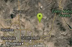
Whiskey Bottle Trail
Scottsdale, Arizona
21.4 miles NEThe trail starts off with sandy single-track then starts a gradual ascent up the side of Fraesfield mountain. The trail then sharply increases (total of 800' elevation gain) and becomes...
Mountain Bike
Cat Peaks - Blevin - Moonrock
Apache Junction, Arizona
21.4 miles EFollow Blevins trail 0.6 miles, the entrance to the Moonrock loop will be on your right, marked by a brown sign and arrow. Take this loop (around 1.4 miles) until it returns to Blevin's...
Mountain Bike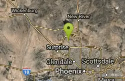
West Wing Mountain Advanced Trail
Peoria, Arizona
21.5 miles NWHike near Peoria, Arizona
Hike 21.4 mi
Spur Cross to Lake Pleasant
Cave Creek, Arizona
21.6 miles NStart at the Flat Tire Bike Shop and head north on Spur Cross Road. You will arrive at the Spur Cross Conservation Ranch in 3.2mi. From there enter the Maricopa Trail system and follow the signs...
Mountain Bike 5.8 mi
Go John Trail
Cave Creek, Arizona
21.6 miles NThe Go John Trail is a 5.8 mile loop trail outside of Cave Creek, Arizona, that is moderately trafficked, used by both hikers and mountain bikers. It is an excellent opportunity to view the desert...
Hike, Horseback, Mountain Bike
Cave Creek Park
Cave Creek, Arizona
21.6 miles NMultiple singletrack loops, just explore and find what works best for you. Watch out for hikers and horses.
Mountain Bike

Goodyear Skatepark
Goodyear, Arizona
22.4 miles WSkate Park Rules USE AT YOUR OWN RISK! This skate park is not supervised. This facility is used by both experienced and inexperienced skaters and riders. Serious injury or death may result from...
Skateboard 8.3 mi
Estrella Mountains Competitive Track
Tolleson, Arizona
22.4 miles SWThe third competitive track in the Maricopa County Regional Park system, located in Estrella Mountain Regional Park, was completed in February 2000. The track consists of two loops totaling 13 miles....
Hike, Horseback, Mountain Bike


