


235 Things to do near Camelback Mountain
first prev 1 2 3 4 5 6 7 8 9 10 next lastShowing results within 50 miles Distance miles of 5700 N Echo Canyon Dr, Phoenix, AZ 85018, USA City, Zip, or Address
Gateway and Tom's Thumb Loop Trail
Scottsdale, Arizona
11.0 miles NEStarting at the 104th St trailhead, head toward the Gateway loop trail. Turn right at the Gateway loop. Next take the Bell pass trail and be prepared for a steep climb. Once you hit...
Hike, Horseback, Mountain Bike
Gatewa-Prospector-Thompson Peak Road Trail
Scottsdale, Arizona
11.0 miles NEHike near Scottsdale, Arizona
Hike
Inspiration Point
Scottsdale, Arizona
11.0 miles NEInspiration Point is a 5.7, moderate hike located on the McDowell Sonoran Preserve near Scottsdale, Arizona. You'll begin your hike at the Gateway area, where you can find a parking lot...
Hike, Mountain Bike 2.3 mi

Hidden Valley Trail Via Mormon Trail
Phoenix, Arizona
11.2 miles SHidden Valley Trail via Mormon Trail is a 2-4 mile hike, depending on the route you choose to take and how much additional exploring you do. This hike offers a natural rock tunnel, petroglyphs,...
Hike, Mountain Bike 0.6 mi
Horseshoe Trail
Scottsdale, Arizona
11.3 miles NEHorseshoe trail is a short, fun singletrack with a lot of quick turns created by wash areas and rocks. It's a nice warm-up heading to Gateway Loop Trail. In some areas there are a lot of cactus,...
Hike, Horseback, Mountain Bike
Scarlett Canyon
Phoenix, Arizona
11.4 miles NScarlett Canyon trail (not officially named) is an unmarked trail adjacent to the Scarlett Canyon residential neighborhood. This is a 3 mile loop trail considered to be easy to...
Hike, Horseback, Mountain Bike, Rock Climb
Reach 11 Trail
Phoenix, Arizona
11.5 miles NHike near Phoenix, Arizona
Hike
Conocido Park
Phoenix, Arizona
11.6 miles NWMostly flat grassy holes with trees in play. Dual tees. Requires hyzers, anhyzers, rollers and tubes. Play backwards for 18. Alt. pins vary difficulty. Public (No Fee)
Disc Golf
Tempe Skatepark
Tempe, Arizona
12.6 miles SPark has a really fun bowl section, also a couple nice kinked rails and some stairs, weird lines but really fun.
Skateboard
Old Man Trail
Phoenix, Arizona
12.8 miles SRanger Office Phone: (602) 262-7393 Hours for all trailhead areas and entrances: 5 a.m. to 7 p.m. (entrance gates close). Trails remain open until 11 p.m.
Hike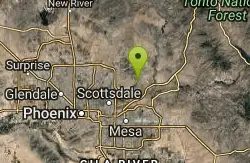
Sunrise Peak via Sunrise Trail
Scottsdale, Arizona
12.9 miles NEHike near Scottsdale, Arizona
Hike
Holbert-Hidden Valley-Mormon Trail Shuttle
Phoenix, Arizona
13.0 miles SWHolbert- Hidden Valley- Mormon Trail is a combination trail hike on the north side of South Mountain near Phoenix, Arizona. This trail is approximately 6.5 miles long, and is suitable for...
Hike, Mountain Bike 0.2-5.0 mi
Holbert Trail to Dobbins Lookout
Phoenix, Arizona
13.0 miles SWStart out at the main entrance to South Mountain and make a left past the vistor's center. Go to the end of the road to the beginning of Holbert Trail. Get to the top and make a right to Dobbins...
Hike
Max Delta
Phoenix, Arizona
13.0 miles SWThis trails follows close to San Juan Rd. Part of the trail is rocky while other parts are well just dirt. Max Delta Trail is a 2.7 mile trail within Phoenix, Arizona on the South Mountain...
Hike 2.5 mi
Hidden Valley from Buena Vista Trail
Phoenix, Arizona
13.0 miles SFor an easily accessible trail, butting right up against Phoenix’s southern border, it is truly surprising how special, quiet and natural the hike through Hidden Valley is! The path...
Hike, Mountain Bike
Reed Skatepark
Mesa, Arizona
13.0 miles SEThis nineteen acre outdoor concrete skatepark is fairly big. It features an intermediate level street course, a combi pool, hips, and a large beginners area. For more information call Mesa Reed...
Skateboard
Desert West Skateboard Plaza
Phoenix, Arizona
13.5 miles W25,000 sq.feet: concrete bowl, street course, ramps, pads and helmets required, free. Open every day 7am to 10pm. one of the first parks built in phoenix, fun for beginners, boring if you really...
Skateboard
Corona Loop
Phoenix, Arizona
13.5 miles SThis is a good hike, take plenty of water and a map or gps would be a very good ideal. I went up the day after we got over a inch of rain so lot of places were washed out. i looked like...
Hike
Thunderbird-Paseo
Glendale, Arizona
13.7 miles NWIn a drainage canal with mostly side hill pins. Starts and ends at playground/restroom area. A range of difficulty - with some length and uphill approaches. Pack water. Some tees are on blacktop...
Disc Golf
Emerald Park
Mesa, Arizona
13.7 miles SEMost holes feature open grassy fairways with limited trees. Pond in play on couple of holes. Alt. pin locations. Play backwards for 18 (bring the map). Practice basket south of the basketball court....
Disc Golf


