


230 Things to do near Buffalo Ridge Park
Showing results within 50 miles Distance miles of 19250 N 16th St, Phoenix, AZ 85024, USA City, Zip, or Address

Scarlett Canyon
Phoenix, Arizona
1.2 miles NScarlett Canyon trail (not officially named) is an unmarked trail adjacent to the Scarlett Canyon residential neighborhood. This is a 3 mile loop trail considered to be easy to...
Hike, Horseback, Mountain Bike, Rock Climb
Reach 11 Trail
Phoenix, Arizona
1.9 miles NEHike near Phoenix, Arizona
Hike
Lookout Mountain Summit Trail
Phoenix, Arizona
2.3 miles SLookout Mountain Summit Trail is a short, 1 mile trail in Phoenix, Arizona. The trail is steep, especially towards the summit, but it's manageable, and well worth the...
Hike
Lookout Mountain Circumference Trail
Phoenix, Arizona
2.3 miles SHike near Phoenix, Arizona
Hike
Paradise Valley Skatepark
Phoenix, Arizona
3.0 miles EThis place is really good, has a decent flow to it, some great bowls with a spine. Some good rails and fun transitions, worth checking out if in the area. Free pads required. This park covers...
Skateboard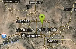
Shadow Mountain Trail
Phoenix, Arizona
3.1 miles SThis particular route trailhead starts at 23rd place and Sweetwater rd it's a great wildlife trail.
Hike

Shaw Butte and Charles M Christiansen Loop Trail
Phoenix, Arizona
4.4 miles SWhen you say "North Mountain," I think most Arizonans know where it is or can find it. When you say "Shaw Butte," it seems like you get a lot more questioning glances and "huh?". Shaw...
Hike, Mountain Bike
North Mountain National Trail
Phoenix, Arizona
5.0 miles SNorth Mountain National Trail is a 2.3 mile moderate, loop trail near Phoenix. It's easy to travel on if you go up the paved sections. The inclines are steep in parts, making it a real...
Hike
Conocido Park
Phoenix, Arizona
5.1 miles SWMostly flat grassy holes with trees in play. Dual tees. Requires hyzers, anhyzers, rollers and tubes. Play backwards for 18. Alt. pins vary difficulty. Public (No Fee)
Disc Golf
Sweetwater
Phoenix, Arizona
5.4 miles SWHilly and challenging moderate length course in a dry lake bed. Not well marked - bring the map. Concrete tees on front 9. Public (No Fee)
Disc Golf
Maxine Lakin Nature Trail
Phoenix, Arizona
6.0 miles SHike near Phoenix, Arizona
Hike
Sonoran Trail
Phoenix, Arizona
6.3 miles NWThe Sonora Trail is smooth, but hilly, and has a 10-12 mile loop course that is well marked at intersections. This ride is suitable for many levels, but beginners should have good...
Mountain Bike
Hawk's Nest Trail and Dixie Mountain Loop
Phoenix, Arizona
6.3 miles NWModerate Trail providing access from the Car Park to all other trails. Directly links to Desert Tortoise Trail and Dixie Mountain Loop. Good hiking shoes/boots recommended....
Hike, Horseback, Mountain Bike
Hawk's Nest/Desert Tortoise/Dixie Mountain Loop
Phoenix, Arizona
6.3 miles NWA nice moderate trail through great desert scenery crossing creeks and twisting and turning around the hills. Provides a loop opportunity between Hawk's Nest Trail, Valle Verde Trail,...
Hike, Horseback, Mountain Bike
Dixie Mountain Loop with Two Summits
Phoenix, Arizona
6.3 miles NWHike, Horseback, and Mountain Bike near Phoenix, Arizona
Hike, Horseback, Mountain Bike
Western Vista Trail
Phoenix, Arizona
6.3 miles NWFairly difficult short Trail to one of the summits on the Dixie Mountain Loop. Great views from the top as well as a birds eye view of the gravel pit below.
Hike 2.8 mi
Desert Tortoise
Phoenix, Arizona
6.3 miles NWAt just over a mile long, Desert Tortoise is a doubletrack connector to the Valle Verde Trail. Very good hiking area with a good range of difficulty levels. Starts with a short climb from the...
Hike, Mountain Bike
Dixie Summit Trail
Phoenix, Arizona
6.3 miles NWA steep and difficult short trail using many switchbacks to get to the summit. You will be rewarded with spectacular views of the surrounding area.
Hike
Dixie Mountain Loop Trail
Phoenix, Arizona
6.3 miles NWThe main loop trail at Phoenix's Sonoran Preserve provides plenty of options for either a short walk or a longer hike. The elevation gain is accumulated through small ups-and-downs along the...
Hike, Horseback, Mountain Bike
Union Peak Loop
Phoenix, Arizona
6.3 miles NWHike near Phoenix, Arizona
Hike
Trail #100
Phoenix, Arizona
6.6 miles SFrom Dreamy Draw you can head NW on Trail 100 and immeadiately hit a ridge with good views. Ride on for 5 - 6 miles of nice single track and great views, to 7th and return. If you...
Mountain Bike 1.3 mi
Dreamy Draw Loop Trail
Phoenix, Arizona
6.7 miles SThe Dreamy Draw Nature Trail is a short multi-access loop trail that provides a true Sonoran Desert experience. The trail crosses a number of desert washes and, at times, becomes somewhat rocky....
Hike, Horseback, Mountain Bike 4.8 mi
Trail 1A
Phoenix, Arizona
6.8 miles SThe trail can be accessed from the Dreamy Draw Park parking lot. From there, the trail can be ridden south towards its origin, or east (the trail makes an "L" shape). It is a mix of double...
Mountain Bike 4.6 mi
Mystery Loop
Phoenix, Arizona
6.9 miles SEThe trail is a nice combination of technical rock trail, washes, and climbs. There is a large network of trails to make the ride longer or shorter depending upon your needs. These trails cross over...
Mountain Bike
L.V. Yates to "Two Bit" Peak Loop
Phoenix, Arizona
7.0 miles SEWell this time of the year there really was not a lot of wild life to see, just to hot. Starting from the 40st trailhead gave me a different view of the preserve. I really enjoyed...
Hike, Horseback 2.6 mi
L.V. Yates Trail (#8)
Phoenix, Arizona
7.0 miles SEThe trail is strewn with large rocks and gulleys from recent torrential rains. Not impassable on foot, but definitely some hike-a-bike areas. Keep in mind there's no ridge hiking...
Hike, Horseback, Mountain Bike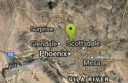
Murphy Bridle Path Trail
Phoenix, Arizona
7.2 miles SHorseback near Phoenix, Arizona
Horseback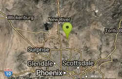
Apache Wash Trail
Phoenix, Arizona
7.2 miles NStart west on Ocitillo to Ridgeback north till you get to the crossing of Sidewinder then head west. Keep on Sidewinder toil you come to the crossing of Octillio and head east back to...
Hike
Apache Wash Sidewinder Loop Trail
Phoenix, Arizona
7.2 miles NHorseback and Mountain Bike near Phoenix, Arizona
Horseback, Mountain Bike
Sidewinder, Apache Vista, Ocotillo Loop Trail
Phoenix, Arizona
7.4 miles NThis is an excellent loop that is very well maintained, well sign posted and if you include the vista summit trail, a moderate work out. Massive Car Park, good restrooms, and plenty of...
Hike, Horseback, Mountain Bike
Ocotillo/Ridgeback/Sidewinder Loop Trail
Phoenix, Arizona
7.5 miles NGreat moderate loop which includes a summit, great views and Classic Sonoran Desert scenery. Multiple access points and other connecting trails allows for the loop to be changed if...
Hike, Horseback, Mountain Bike
Deem Hill
Phoenix, Arizona
7.6 miles NWThe trail starts out going north around the mountain then heads uphill and gives you some good inclines with switch backs. Total incline is approximately 650'. The trail is rocky and...
Mountain Bike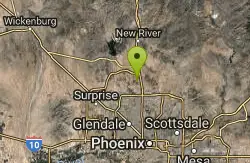
Deem Hills East Trail
Phoenix, Arizona
7.6 miles NWDeem Hills is one of the newer parks in Phoenix to open (2010) and as such a lot of people still don't know it's there. This means that it has much more of a secluded feel then some of...
Hike
Palisade to Basalt to Circumference Trail Loop
Phoenix, Arizona
7.6 miles NWHike near Phoenix, Arizona
Hike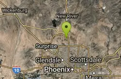
Deem Hills Inner Loop
Phoenix, Arizona
7.6 miles NWHike and Mountain Bike near Phoenix, Arizona
Hike, Mountain Bike 7.1 mi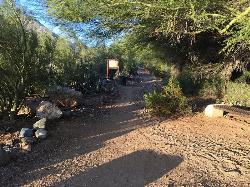
Trail 100
Phoenix, Arizona
7.6 miles SEMountain Bikers and Hikers in Phoenix, Arizona can rejoice in the challenge that is Trail 100. Trail 100, or Charles M. Christensen Memorial Trail, is a little over 14 miles out and back in the...
Hike, Mountain Bike 3.6 mi
Charles M. Christiansen Memorial Trail
Phoenix, Arizona
7.7 miles SEPhoenix, Arizona is home to some of the best and largest city parks in the country and the Charles M. Christiansen Memorial Trail is a great introduction to this fantastic park system. Also known as...
Hike, Horseback, Mountain Bike
Foothills Skate Court Glendale
Glendale, Arizona
7.9 miles WThis park looks really fun especially for the intermediate skater, some great bowls.Check it out for sure.
Skateboard
Thunderbird H-2 Trail
Glendale, Arizona
8.0 miles WThe trail is great for hiking and normally takes 1-3 hours. This is a nice, steady, non-strenuous, climb to the summit for anyone who is somewhat active. The type of incline where you...
Hike
Arrowhead Point Trail
Glendale, Arizona
8.0 miles WArrowhead Trail is a 2.4 mile hiking and mountain biking trail within Thunderbird Conservation Park. This trail is manageable enough for beginners, but offers enough challenge for more experienced...
Hike, Mountain Bike


