


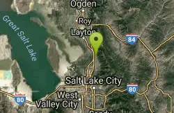
235 Things to do near Bonneville Shoreline Trail - Layton Section
first prev 1 2 3 4 5 6 7 8 9 10 next lastShowing results within 50 miles Distance miles of 1553 E 650 N, Kaysville, UT 84037, USA City, Zip, or Address
Adams Canyon Waterfall
Layton, Utah
1.4 miles NA great hike that is moderate in difficulty, but also provides a sense of adventure to hikers who love climbing rocks and seeing majestic waterfalls.
Hike
David Applied Technology College Disc Golf
Kaysville, Utah
1.6 miles SWA fun park course with elevation changes. There are a lot of longer open holes and some shorter more technical ones around obstacles and trees. Nicely designed for the terrain and available space....
Disc Golf 1.8 mi
Gailey Trail At Nicholls Park (Nicholls Hollow)
Kaysville, Utah
2.0 miles SWThe shady Gailey Trail at Nicholls Park (also known as Bair Creek or Nicholls Hollow) is perfect for walking, running, and enjoying the fresh air of nature all four seasons of the...
Hike, Mountain Bike 6.4 mi
Farmington Canyon
Farmington, Utah
3.8 miles SFarmington Canyon is a gorgeous location to explore during all four seasons of the year, but the prime months for visiting are April through October. The dusty Skyline Drive long is along a...
Hike, Mountain Bike 0.7-2.0 mi
Farmington Creek trail
Farmington, Utah
4.2 miles SThe Farmington Creek trail is a unique pathway that allows access to many different points of interest such as; Farmington pond, Lagoon, and Farmington Station mall. the Farmington pond route is...
Hike, Mountain Bike, Skateboard
Falcons Nest
Hill Air Force Base, Utah
5.0 miles NWMust have access to Hill Air Force Base to play this military base course. 3 tee pads per hole. Gets very limited play. Needs a redesign and some tee signs. The map may help with navigation. Private...
Disc Golf
Layton City Skate Park
Layton, Utah
5.3 miles WLooks good if you like bowls and clovers.
Skateboard
Hill AFB Skatepark
Hill Air Force Base, Utah
5.7 miles NWSkateboard near Hill Air Force Base, Utah
Skateboard
Great Salt Lake Shorelands Preserve
Layton, Utah
6.3 miles WBeautiful scenery with great trails that are close to the shoreline of the Great Salt Lake. Great for any skill level or just a leasurly walk on a beautiful day.
Hike, Mountain Bike
Hill AFB Sledding Hill
Hill Air Force Base, Utah
6.4 miles NWSled near Hill Air Force Base, Utah
Sled
Freedom Hills Park
Centerville, Utah
6.9 miles SShort open course in a well kept park. Tee signs are plaques in the ground near the tee markers. Public (No Fee)
Disc Golf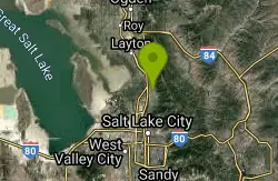
Parrish Canyon Trail
Centerville, Utah
8.8 miles SParrish Canyon Trail goes long the Wasatch Mountains; from the top of the mountain, this trail has beautiful views of Salt Lake City from a distance and interconnects with the Barnard Creek. It's...
Hike, Mountain Bike
Riverpark Disc Golf Course
Riverdale, Utah
10.2 miles NWNatural course - open meadow with trees, bushes and the Weber River. Expanded to 13 holes in 2005, 18 holes in 2006, then 27 holes and all homemade baskets replaced in 2010. Public (No Fee)
Disc Golf
Needles
Ogden, Utah
10.3 miles N2004 is Snowbasin's official "kick off" year for summer activities, and they have done an outstanding job building, marking and maintaining their network of trails! The trails are all...
Mountain Bike
Riverdale Wave
Riverdale, Utah
10.6 miles NWThe Riverdale wave premiered in the Spring of 2005 and was an instant success. The wave was engineered by Nick Turner as a high water wave-hole. Usually good only during spring runoff, the...
Kayak
Bountiful City Park
Bountiful, Utah
10.6 miles SLength: ~100-200ft Slope: ~45°
Sled
Bountiful to Farmington ATV Trail
Bountiful, Utah
10.8 miles SThe Farmington Canyon (or Skyline Drive) trail system ties into the same trail system as the Skyline Drive trail system in Bountiful. This is a fun trail that's close to home (if you live along...
Atv/motorcycle
Bonneville Shoreline Trail, Ogden, UT, USA
Ogden, Utah
10.9 miles NBackpack, Hike, and Mountain Bike near Ogden, Utah
Backpack, Hike, Mountain Bike
Mt Ogden Golf Course
Ogden, Utah
11.4 miles NProbably the safest public tubing/sledding location in the North Davis County area isn't in Davis County - it's Ogden's Mount Ogden Golf Course. "It is legal. We are...
Sled
Riverdale Parkway
Ogden, Utah
11.6 miles NWTake the paved trail to the south, and after the Frisbee Golf course there is a lot of single track network trails to ride. You'll feel close to nature while still being close...
Mountain Bike


