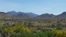
218 Things to do near Baseline Trail
first prev 1 2 3 4 5 6 7 8 9 10 next lastShowing results within 50 miles Distance miles of 14327 W Casey Abbott Rd S, Goodyear, AZ 85338, USA City, Zip, or Address

Quail Trail
Goodyear, Arizona
0.6 miles WQuail Trail is the access trail from the Nature Center to the main trail system. It is a pretty steep climb, but smooth and steady. Quail Trail is a spur trail in the Estrella Mountain...
Hike, Horseback, Mountain Bike 13.8 mi
Butterfield to Gadsen Loop Trail
Goodyear, Arizona
0.8 miles SAs with other trails in Estrella, the trail is wide and the surface tends to be rather benign, varying from mostly smooth, to occasionally strewn with small rocks, sandy in the washes. Butterfield...
Hike, Horseback, Mountain Bike
Rainbow Valley to Toothaker Loop Trail
Goodyear, Arizona
0.8 miles SEstrella Mountain Regional Park has many trails within it, a great beginner to intermediate friendly trail is the Rainbow Valley to Toothaker Loop Trail. This 6.6 mile hike is mostly flat with a few...
Hike, Horseback, Mountain Bike
Estrella Mountain Park
Goodyear, Arizona
0.8 miles SNice mix of singletrack and doubletrack. One way loops, long loop and tech loop. A few mild climbs and some mild rock gardens, just let it ride. There is a lot of loose rocks on the...
Mountain Bike 2.9 mi
Coldwater Trail
Goodyear, Arizona
0.8 miles SThe Cold Water Trail #27 is a seldom visited, remote backcountry destination along the backdrop of the rugged Verde Rim with healthy mixed vegetation and unique geology. The trail was originally used...
Hike, Horseback, Mountain Bike
Dysart Trail
Goodyear, Arizona
0.8 miles S$6 entry fee per car.
Hike, Horseback, Mountain Bike 3.6 mi
Toothaker Trail
Goodyear, Arizona
0.8 miles SToothaker is an easy roller coaster of a trail. It crosses numerous washes ranging from small to large and can be a tad loose and/or rocky in some sections. The end reward is a nice view of Rainbow...
Hike, Horseback, Mountain Bike 8.3 mi
Estrella Mountains Competitive Track
Tolleson, Arizona
3.4 miles EThe third competitive track in the Maricopa County Regional Park system, located in Estrella Mountain Regional Park, was completed in February 2000. The track consists of two loops totaling 13 miles....
Hike, Horseback, Mountain Bike
Black jack
Goodyear, Arizona
4.7 miles SWExtreme terrain, advance riders only.
Mountain Bike
Goodyear Skatepark
Goodyear, Arizona
6.9 miles NSkate Park Rules USE AT YOUR OWN RISK! This skate park is not supervised. This facility is used by both experienced and inexperienced skaters and riders. Serious injury or death may result from...
Skateboard
Sundance Park
Buckeye, Arizona
9.1 miles WCourse area is bounded by a residential neighborhood, a water reclamation facility and a farming ravine. There are a variety of lengths and a few trees on this dirt course. There is a gated/fenced...
Disc Golf
Desert West Skateboard Plaza
Phoenix, Arizona
11.6 miles NE25,000 sq.feet: concrete bowl, street course, ramps, pads and helmets required, free. Open every day 7am to 10pm. one of the first parks built in phoenix, fun for beginners, boring if you really...
Skateboard 4.8 mi
Lost Creek Petroglyph Trail
Buckeye, Arizona
11.9 miles NWStarting at Verrado's trailhead, the trail heads a short ways to a petroglyph site. While a little rocky at times, the trail is easy. To deter vandals, a very necessary fence with barbed-wire has...
Hike, Mountain Bike
Verrado
Buckeye, Arizona
12.0 miles NWTechnical, good climbs, lots of open roads to add cardio loops as well.
Mountain Bike
South Mountain Park / National Trail
Phoenix, Arizona
12.5 miles ENational trail can be acended or decended. Both require expert skills and fitness. You cannot and will not find a climb this technical, challenging and fun in AZ. It will kick your...
Mountain Bike
X-Court BMX Park
Glendale, Arizona
12.6 miles NEA no-fee, 26,000-square-foot, concrete multi-use (bikes, boards, blades) facility. Site Design Group, a leader in skate park design, created a facility that will provide challenges for skaters and...
Skateboard 12.6 mi
National Trail
Phoenix, Arizona
13.5 miles ENational Trail is the gem of South Mountain and home to the infamous Waterfall. It’s a local favorite as well as a destination trail for MTB snowbirds. Like most trails in the Sonoran...
Hike, Mountain Bike
Alta Trail And Bajada Trail
Phoenix, Arizona
13.5 miles EHike near Phoenix, Arizona
Hike
Quartz Peak Trail
14.7 miles SE
Hike near
Hike
South, Bajada, Mule Deer Loop Trail
Waddell, Arizona
14.8 miles NWSouth - Bajada - Mule Deer Loop is a 4.1 mile loop trail located near Waddell, Arizona that offers the chance to see wildlife. The trail is rated as moderate and is accessible from...
Hike, Horseback, Mountain Bike


