


204 Things to do near Amphitheater Lake
first prev 1 2 3 4 5 6 7 8 9 10 next lastShowing results within 50 miles Distance miles of End Highlands Rd, Alta, WY 83414, USA City, Zip, or Address

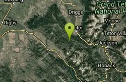
Twin Creek Trail
Driggs, Idaho
22.5 miles WThe Twin Creek trail is 2.3 miles long. It begins at Trail 6195 and ends at Trail 6219. source: fs.usda.gov
Mountain Bike
Pine Creek Campground
Victor, Idaho
23.9 miles SWThe Pine Creek Campground has 10 single units and has restrooms.
Camp
Bitch Creek Trestle
Tetonia, Idaho
24.0 miles NWAs part of the Rails to Trails project, this old railroad bridge has been transformed into a very safe little viewing experience for the whole family. You can drive right up to the bridge where...
Hike
Sheep Driveway
Irwin, Idaho
24.5 miles SWOHVs, mountain biking, day hiking, horse riding. source: fs.usda.gov
Mountain Bike
Southbound
Driggs, Idaho
24.9 miles WTrail starts by going up the Channel lock trail. At the top of Channel Lock go right onto the Southbound trail. Trail will loop back to Channel lock which you take back to your car. Trail is...
Mountain Bike
Sharks Belly
Driggs, Idaho
24.9 miles WTrail system can start from Channel lock or Bovine. Channel Lock is an easier climb than Bovine. This description and mileage starts at the Channel Lock trail, forest service boundary marker. Take...
Mountain Bike
Channel Lock
Driggs, Idaho
24.9 miles WTrail is a little over 1 mile uphill. Recommended route up to access the larger Horseshoe canyon trail system. Makes a nice downhill with twists. Gets its name from the deep ruts made from cows....
Mountain Bike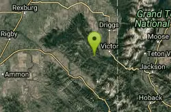
Red Creek Via Spooky Trail
Victor, Idaho
25.1 miles SWTrail starts on the Spooky trail segment. About 1.2 up you'll see a trail on your left. This is where you will be coming out at. Continue straight. At about 2.6 from the car you'll...
Mountain Bike 1.2 mi
Spooky
Victor, Idaho
25.1 miles SWTrail serves as the stem to Red Creek or access to Corral Creek as well as other possibilities in the big hole mountains. Nice fun singletrack to run as an out n back if your time is...
Mountain Bike
Horseshoe Trails
Driggs, Idaho
25.4 miles WMountain Bike near Driggs, Idaho
Mountain Bike
Bovine
Driggs, Idaho
25.4 miles WBovine trail is part of a larger system. You can use it to access more trails or make it your end destination from other trailheads. It is a steep climb but returns the favor with a fast downhill....
Mountain Bike
Horseshoe Canyon
Tetonia, Idaho
25.5 miles WHorseshoe Canyon is one of the closest trail systems to the town of Driggs, Idaho. This network doesn't have a ton of climbing or descending, but the smooth, swooping singletrack with a...
Mountain Bike
North Mahogany Trail #220
Tetonia, Idaho
26.1 miles Whe N. Mahogany Trail is open to Motorbikes, Mountain bikes, Horses, and Hikers. Motorbikes and Horseback riders are the most common visitors, but the trail is becoming increasingly...
Mountain Bike
Probation And Burg Bumper
Tetonia, Idaho
26.4 miles WThe Probation part of the trail is the steepest downhill in the area. Has multiple bridges and log jumps in the short mile down. The Burg portion of the trail is uphill with some...
Mountain Bike 1.9 mi
Terraced Falls
Grant Village, Yellowstone National Park
27.8 miles N3.6 mile easy out and back trail. 430 ft Elevation gain. The trailhead is off Ashton-Flagg Ranch Road along Yellowstone's South border. Ashton-Flagg Ranch Road is closed during the winter.
Hike
Loon Lake
Ashton, Idaho
27.8 miles NCamp, Kayak, and Swim near Ashton, Idaho
Camp, Kayak, Swim 0.6 mi
Packsaddle Lake
Tetonia, Idaho
28.0 miles WPacksaddle is one of the less well known lakes/trails in the area. If you've got a good offroad vehicle, you can probably make it all the way to the end of the road, otherwise, it's just an...
Dive, Hike, Mountain Bike, Snowshoe, Swim 1.1 mi
Fish Lake
Ashton, Idaho
28.4 miles NHike near Ashton, Idaho
Hike 15.9-16.6 mi
Union Falls & Ouzel Pool
Grant Village, Yellowstone National Park
28.4 miles NBackpack, Hike, Hot Springs, and Swim near Grant Village, Yellowstone National Park
Backpack, Hike, Hot Springs, Swim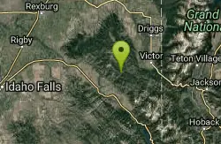
Trail Canyon Trail
Ririe, Idaho
28.5 miles SWThe Trail Canyon trail begins at Trail Canyon Parklot, T8s R43e Sec28 and ends at Intersect Trail 5251,t8s R43e Sec28. source: fs.usda.gov
Mountain Bike


