


182 Things to do near Ammon, Idaho
first prev 1 2 3 4 5 6 7 8 9 10 next lastShowing results within 50 miles Distance miles of Ammon, ID, USA City, Zip, or Address
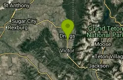
Three Wookie Trail
Driggs, Idaho
46.2 miles EMountain Bike near Driggs, Idaho
Mountain Bike 0.1-0.2 mi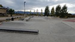
Driggs Bike and Skate Park
Driggs, Idaho
46.6 miles EThis is a great concrete skatepark and small mountain bike park with great features, both natural and wooden. There's a great pavilion right next to the skatepark and parking lot. While...
Mountain Bike, Skateboard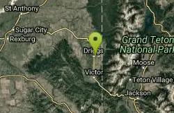
Teton Valley Disc Golf Course
Driggs, Idaho
46.6 miles EEnjoy 360-degree mtn views from this city park that also features a skateboard area. This course is on your way to the Grand Targhee course. Public (No Fee)
Disc Golf
Cave Trail
Pocatello, Idaho
47.0 miles SWMountain Bike near Pocatello, Idaho
Mountain Bike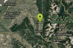
Driggs Nordic Trail
Driggs, Idaho
47.1 miles NEDistance: 3.1 miles (5km) Trail Map: Driggs_Nordic_Track_2015.pdf Grooming Report: http://tvtap.org/nordic-grooming
Cross-country Ski, Snowshoe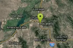
Bengal Ridge at ISU
Pocatello, Idaho
47.2 miles SWChallenging desert course with extreme elevation changes and large scrubby junipers. . Public (No Fee)
Disc Golf
River Rush
Ashton, Idaho
47.3 miles NEPaintball near Ashton, Idaho
Paintball
Indian Creek Campground (Palisades)
Irwin, Idaho
47.6 miles EPalisades Reservoir is a picturesque body of water in eastern Idaho on U.S. Highway 26 near the Idaho & Wyoming border and about 25 miles west of Jackson Hole Wyoming. The reservoir is nestled...
Camp, Hike, Horseback, Swim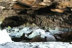
Civil Defense Caves
Rexburg, Idaho
48.3 miles NThe caves are large lava tubes. The name comes from the cold war era when they were anticipated as a safe area in the case of an attack. The entrance is pretty bouldery and does require a small...
Cave 0.8 mi
Conant Creek Pegram Truss Railroad Bridge
Ashton, Idaho
48.7 miles NEAs part of the Rails to Trails project, this old railroad bridge has been transformed into a very safe little viewing experience for the whole family. You can drive right up to the bridge where there...
Hike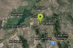
Ross Park
Pocatello, Idaho
48.9 miles SWOn grass with elevation and large trees that force a variety of throws. Alt. pins throughout the seasons. Public (No Fee)
Disc Golf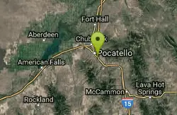
Upper Ross Park
Pocatello, Idaho
48.9 miles SWOn grass with elevation and large trees that force a variety of throws. Alt. pins throughout the seasons. Public (No Fee)
Disc Golf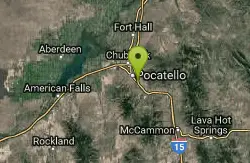
Shady Side Cliffs at Ross Park
Pocatello, Idaho
48.9 miles SWThe routes on the Shady Side can be identified by a number on top of the cliff as well as on the face at the bottom of the climbs. The number is close to where the rope should hang for a given...
Rock Climb
Badger Creek
Tetonia, Idaho
48.9 miles NEBadger Creek is a stream located just 13.6 miles from Ashton, in Teton County, in the state of Idaho, United States, near France, ID. Whether you’re spinning, baitcasting or fly fishing your...
Camp, Cross-country Ski, Hike, Mountain Bike, Rock Climb 0.2-9.7 mi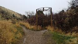
City Creek
Pocatello, Idaho
49.1 miles SWThe City Creek Management Area (CCMA) Trail System is a vast network of trails maintained by the City of Pocatello. There are trails to go up and others to come down. Most trails come back to the...
Hike, Horseback, Mountain Bike 4.6 mi

Coal Creek Trail
Alta, Wyoming
49.2 miles EEnjoy outstanding views from upper Coal Creek Meadows, this hike description travels just beyond the meadows to the top of Coal-Mesquite Divide where you'll enjoy some rather dramatic views of...
Hike, Mountain Bike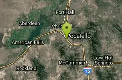
Sunnyside Cliffs at Ross Park
Pocatello, Idaho
49.3 miles SWThe routes on the Sunny Side can be identified by a number at the bottom of the climbs. The number is close to where the rope should hang for a given climb. These numbers were put up years ago and...
Rock Climb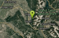
Darby Canyon Cliffs
Alta, Wyoming
49.3 miles EAn interesting cave by Darby Canyon is the major draw to this popular west slope hike, closely followed by intermittent waterfalls splashing down the canyon rim along with impressive displays of...
Rock Climb
Darby Canyon Camping
Alta, Wyoming
49.3 miles EThere's no official campgrounds up the canyon but there are several dispersed campsites with existing fire lays. Please adhere to principles of Leave No Trace. Use existing fire lays and leave...
Camp 29.6 mi
Ashton to Tetonia Trail
Ashton, Idaho
49.5 miles NEThe Idaho Department of Parks and Recreation undertook the project to transform the old Teton Valley Branch of the Union Pacific Railroad from Ashton to Tetonia into a trail for bikes, ATVs, and...
Mountain Bike


