The Escalante Route Trail
Grand Canyon Village, Arizona
| Address: | ~Unnamed Road, Grand Canyon Village, AZ 86023, USA |
| GPS: |
36°1'58.4"N 111°51'8.3"W Maps | Directions |
| State: | Arizona |
| Trail Length: | 36.00 miles |
| Elevation Gain: | 9701.00 feet |
| Hike Difficulty: | Advanced |
| Trail Type: | Out & Back |
Pet Friendly
Backpack and Hike
The route can be hiked in either direction, but this passage will be described from the perspective of a downcanyon hiker. Follow the Tanner Trail to the shoreline. Rocks placed at the trail margins make it easy to see the way across Tanner Beach and up onto the bench above the river that forms the route downstream towards Cardenas Canyon. The trail works its way along the foot of the Supergroup slopes above the shoreline. Shallow gullies must be crossed at intervals; but generally speaking, the route from Tanner to Cardenas is straightforward. The Colorado via the bed of Cardenas Creek is last reliable water source until one reaches the river at the mouth of Escalante Creek. The trail crosses Cardenas Creek about two hundred yards above the shoreline and climbs the Dox Hill immediately west. The correct path follows the rising slope of red sandstone toward and up the unnamed side canyon between Cardenas and Escalante Creeks and reaches the bed of the drainage above the cliff bands that block access to the Colorado River. The route crosses the unnamed drainage and traverses west toward the crest of the ridge north of Escalante Creek. Caution is indicated throughout this area, as there are many places where you will want to avoid a misstep at all cost. Some sections offer a walking surface about a boot-sole wide while traversing slopes that fall steeply away for hundreds of feet. Take your time and walk with care. The trail seems to traverse west forever, finally going to the top of the ridge just short of the west end. A fine view in all directions is the reward for all the side hill walking. The trail crosses the ridge and descends rapidly to the bed of Escalante Creek. A barrier fall in the main arm prevents direct access to the river, so the route crosses to the south side of the wash and around into the short arm of Escalante. The canyon bottom forms the route for a short distance but soon the trail traverses west to pass a high pouroff, crosses a bit of talus and descends to the creek bed below the fall. Both arms of Escalante Creek are normally dry, but once established below the fall it's an easy walk to the shoreline. The trail climbs away from the river below the mouth of Escalante Creek and follows a rising ramp of Shinumo Quartzite downcanyon. Walk the top of this formation around into Seventyfive Mile Creek. Enter the bed of Seventyfive Mile Creek over a fallout and continue down the drainage bottom to the river. A couple of minor obstacles present themselves but the solutions are obvious. The Shinumo Quartzite section of Seventyfive Mile Creek is a real treat - deep and narrow. Nevills Rapids provides a backdrop for several nice camping spots. The area is equally popular among river runners so you may encounter other groups. Seventyfive Mile Creek is normally dry in its lower reaches, but there is access to the river at various points throughout the stretch from Escalante to Papago Creeks. Trails along the beach form the route downriver towards Papago Creek. Eventually sand gives way to rock and a series of ledges require a bit of attention to avoid being rimmed up. In general, stay as close to the river as is conveniently possible. The trail goes up and over a small outcrop of sandstone before dropping back to river level at the mouth of Papago Creek. A high route is possible and is cairned. It first cairn is at the mouth of 75 mile Canyon and is recommended if you want to avoid a short river stretch. Exit Papago on the west and work up a series of tall ledges. A short rope to better facilitate pack handling will prove a worthwhile accessory. Start up immediately west of the mouth of the drainage. The holds are big and secure. The route leads up from ledge to ledge, so it's never more than a move or two between resting places if you have chosen the line of least resistance. The climbing is easy, but no mistakes are allowed. About 35 feet up the angle relents and one can scramble up the talus toward minor cliff bands above. There are several ways to surmount these little crags, all with obvious trails giving access. Climb the slopes to a (more or less) horizontal trail about 300 vertical feet above the river. The trail traverses less than 100 yards downcanyon before coming to the top of a talus filled runnel that allows passage back to the shoreline. This gully seems dangerous - steep, with lots of big boulders in precarious balance. The immediate shoreline forms the most efficient route between bottom of this treacherous little gully and the mouth of Red Canyon. The walk downstream through riparian vegetation is a real pleasure. A downcanyon walker arriving at Hance Rapids could continue west via the Tonto Trail toward Mineral Canyon, the Grandview Trail and points beyond, or ascend to the rim via the bed of Red Canyon on the New Hance Trail. Courtesy of AllTrails.com
More Information
Be courteous, informed, and prepared. Read trailhead guidelines, stay on the trail, and don't feed the wildlife.
Read MoreDirections
From Grand Canyon Village, Arizona
- Head west (344 ft)
- Turn right toward Village Loop Drive (141 ft)
- Turn right onto Village Loop Drive (0.2 mi)
- Turn right onto Center Rd (1.6 mi)
- Turn left onto AZ-64 E (1.3 mi)
- Turn right to stay on AZ-64 E (19.7 mi)
- Turn left (0.4 mi)

Other Hiking Trails and Backpacking Trails Nearby

Tanner Trail
Grand Canyon Village, Arizona
0.1 miles WA rigorous rim-to-river backpack of three or more days, following one of the South Rim's more difficult trails. The unmaintained trail, recommended only for seasoned hikers, is...
Backpack, Camp, Hike
Desert View Visitor Center Trail
Grand Canyon Village, Arizona
1.5 miles EDirections from East Entrance Station: Drive westward less than a mile on East Rim Drive to reach the Desert View Visitor Center.
Hike
Tusayan Ruin Walk Trail
Grand Canyon Village, Arizona
1.6 miles SWDirections from East Entrance Station: Drive approximately 4 miles west along East Rim Drive to the Tusayan Museum.
Hike
Blue Springs Trail
Grand Canyon Village, Arizona
3.2 miles EHike 9.1 mi
New Hance Trail
Grand Canyon Village, Arizona
4.5 miles SWNew Hance Trail is a colorful hike through Red Canyon to the Colorado River. This trail is considered one of the more difficult trails in the Grand Canyon and is a challenge only prepared hikers...
Backpack, Camp, Hike
Tonto Trail: New Hance Trail to Grandview Point
Grand Canyon Village, Arizona
6.0 miles SWBackpack, Camp, Hike

Arizona Trail
Grand Canyon Village, Arizona
7.8 miles SWThe Arizona Trail, located near the Grand Canyon, is great from January through November. At 16.8 miles (one way) in distance, the trail is out and back and rated with high difficulty.
Hike, Horseback
Grandview Point to Horseshoe Mesa Trail
Grand Canyon Village, Arizona
7.9 miles WA rewarding day hike or backpack to a wooden mesa below the South Rim.
Backpack, Hike
Grandview Trail Loop
Grand Canyon Village, Arizona
7.9 miles WThis is definitely not a mountain biking trail! I am a resident of Grand Canyon and know for sure. Also use of Mtn bikes on canyon trails is illegal in the Park....
Backpack, Camp, Cross-country Ski, Hike
Tonto Trail from Grandview Point to South Kaibab Trailhead
Grand Canyon Village, Arizona
7.9 miles WA rigorous point-to-point backpack of four to five days; recommended for experienced Grand Canyon backpackers only. Long stretches of this scenic, lonely segment of the Tonto Trail are...
Backpack, Camp, Hike 0.5-0.8 mi
Cape Royal Trail
North Rim, Arizona
8.2 miles NWCape Royal is a long peninsula extending from the North Rim out over the Grand Canyon. It offers a phenomenal view, perhaps the most sweeping view of any Grand Canyon vista. Take the short stroll to...
Hike 0.8 mi
Cliff Springs
North Rim, Arizona
8.3 miles NWStarting just down the hill from the Cape Royal Overlook, the trail immediately heads down into a small valley, passing the granary ruin in a few hundred feet. The valley descends into a side canyon...
Hike
Walhalla Overlook
North Rim, Arizona
8.5 miles NWHistory unfolds as you explore Walhalla Overlook on the North Rim of the Grand Canyon, with views of the Unkar Delta, farmland of the ancient people who once lived here.
Hike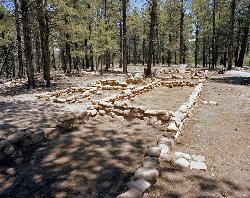
Walhalla Ruins
North Rim, Arizona
8.5 miles NWWalhalla Ruin overview. Nine hundred years ago, people were living on the North Rim at Walhalla Glades. The site was a summer home for families for over 100 years. Walhalla Plateau is...
Hike
Cape Final
North Rim, Arizona
9.1 miles NWThere are plenty of trails on the Grand Canyon's North Rim that have great views, but there may not be a hike more pleasant and more rewarding than the Cape Final Trail. As part of a full...
Camp, Hike 1.1 mi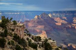
Shoshone Point Trail
Grand Canyon Village, Arizona
12.1 miles WShoshone Point Trail is a non-marked trail for hikers of all skill levels. The trail has limited views until the Shoshone Point overlook past the picnic area where astonishing canyon...
Hike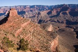
The Grand Canyon: Kaibab to Bright Angel Trail
Grand Canyon Village, Arizona
13.0 miles WExperience the Grand Canyon like few others with this unforgettable 2-3 day trip down into the canyon. If you are looking for the perfect hike in the Grand Canyon, this is it. The 2 (or 3) day hike...
Backpack, Camp, Hike
South Kaibab to North Kaibab to Bright Angel Trail
Grand Canyon Village, Arizona
13.0 miles WGenerally an early morning start and a late finish with an amazing sunrise on the way down the South Kaibab and depending on your speed, a beautiful sunset as you hike back toward (or up) Bright...
Backpack, Camp, Hike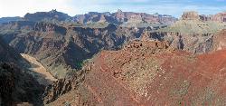
South Kaibab to Phantom Ranch to Bright Angel Trail
Grand Canyon Village, Arizona
13.0 miles WOne of the most popular hikes in Grand Canyon National Park is the South Kaibab to Phantom Ranch to Bright Angel Trail. Marked as difficult, the trail is well maintained and labeled. This Grand...
Backpack, Camp, Hike 5.7 mi
Rim Trail
Grand Canyon Village, Arizona
13.0 miles WThe Rim Trail is approximately 12 miles in length and is packed full of incredible Grand Canyon views. The majority of the path is paved and is more of a walking than hiking trail and is great for...
Hike, Mountain BikeNearby Campsites

Tanner Trail
Grand Canyon Village, Arizona
0.1 miles WA rigorous rim-to-river backpack of three or more days, following one of the South Rim's more difficult trails. The unmaintained trail, recommended only for seasoned hikers, is...
Backpack, Camp, Hike 9.1 mi
New Hance Trail
Grand Canyon Village, Arizona
4.5 miles SWNew Hance Trail is a colorful hike through Red Canyon to the Colorado River. This trail is considered one of the more difficult trails in the Grand Canyon and is a challenge only prepared hikers...
Backpack, Camp, Hike
Tonto Trail: New Hance Trail to Grandview Point
Grand Canyon Village, Arizona
6.0 miles SWBackpack, Camp, Hike

Grandview Trail Loop
Grand Canyon Village, Arizona
7.9 miles WThis is definitely not a mountain biking trail! I am a resident of Grand Canyon and know for sure. Also use of Mtn bikes on canyon trails is illegal in the Park....
Backpack, Camp, Cross-country Ski, Hike
Tonto Trail from Grandview Point to South Kaibab Trailhead
Grand Canyon Village, Arizona
7.9 miles WA rigorous point-to-point backpack of four to five days; recommended for experienced Grand Canyon backpackers only. Long stretches of this scenic, lonely segment of the Tonto Trail are...
Backpack, Camp, Hike
Cape Final
North Rim, Arizona
9.1 miles NWThere are plenty of trails on the Grand Canyon's North Rim that have great views, but there may not be a hike more pleasant and more rewarding than the Cape Final Trail. As part of a full...
Camp, Hike
The Grand Canyon: Kaibab to Bright Angel Trail
Grand Canyon Village, Arizona
13.0 miles WExperience the Grand Canyon like few others with this unforgettable 2-3 day trip down into the canyon. If you are looking for the perfect hike in the Grand Canyon, this is it. The 2 (or 3) day hike...
Backpack, Camp, Hike
South Kaibab to North Kaibab to Bright Angel Trail
Grand Canyon Village, Arizona
13.0 miles WGenerally an early morning start and a late finish with an amazing sunrise on the way down the South Kaibab and depending on your speed, a beautiful sunset as you hike back toward (or up) Bright...
Backpack, Camp, Hike
South Kaibab to Phantom Ranch to Bright Angel Trail
Grand Canyon Village, Arizona
13.0 miles WOne of the most popular hikes in Grand Canyon National Park is the South Kaibab to Phantom Ranch to Bright Angel Trail. Marked as difficult, the trail is well maintained and labeled. This Grand...
Backpack, Camp, Hike 13.6 mi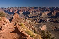
South Kaibab Trails
Grand Canyon Village, Arizona
13.0 miles WSouth Kaibab Trail is a 7 mile point-to-point trail located near Grand Canyon, Arizona that features a river and is rated as difficult. The trail is primarily used for hiking & walking and is...
Camp, Hike, Horseback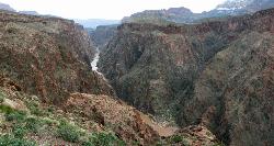
Clear Creek Trail
Grand Canyon Village, Arizona
13.0 miles WAn extended backpack trip of four to six days deep within the Grand Canyon. NOTE: The starting point for Clear Creek Trail, Bright Angel Campground, is in a remote location away from a trailhead. The...
Backpack, Camp, Hike 0.6 mi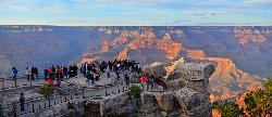
Mather Campground Trail
Grand Canyon Village, Arizona
14.8 miles WLocated on the South Rim of the Grand Canyon, Mather Campground Trail is a brief one mile out and back connector trail which is great for hiking, mountain biking, walking, and trail running. The...
Camp, Hike, Mountain Bike
Grand Canyon South Rim Area Campgrounds
Grand Canyon Village, Arizona
15.5 miles WCamp 1.4-9.8 mi
The Bright Angel Trails
Grand Canyon Village, Arizona
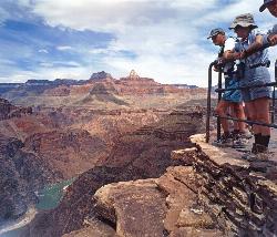
16.4 miles WPrepare yourself for switchbacks as part of a tough elevation gain on the Bright Angel trail to Plateau Point trail. This trail features spectacular views as you hike along the edge of...
Backpack, Camp, Hike, Horseback 4.5 mi
Bright Angel Trail to Bright Angel Campground and River Trail
Grand Canyon Village, Arizona
16.4 miles WBright Angel Trail to Bright Angel Campground and River dirt trail is one of the most famous trails near Grand Canyon, Arizona. The well-maintained trail encompasses incredible views and has an...
Backpack, Camp, Hike, Rock Climb
Bright Angel Trail to Three-Mile Rest house
Grand Canyon Village, Arizona
16.4 miles WThe popular out-and-back Bright Angel Trail to Three-Mile Resthouse is 5.4 miles out in distance. The trail includes many steep switchbacks and 360 degrees of absolutely stunning views of the inside...
Backpack, Camp, Hike 4.9 mi
Bright Angel Trail to Tonto Trail
Grand Canyon Village, Arizona
16.4 miles W"[T]he Tonto Trail offers a degree of civility not found elsewhere along the trail, and it is here that most hikers get their first exposure to the unique nature of this singular transcanyon...
Backpack, Camp, Hike
Rim-to-Rim: North Kaibab to Grand Canyon Village
North Rim, Arizona
17.1 miles NWFour days across the Grand Canyon you will never forget! There is a secret to a Grand Canyon rim-to-rim hike: Take four days to do it, even if you can do it in one. I have friends who go South to...
Backpack, Camp, Hike
Rim-to-Rim: North to South Kaibab Trail
North Rim, Arizona
17.1 miles NWArizona Office of Tourism, 2702 N. 3rd St., Suite 4015 , Phoenix, AZ, 85004, Phone: 888-520-3434, Fax: 602-240-5432, mfioritt@pni.com
Camp, Hike, Horseback
Phantom Ranch to Ribbon Falls on North Kaibab Trail
North Rim, Arizona
17.1 miles NWCamp, Hike


