


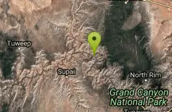
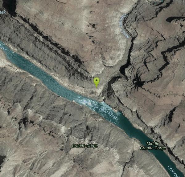
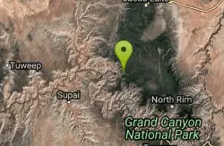
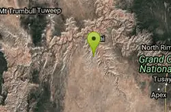
Tapeats Creek to Deer Creek
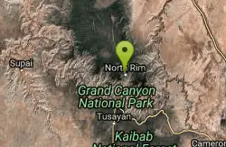
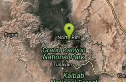
North Rim, Arizona
| Address: | ~Unnamed Road, North Rim, AZ 86052, USA |
| GPS: |
36°22'16.5"N 112°28'9.8"W Maps | Directions |
| State: | Arizona |
| Trail Length: | 5.70 miles |
| Elevation Gain: | 1236.00 feet |
| Hike Difficulty: | Intermediate |
| Trail Type: | Out & Back |
Pet Friendly
Backpack, Camp, and Hike
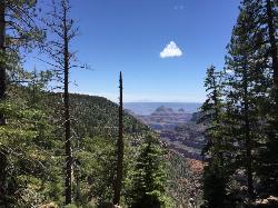
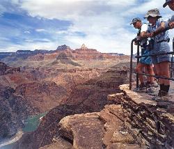
NOTE: The beginning of this hike is in a remote location. The nearest trailhead is Bill Hall trailhead. This is an excellent route ranging from the trackless beaches of the Colorado River to a good trail segment high above Granite Narrows, connects the Tapeats Creek and Deer Creek Trails, allowing backpackers the opportunity to trace a superb loop trip. Courtesy of AllTrails.com
More Information
Be courteous, informed, and prepared. Read trailhead guidelines, stay on the trail, and don't feed the wildlife.
Read More- Plan Ahead and Prepare
- Travel & camp on durable surfaces
- Dispose of waste properly
- Leave what you find
- Minimize campfire impacts
- Respect wildlife
- Be considerate of other visitors
Directions
- Get directions on Google Maps
Other Hiking Trails and Backpacking Trails Nearby
Bill Hall Trail
North Rim, Arizona
4.1 miles NEHike

Thunder River and Tapeats Creek Trail
North Rim, Arizona
4.9 miles NEThunder River Trail - Grand Canyon National Park (North Rim) is a 25 mile out and back trail located near North Rim, Arizona that features a river. The trail is only recommended for...
Backpack, Camp, Hike
Deer Creek to Colorado River
North Rim, Arizona
4.9 miles NEBackpack, Camp, Hike
Bill Hall Trail to Monument Point
North Rim, Arizona
4.9 miles NEBackpack, Hike
Rainbow Rim Trail - North Rim of the Grand Canyon
North Rim, Arizona
6.3 miles EThis incredibly sweet ride offers great views, ponderosa and aspen forest, all on a sweet single track. This sweet Grand Canyon ride will take you through some outstanding and remote...
Hike, Mountain Bike
North Bass Trail
North Rim, Arizona
7.1 miles EDirections from North Rim Entrance Station: Drive northward to Forest Service Road (FSR) 422 and turn left. Follow 422 to FSR 270 and turn left. Drive approximately 3 miles to FSR 223...
Backpack, Camp, Hike
North Bass Trail to Muav Cabin
North Rim, Arizona
7.1 miles EBackpack, Hike

Powell Plateau Trail
North Rim, Arizona
7.1 miles EA rewarding plateau-top day hike or backpack to a remote North Rim plateau. Hikers who pack enough water can easily wander around the plateau for days, visiting various rim overlooks...
Backpack, Camp, Hike
South Bass Trail
Supai, Arizona
14.0 miles SThis is a strenuous, 15.6-mile (round-trip), remote, non-corridor hike in Grand Canyon National Park. Camping here is at large, as there are no established sites below the rim. There is...
Backpack, Camp, Hike
Tuckup Trail
17.3 miles W
Hike
Havasu Falls and Mooney Falls Trail
Supai, Arizona
19.8 miles SWThe Havasupai Indian Reservation is not part of the Grand Canyon National Park, but you cannot tell that from the scenery. From your very first step at the trailhead parking lot until...
Backpack, Camp, Hike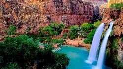
Havasu Falls Trail
Flagstaff, Arizona
19.8 miles SWBackpack, Dive, Horseback, and Swim near Flagstaff, Arizona
Backpack, Dive, Horseback, Swim
Havasupai Falls
Supai, Arizona
19.8 miles SWThe Havasupai Reservation is located in one of the most beautiful and remote areas of the western Grand Canyon. The Village of Supai, is located in Havasu Canyon, a southwestern branch...
Backpack, Camp, Hike
Havasu Canyon Trail
Supai, Arizona
19.8 miles SWHike
Widforss Trail - Short Option
North Rim, Arizona
24.7 miles SEHike
Widforss Trail
North Rim, Arizona
24.7 miles SEWidforss Trail overlooks the Grand Canyon as it leads along the beautiful North Rim. The peaceful forested trail features numerous picture perfect locations from the beginning of the trail on over to...
Backpack, Hike 6.3 mi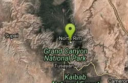
Tiyo Point Trail
North Rim, Arizona
25.0 miles SEThis former road is becoming increasingly overgrown by the encroaching forest. This being said, it is generally easy to follow with some blown down trees to climb over or around. There are some old...
Backpack, Camp, Hike
North Kaibab Trail to Roaring Springs
North Rim, Arizona
25.3 miles SEThe North Kaibab to Roaring Springs trail is a well-shaded hike which is downhill on the way out. The trail provides places to stop all along the way. The views are beautiful and perfect for...
Backpack, Hike
North Kaibab Trail to Colorado River
North Rim, Arizona
25.4 miles SEThe North Kaibab Trail to Colorado River Trail is perfect for experienced hikers. The trail contains many elevation changes and is very steep. The trail is well maintained and well marked so you can...
Backpack, Camp, Hike
Phantom Ranch to Ribbon Falls on North Kaibab Trail
North Rim, Arizona
25.4 miles SECamp, Hike
Nearby Campsites
Thunder River and Tapeats Creek Trail
North Rim, Arizona
4.9 miles NEThunder River Trail - Grand Canyon National Park (North Rim) is a 25 mile out and back trail located near North Rim, Arizona that features a river. The trail is only recommended for...
Backpack, Camp, Hike
Deer Creek to Colorado River
North Rim, Arizona
4.9 miles NEBackpack, Camp, Hike
North Bass Trail
North Rim, Arizona
7.1 miles EDirections from North Rim Entrance Station: Drive northward to Forest Service Road (FSR) 422 and turn left. Follow 422 to FSR 270 and turn left. Drive approximately 3 miles to FSR 223...
Backpack, Camp, Hike
Powell Plateau Trail
North Rim, Arizona
7.1 miles EA rewarding plateau-top day hike or backpack to a remote North Rim plateau. Hikers who pack enough water can easily wander around the plateau for days, visiting various rim overlooks...
Backpack, Camp, Hike
South Bass Trail
Supai, Arizona
14.0 miles SThis is a strenuous, 15.6-mile (round-trip), remote, non-corridor hike in Grand Canyon National Park. Camping here is at large, as there are no established sites below the rim. There is...
Backpack, Camp, Hike
Havasu Falls and Mooney Falls Trail
Supai, Arizona
19.8 miles SWThe Havasupai Indian Reservation is not part of the Grand Canyon National Park, but you cannot tell that from the scenery. From your very first step at the trailhead parking lot until...
Backpack, Camp, Hike
Havasupai Falls
Supai, Arizona
19.8 miles SWThe Havasupai Reservation is located in one of the most beautiful and remote areas of the western Grand Canyon. The Village of Supai, is located in Havasu Canyon, a southwestern branch...
Backpack, Camp, Hike 6.3 mi
Tiyo Point Trail
North Rim, Arizona
25.0 miles SEThis former road is becoming increasingly overgrown by the encroaching forest. This being said, it is generally easy to follow with some blown down trees to climb over or around. There are some old...
Backpack, Camp, Hike
North Kaibab Trail to Colorado River
North Rim, Arizona
25.4 miles SEThe North Kaibab Trail to Colorado River Trail is perfect for experienced hikers. The trail contains many elevation changes and is very steep. The trail is well maintained and well marked so you can...
Backpack, Camp, Hike
Phantom Ranch to Ribbon Falls on North Kaibab Trail
North Rim, Arizona
25.4 miles SECamp, Hike
Rim-to-Rim: North to South Kaibab Trail
North Rim, Arizona
25.4 miles SEArizona Office of Tourism, 2702 N. 3rd St., Suite 4015 , Phoenix, AZ, 85004, Phone: 888-520-3434, Fax: 602-240-5432, [email protected]
Camp, Hike, Horseback
Rim-to-Rim: North Kaibab to Grand Canyon Village
North Rim, Arizona
25.4 miles SEFour days across the Grand Canyon you will never forget! There is a secret to a Grand Canyon rim-to-rim hike: Take four days to do it, even if you can do it in one. I have friends who go South to...
Backpack, Camp, Hike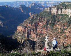
Uncle Jim Trail
North Rim, Arizona
25.4 miles SEDirections from North Rim Entrance: Drive southward along North Rim Drive to the North Kaibab Trailhead. Turn left into the parking area and locate the trailhead on the eastern side of the lot.
Backpack, Camp, Hike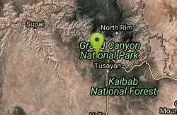
Hermit Trail
Grand Canyon Village, Arizona
25.8 miles SEThe Grand Canyon's Hermit Trail is a scenic beauty which begins at the end of Hermit Road. The rocky trail is well-marked and less busy than the Bright Angel and North Kaibab trails. While...
Backpack, Camp, Hike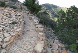
Hermit's Rest Viewpoint to Tonto Trail to Bright Angel Trail
Grand Canyon Village, Arizona
25.8 miles SEHermit’s Rest Viewpoint to Tonto Trail to Bright Angel Trailhead is perfect for hiking, backpacking, walking, and trail running. The Trail takes you across a well-established portion of the...
Backpack, Camp, Hike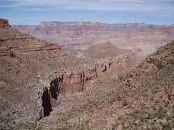
Boucher Trail to Hermit Trail Loop
Grand Canyon Village, Arizona
25.8 miles SEA demanding loop trip of three to four days, tracing one of the most difficult South Rim trails. Even seasoned Grand Canyon backpackers consider the Boucher Trail to be the most difficult, hazardous,...
Backpack, Camp, Hike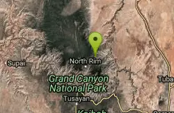
Nankoweap Trail
North Rim, Arizona
28.0 miles EBackpack, Camp, Hike 1.4-9.8 mi
The Bright Angel Trails
Grand Canyon Village, Arizona
28.3 miles SEPrepare yourself for switchbacks as part of a tough elevation gain on the Bright Angel trail to Plateau Point trail. This trail features spectacular views as you hike along the edge of...
Backpack, Camp, Hike, Horseback 4.9 mi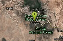
Bright Angel Trail to Tonto Trail
Grand Canyon Village, Arizona
28.3 miles SE"[T]he Tonto Trail offers a degree of civility not found elsewhere along the trail, and it is here that most hikers get their first exposure to the unique nature of this singular transcanyon...
Backpack, Camp, Hike 4.5 mi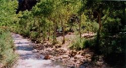
Bright Angel Trail to Bright Angel Campground and River Trail
Grand Canyon Village, Arizona
28.3 miles SEBright Angel Trail to Bright Angel Campground and River dirt trail is one of the most famous trails near Grand Canyon, Arizona. The well-maintained trail encompasses incredible views and has an...
Backpack, Camp, Hike, Rock Climb


