


Sycamore Rim Trail
Parks, Arizona
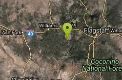
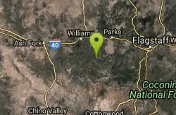
| Address: | ~6711 Thomas Loop Rd, Parks, AZ 86018, USA |
| GPS: |
35°9'18.0"N 111°58'59.2"W Maps | Directions |
| State: | Arizona |
| Trail Length: | 5.00 miles |
| MTB Difficulty: | Expert |
| Trail Type: | Loop |
| MTB Trail Type: | Singletrack |
Mountain Bike
Most people come to this ride for the view of Sycamore Canyon at the overlook, but the scenery along the way is worth the trip, too. The ride starts out in a ponderosa pine forest where big pines and bright green Gambel oaks stand in clumps by the roadside. Farther into the ride, the trees give way to broad grasslands dotted with alligator junipers. These squat, spreading trees have been pruned into bizarre shapes by years of cattle browsing, creating a landscape that looks like something straight out of Africa.At road's end, the view is spectacular. Sycamore Canyon with its buff cliffs of Coconino Sandstone drops precipitously at your feet. To the north, San Francisco Peaks seem to rise right out of the upper reaches of this chasm, creating a landscape that encompasses 8,000 feet of elevation change, from canyon floor to mountain summit. Mingus Mountain and the Verde Valley complete the panorama to the south.The Sycamore Point Ride follows FR 110 out and back to the scenic overlook. This road is used by a moderate amount of motorized traffic, so be prepared to share the road with vehicles. The road surface is reasonably smooth with no steep grades. There is no possibility of a loop ride, although you could start a ride at White Horse Lake and use a different return route from the Sycamore Point Road Intersection. source: fs.usda.gov Courtesy of Singletracks.com
More Information
Add ResourceNever modify trail features. Ride trails when they're dry enough that you won't leave ruts. Speak up when you see others on the trail and always yield to hikers, horses, and others coming uphill. Always ride on the established trail.
Read More- Plan Ahead and Prepare
- Travel & camp on durable surfaces
- Dispose of waste properly
- Leave what you find
- Minimize campfire impacts
- Respect wildlife
- Be considerate of other visitors
Directions
From Parks, Arizona
- Head south on N Spring Valley Rd toward E Old Rte 66 (249 ft)
- Turn left onto E Old Rte 66 (420 ft)
- Keep right to continue on Old Rte 66 (0.5 mi)
- Turn right onto Garland Pr (0.4 mi)
- Continue onto Fire Rd 141 (0.6 mi)
- Merge onto Garland Prairie Rd (8.5 mi)
- Turn left onto Thomas Loop RdDestination will be on the right(0.6 mi)

Other Mountain Bike Trails Nearby
Sunflower Flat
Williams, Arizona
5.3 miles WThis ride is actually two rides in one. The first follows a secondary road through flat open forest country with a short detour to one of the best views on the forest. The second traces...
Mountain Bike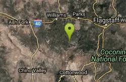
Round Mountain Loop
Williams, Arizona
7.9 miles SWThis ride follows a little used forest road that passes through virtually every type of ponderosa pine habitat that one could find on the south Kaibab. The scenery here is diverse....
Mountain Bike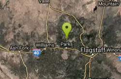
Spring Valley Loop
Williams, Arizona
12.9 miles NThe Spring Valley Loop offers a ride on remote roads and trails with good views and abundant wildlife. Since the route serves as a cross country ski trail in winter, it offers the fat...
Mountain Bike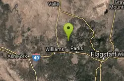
Coxcomb Mountain Bike Trail
Williams, Arizona
14.9 miles NThe Coxcombs Loop follows a sparsely traveled road that climbs and dips over rolling terrain. The hills are all of moderate length and gradient, and the road surface is fairly smooth....
Mountain Bike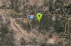
Stage Station Loop
Williams, Arizona
15.4 miles WThis is a pleasant ride over rolling terrain along a primitive road that winds through ponderosa pine forests, pinyon and juniper stands and open grasslands. The scenery consists of...
Mountain Bike
Soldiers Loop / Fairgrounds trails
Flagstaff, Arizona
16.5 miles ESoldiers Loop makes a loop around the park with moderate ups and downs and not really any tech to worry about. Bridge Trail cuts through the center of the loop and has more more tech...
Mountain Bike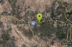
Devil Dog Loop #117
Williams, Arizona
17.0 miles WThe Devil Dog Loop starts out on FR 108 and turns almost immediately onto the unpaved 1922 alignment of Route 66 (now FR 45). At 0.7 miles into the ride, FR 45 branches off to the south...
Mountain Bike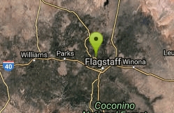
Arizona Trail: Flagstaff
Flagstaff, Arizona
17.6 miles NELeaving the back of Buffalo Park, stay right on the MT Elden Trail System. Any combination of this network of trails will get you over to the east side where you pick up the AZT and follow that to...
Mountain Bike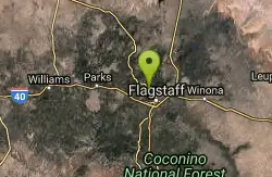
Fort Valley Trail System
Flagstaff, Arizona
17.9 miles ELocated at the base of the San Francisco Peaks, the Fort Valley Trail System was designed primarily for connecting popular mountain biking trails. This system is a multi-use trail to be...
Mountain Bike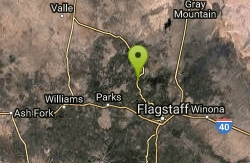
Barn Burner Course
Flagstaff, Arizona
18.2 miles NENice fast smooth trail with some good climbing and a few technical sections.
Mountain Bike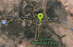
Observatory Mesa
Flagstaff, Arizona
18.6 miles ENovice ridingBeginner skill levelRide between apr-novLots of options. Refer to cosmic rays fat tire guide for more info2-20 miles
Mountain Bike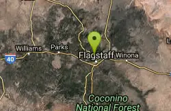
Flagstaff Loop Trail
Flagstaff, Arizona
18.7 miles EThe trail forms a 42 mile loop around the city of Flagstaff. It is nearly completed and consists of various existing trails, forest roads, and newly constructed ST. It is divided into...
Mountain Bike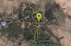
Schultz Creek
Flagstaff, Arizona
19.2 miles EGreat trail, once you get there. I bit of just a bit too much for my self . 25 miles to be exact. It's a network of trails to get there but once you do the actual Shultztrail is about 6-8 miles...
Mountain Bike
Cockscomb Trail
Sedona, Arizona
19.3 miles SAs with most trails in Sedona, a recreation pass is required to park your car at the trailhead. There is a kiosk at a nearby parking area. From the Cockscomb trailhead, ride to the left...
Mountain Bike
Willard Springs
Sedona, Arizona
19.7 miles SEMultiple forest roads that are in poor driving condition. There are about 1' deep ruts and washouts.
Mountain Bike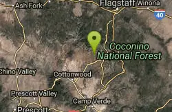
Dawa Loop
Sedona, Arizona
19.7 miles SESometimes you are traveling with kids or neophyte mountain bikers and are wondering where to take them. The following route describes a fun and fairly easy practice trail. Can't...
Mountain Bike
Fisher Point Trail
Flagstaff, Arizona
19.8 miles EThe trail run approximately 3 miles from Pine Canyon housing development to Fisher Point. It is mostly downhill to Fisher Point. It is predominately doubletrack with some singletrack...
Mountain Bike
Oldham Trail
Flagstaff, Arizona
20.2 miles EThere is a sigletrack here down though the towering trees. Follow this to a network of trails. Then look for the Oldham tr sign and head up hill. Climb all the way up to the fire road...
Mountain Bike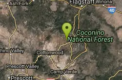
Mescal Trail
Sedona, Arizona
20.5 miles SEMany of the newer trails and best riding in the Sedona area are in the Boynton Pass area. The route described with the accompanying TOPO map includes all or part of Chuckwagon, Mescal,...
Mountain Bike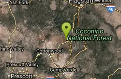
Upper Dry Creek Area Trails
Sedona, Arizona
21.0 miles SEThe Upper Dry Creek Area Trails are easily accessible from West Sedona and include a lot of Sedona classics like Chuckwagon, Mescal, and Aerie. While this trail system offers gorgeous...
Mountain BikeNearby Campsites

Cave Springs
Sedona, Arizona
17.6 miles SECave Springs Campground is a scenic campground that sits in Oak Creek Canyon. Cave Springs is nestled perfectly in the town of Sedona, giving the campground the notorious Sedona red views. Uniquely,...
Camp, Hike, Swim
Chavez Crossing
Sedona, Arizona
24.5 miles SEChavez Crossing is a campground in Sedona, Arizona. It sits perfectly nestled in Arizona's most beautiful red rock attractions along with the grand summer sunsets. If that didn't sound...
Camp, Hike, Swim
Beaver Creek Dispersed Camping
36.3 miles SE
Free dispersed camping on the cliffs above Beaver Creek.
Camp
Beaver Creek Campground
Camp Verde, Arizona
36.9 miles SECamp, Canoe, Kayak, and Swim near Camp Verde, Arizona
Camp, Canoe, Kayak, Swim 0.4 mi
Clear Creek Campground
Camp Verde, Arizona
45.9 miles SWest Clear Creek flows along the boundary of this desert canyon country camp and is a popular place for hiking, swimming, wading and fishing. Cool water species such as smallmouth bass and green...
Camp, Hike, Swim


