Sycamore Reservoir
Tucson, Arizona
| Address: | Arizona Trail, Mt Lemmon, AZ 85619, USA |
| GPS: |
32°20'9.4"N 110°43'18.7"W Maps | Directions |
| State: | Arizona |
| Trail Type: | Out & Back |
| Trails/Routes: | 2.4 mi |
Trails
Hike and Swim
Sycamore Reservoir is a small lake up in Bear Canyon on Mount Lemmon that was originally a water source for an abandoned prison camp. Nowadays, the lake is great for recreation, complete with a sandy shore, a dam, and beautiful trees along the banks. When full, the dam provides a beautiful little waterfall, fed from both Bear and Sabino Canyons. The foilage from the trees are especially striking during the autumn months, although this trail could be hiked any time in the fall, winter, or spring.
The reservoir can be accessed by a lightly trafficked hike through the surrounding Arizona desert. The trail starts off of the old prison camp, which is itself just a short drive from the Catalina Highway. It will lead you down the Arizona Trail from the south end of the parking lot. After two miles, the Molino Basin trail transitions to the Sycamore Reservoir trail at Shreve Saddle (marked with a sign). Along the Sycamore Reservoir trail, a side path to the left will lead you to the dam and reservoir. The main trail will continue until a junction that splits into the East Fork Trail and the Palisades trail.
Make sure to bring plenty of outside water on the hike, as water from the dam is not potable, and requires purification. There are bathrooms at the parking lot, but they may be closed seasonally. There is no running water at the lot.
Mapped Route/Trail Distances
| Arizona Trail from Gordon Hirabayashi Recreation Area to Sycamore Reservoir | 2.4 miles |
More Information
Be courteous, informed, and prepared. Read trailhead guidelines, stay on the trail, and don't feed the wildlife.
Read MoreDirections
From Tucson, Arizona
- Head west on E Broadway Blvd toward S Country Club Rd (39 ft)
- Turn right at the 1st cross street onto N Country Club Rd (1.0 mi)
- Turn right onto E Speedway Blvd (4.0 mi)
- Turn left onto N Wilmot Rd (0.5 mi)
- Continue onto E Tanque Verde Rd (1.7 mi)
- Keep left to stay on E Tanque Verde Rd (2.1 mi)
- Turn left onto E Catalina Hwy (4.5 mi)
- Continue onto E Mt Lemmon Hwy (7.3 mi)
- Turn left toward N Prison Camp Rd (0.2 mi)
- Continue onto N Prison Camp Rd (446 ft)
- Turn right toward N Prison Camp Rd (184 ft)
- Turn right onto N Prison Camp RdDestination will be on the left(0.2 mi)
Trails
Distance ?
2.4 milesElevation Gain ?
-461 feetReal Ascent ?
410 feetReal Descent ?
871 feetAvg Grade (-2°)
-4%Grade (-27° to 23°)
-52% to 42%Elevation differences are scaled for emphasis. While the numbers are accurate, the cut-away shown here is not to scale.
Other Swimming Holes and Hiking Trails Nearby
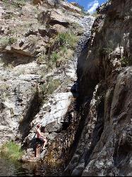
Seven Cataracts
Tucson, Arizona
1.8 miles NSeven Cataracts is a set of waterfalls located within Willow Canyon near Tucson, Arizona. The best way to reach the pools at the bottom involve some canyoneering to maneuver down the rocks along the...
Canyoneer, Hike, Swim 1.1 mi
La Milagrosa Canyon
Tucson, Arizona
2.7 miles SLa Milagrosa Canyon is a hidden gem just east of Tucson, Arizona and north of the Tanque Verde area. It features many rock-climbing walls, and even a seasonal waterfall with pools for swimming, best...
Hike, Mountain Bike, Rock Climb, Swim 1.0-7.5 mi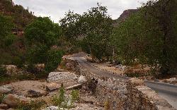
Hutch's Pool
Tucson, Arizona
6.1 miles WHutch's Pool is a popular destination near Tucson, Arizona. Famed for its cool water in the desert heat, the pool is an 8-mile hike round trip into the canyons and mountains of Sabino Canyon...
Hike, Swim 2.7-3.5 mi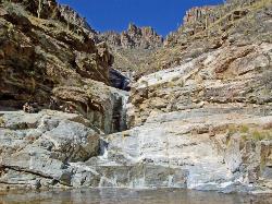
Seven Falls
Tucson, Arizona
6.2 miles WSeven Falls is a waterfall located in the Sabino Canyon near Tucson, Arizona. It's a great hike and a fun swimming hole, and listed often as one of the best or most popular activities of the...
Hike, Swim 4.4 mi
Chiva Falls
Mount Lemmon, Arizona
6.4 miles SEChiva Falls is a waterfall nestled within Coronado National Forest. The path to get there is quite rocky, proving a favorite for mountain biking and motorized vehicles, although hiking is also...
Hike, Mountain Bike, Swim 0.9 mi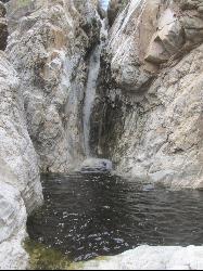
Tanque Verde Falls
Tucson, Arizona
6.6 miles SETanque Verde Falls are a set of waterfalls and pools inside of Tanque Verde Canyon near Tucson, Arizona. The canyon is located within Coronado National Forest. There is a parking area on the...
Hike, Swim 3.6 mi
Lemmon Pools
Mount Lemmon, Arizona
6.7 miles NHidden among the trees and boulders of Mount Lemmon lies Lemmon Pools, a swimming hole near the Santa Catalina Mountains and Mount Lemmon itself. It's about 8.5 miles round trip to the pools and...
Hike, Swim 1.0-1.2 mi
Maiden Pools
Tucson, Arizona
7.8 miles WOver the course of time, the Ventana Stream has exposed the canyon’s base granite, and then smoothed and formed into a series of small pools -- now called the Maiden Pools. With...
Hike, Rock Climb, Swim 0.5-9.3 mi
Frog's Hollow
Vail, Arizona
8.9 miles EFrog's Hollow is a little-known swimming hole located along the Arizona Trail in the Upper Tanque Verde Canyon near Tucson, Arizona. It is found by hiking or mountain biking along the Arizona or...
Hike, Mountain Bike, Swim
Cactus Forest Trail
Tucson, Arizona
9.4 miles SPart of the approximately 10-mile Cactus Forest Trail runs through Saguaro National Park East and provides a nice landscape introduction for newcomers to the desert. A 2.5 mile dirt trail that...
Hike, Mountain Bike 2.8-3.5 mi
Romero Pools
Tucson, Arizona
12.5 miles NWNestled in Arizona's Catalina State Park, just north of Tuscon, are the Romero Pools. The pools are accessible by a hike through Romero Canyon that takes an average of two hours. The hike gets...
Hike, Swim 1.9 mi
Montrose Pool
Tucson, Arizona
12.5 miles NWMontrose Pool is a seasonal catchment accessable through the Romero Canyon trail in Catalina State Park, Arizona. The pool fills up after rain, but is often dry. The trailhead is the same...
Hike, Swim


