


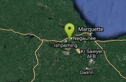
Suicide Bowl
Negaunee, Michigan
Rock Climb
Famous ski jump located in Michigan's upper peninsula that is on the National Register of Historic Places.
More Information
- Plan Ahead and Prepare
- Travel & camp on durable surfaces
- Dispose of waste properly
- Leave what you find
- Minimize campfire impacts
- Respect wildlife
- Be considerate of other visitors
Directions
From Negaunee, Michigan
- Head north on Baldwin Ave toward US-41 S (39 ft)
- Turn left at the 1st cross street onto US-41 N (0.3 mi)
- Turn left onto N Teal Lake Ave (0.5 mi)
- Turn right onto W Main St (430 ft)
- Continue onto Jackson St (0.1 mi)
- Turn left onto N Silver St (0.3 mi)
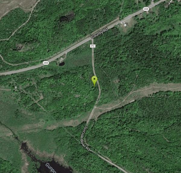
- Continue onto County Rd (0.9 mi)
- Turn left onto Suicide Bowl RdDestination will be on the right(0.2 mi)
From Marquette, drive into Negaunee on 41, take a left just before Teal Lake. Grandma T's pasty shop will be on that corner. You should now be on bus28. It will take one right, and then one left, and then it will curve to the right and become straighter. You will be on the outskirts of the neighborhood. Drive west for a couple minutes. You will see a suicide bowl ski jump sign on your left. This road is called cliffs drive/suicide bowl road. Just before you get to the power lines, take note of a 4wheel trail on your right. Park under the powerlines (usually off to the left in a flat spot). Walk back to the 4wheel trail and follow it for a couple minutes. When leaves are off the trees you will easily see the rock on your right. There is a small trail that cuts straight up the hill to the crag.
(Courtesy of rockclimbing.com)
Other Rock Climbing Walls Nearby
Marquette Mountain
Skandia, Michigan
22.4 miles SEMarquette Mountain is a winter sports area for skiing and snow boarding, located within city limits a few miles south of downtown Marquette, Michigan, the major city in the state's Upper...
Hike, Rock Climb
AAA Rock (Bud Rock)
Marquette, Michigan
23.0 miles NFor Michigan this a great spot. Three bolted 5.11a sport routes, one about 5.8, two 5.11a. and three TR set ups. The two routes on the left have walk up TR set up, the right, well, thin sport lead.
Rock Climb


