St. George Narrows
St. George, Utah
| Address: | 551 N 1400 E #1, St. George, UT 84770, USA |
| GPS: |
37°7'0.1"N 113°34'33.5"W Maps | Directions |
| State: | Utah |
| Trails/Routes: | 0.1 mi |
Hike
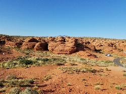
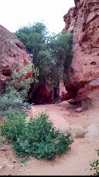
Not to be confused with the Narrows of Zion National Park, the St. George Narrows, also referred to by locals as the "Crack", are located near downtown St.George, Utah just a stones throw from many popular shopping centers and hotspots. Located in scenic Pioneer park, the St. George narrows offers a unique experience that you don't have to go outside of the city limits for. The Red Bluff Gardens are located near the entrance of the park which offers beautiful desert scenery, as well as a small trail that gives information about animals and plants native to Southern Utah.
The small slot canyon is about 0.17 miles in length and is a perfect introduction to the adventures you are likely to have as you explore scenic St. George. Pioneer Park offers other trails in the same park such as the Dixie Sugarbluff trail, the Pioneer Park arch trail, the Powell Eagle Nest, and the Pioneer "Cabin" trail. It is a great place to spend some time just before you leave town for a last minute adventure or if you are killing time between activities in the St. George area. It is safe to bring children in to the St. George Narrows and don't worry about any water due to flash floods or the mighty Virgin River flowing through, these narrows are completely dry!
More Information
Be courteous, informed, and prepared. Read trailhead guidelines, stay on the trail, and don't feed the wildlife.
Read MoreDirections
From St. George, Utah
- Head north on S 700 E toward E 600 S (0.9 mi)
- Turn right onto E 100 N/
St George Blvd Pass by McDonald's (on the right)(0.2 mi) - Turn left onto N 900 E (0.2 mi)
- Turn left onto E Red Hills Pkwy (0.7 mi)
- Turn rightDestination will be on the right(0.2 mi)
Trails
Distance ?
432 feetElevation Gain ?
63 feetReal Ascent ?
65 feetReal Descent ?
2 feetAvg Grade (8°)
15%Grade (-2° to 21°)
-3% to 39%Elevation differences are scaled for emphasis. While the numbers are accurate, the cut-away shown here is not to scale.
Other Hiking Trails Nearby

Dixie Sugarloaf / Dixie Rock
St. George, Utah
0.2 miles SWHike near St. George, Utah
Hike 11.3 mi
Grapevine Trail
Washington, Utah
5.2 miles NEThe Grapevine trail located near Washington, UT is a unique trail that connects to several other trails in the area such as the Prospector trail and the Church Rocks trail. What makes the Grapevine...
Hike, Mountain Bike 0.5-15.1 mi
Green Valley Trail System
St. George, Utah
5.2 miles SWThe Green Valley trail system, located just outside of St. George, Utah, is a heavily trafficked trail system that features some of the more popular trails in Southern Utah. With trails such as the...
Hike, Mountain Bike 18.8 mi
Church Rocks
Washington, Utah
5.4 miles EThe Church Rocks hike near Hurricane, Utah, about a half hour outside of St. George, is another hidden gem outside of Zion National Park. Similar to the Slick Rock Trail in Moab, there are lots...
Hike, Mountain Bike 0.2-0.4 mi
Snow Canyon State Park
St. George, Utah
7.0 miles NWSnow Canyon State park is often described as a smaller version of Zion National park. While both offer similar beautiful landscapes, exciting trails for adventure seeking hikers, and family friendly...
Cave, Hike, Mountain Bike, Rock Climb 0.7 mi
Snow Canyon Lava Caves
St. George, Utah
8.1 miles NWThese caves are located in Snow Canyon State Park near Dammeron Valley in Utah and it's one of the most unique places in southern Utah. Years ago, lava flowed through these caves until...
Cave, Hike 0.7 mi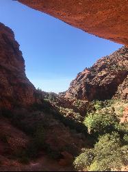
Red Reef trail
Hurricane, Utah
11.9 miles NEThe Red Reef trail is located near the small town of Leeds, Utah and in the Red Cliffs Desert Reserve. It is a 2 mile trail that takes hikers near the beautiful red slick rock cliffs of Southern...
Hike 3.4 mi
More Cowbell
Virgin, Utah
18.4 miles EThe More Cowbell loop, located outside of Hurricane, Utah, is a beginner level bike trail that gives riders a good feel for what mountain biking is like. It is a great practice run for bigger, more...
Hike, Mountain Bike 5.1 mi
Dead Ringer
Virgin, Utah
18.4 miles EThe Dead Ringer trail is one of three biking trails located just outside of Hurricane, Utah. Starting at the JEM trailhead, bikers start on a winding, up and down trail that runs parallel to the JEM...
Hike, Mountain Bike 6.9 mi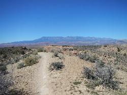
J.E.M. Trail
La Verkin, Utah
20.7 miles EThe J.E.M. trail is one of the many exciting trails located just outside of Hurricane, Utah. It is connected with the More Cowbell and Dead Ringer trails and is the longest of all three trails...
Hike, Mountain Bike 11.6 mi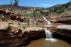
Toquerville Falls
La Verkin, Utah
22.0 miles NENothing says desert oasis quite like driving for 5.5 miles through winding sandy roads to find a favorite swimming hole with ledges, falls, and even a ladder to climb up to the best jumping spots....
Dive, Hike, Mountain Bike, Swim 0.2 mi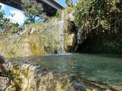
Little Jamaica aka Desert Springs
Littlefield, Arizona
24.4 miles SWLittle Jamaica is a warm springs waterfall and pool just off the highway between Desert Springs and Littlefield, Arizona. It's a family location that doesn't get more than 5 feet deep in the...
Hike, Swim 3.3 mi
Guacamole Mesa
Virgin, Utah
26.5 miles EGuacamole Mesa, also known by locals as the Whole Guacamole, is an advanced level biking trail in Virgin, Utah (just outside of Hurricane). The trail starts in a climb up the mesa that features tight...
Hike, Mountain Bike 7.5 mi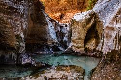
The Subway
Apple Valley, Utah
31.7 miles NEThe Subway is one of the best kept secrets of Zion National Park. A little off the beaten path, but a hike that is a must see for any adventure seeking person out there. Hikers begin at the Wildcat...
Canyoneer, Hike, Swim
Zion National Park
Hurricane, Utah
33.2 miles EThis is a unique place in the world. Sandstone,carved from wind, water and ice have created icons to visitors. The buttes, landings, bends, mounts and mountains have all been given names over the...
Camp, Hike, Mountain Bike, Swim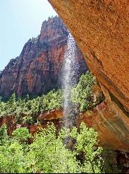
Emerald Pools Trail
Hurricane, Utah
35.2 miles EThe Emerald Pools were named for their unusual color. At some times of the year, algae gives the water in these pools a distinctive hue. A series of basins have been carved into a rock ledge in the...
Hike
The Grotto Trail
Springdale, Utah
35.7 miles EThe Grotto Trail is a short easy trail that connects The Grotto shuttle stop and Zion Lodge. It follows near the road for about 1.5 miles and has an elevation gain of about 130 feet.
Hike 2.6 mi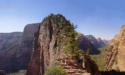
Angels Landing
Springdale, Utah
35.7 miles EAngels Landing is one of the park's most strenuous day hikes, but it offers spectacular vistas. It follows the West Rim Trail through the famous switchbacks of Walters Wiggles, past dramatic...
Hike 3.6 mi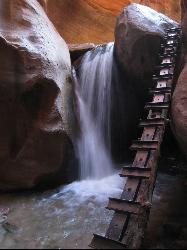
Kanarraville Falls
Kanarraville, Utah
36.4 miles NEKanarraville falls (also known as Kanarra falls) located outside of Cedar City, Utah is a must-see stop for any adventurous souls. Kanarra Falls is a medium length hike, both on trail and through...
Hike, Swim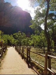
Riverside Walk
Springdale, Utah
36.6 miles EThe Virgin River has many moods, from quiet and slow to a raging torrent. This beautiful, shaded walk meanders through forested glens, following the path of the stream ever deeper into the...
HikeNearby Campsites
Sand Hollow State Park
Hurricane, Utah
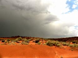
10.7 miles ESand Hollow is the closest thing to a tropical paradise in the middle of the Utah desert, near Hurricane, Utah. It features a beach area, places to cliff jump, swim, and off-road with your ATV. There...
Camp, Canoe, Dive, Kayak, Swim
Zion National Park
Hurricane, Utah
33.2 miles EThis is a unique place in the world. Sandstone,carved from wind, water and ice have created icons to visitors. The buttes, landings, bends, mounts and mountains have all been given names over the...
Camp, Hike, Mountain Bike, Swim


