


Spruces Campground
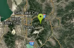
Salt Lake City, Utah
| Address: | UT-190, Salt Lake City, UT 84121, USA |
| GPS: |
40°38'28.5"N 111°38'19.5"W Maps | Directions |
| State: | Utah |
Restrooms Picnic Tables Rivers Trails
Camp and Sled
Camping isn't free. See USDA.gov for details.
If you know the coordinates of the sledding hill here, please comment.
More Information
- Plan Ahead and Prepare
- Travel & camp on durable surfaces
- Dispose of waste properly
- Leave what you find
- Minimize campfire impacts
- Respect wildlife
- Be considerate of other visitors
Directions
From Salt Lake City, Utah
- Head west on 400 S/University Blvd toward Main St (0.2 mi)
- Turn left at the 1st cross street onto W Temple (0.2 mi)
- Turn right onto 500 S/Cesar E. Chavez Blvd (0.6 mi)
- Take the I-80 E/I-80 W ramp on the left to Cheyenne/Reno/S.L. International Airport/Las Vegas (0.2 mi)
- Keep left at the fork, follow signs for I-15 S/I-80 E/Cheyenne/Las Vegas and merge onto I-15 S/I-80 E (2.5 mi)
- Keep left at the fork to continue on I-15 S (5.9 mi)
- Take exit 298 to merge onto I-215 E/Belt Route (5.5 mi)
- Take exit 6 for UT-190 E toward 3000 E (0.3 mi)
- Keep left, follow signs for 6200 South E (341 ft)
- Turn right onto UT-190 E/6200 S/Big Cottonwood Rd SContinue to follow UT-190 E(1.7 mi)
- Turn left onto UT-190 E/Big Cottonwood Cyn RdContinue to follow UT-190 E(9.7 mi)
- Turn right onto FR021Restricted usage road(397 ft)
- Turn left to stay on FR021Restricted usage road(469 ft)
- Turn right to stay on FR021Destination will be on the right(82 ft)
Vivit-Tours
1/27/20 8:37 am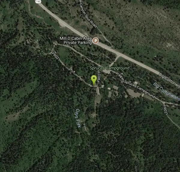
Other Sledding Hills Nearby
Mountain Dell Golf Course
Salt Lake City, Utah
8.2 miles NWDuring the winter, the hill behind the clubhouse makes a great sledding hill which the golf course permits free of charge.
Sled
Bella Vista Elementary School'
Cottonwood Heights, Utah
10.1 miles WSled near Cottonwood Heights, Utah
Sled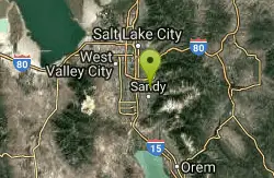
Willow Creek Park
Sandy, Utah
10.5 miles WThese are pretty short slopes for sledding. One is steeper than the other.
Sled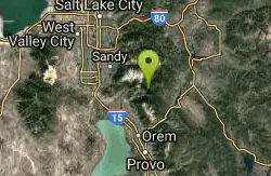
Tibble Fork Reservoir
Provo, Utah
10.9 miles SThere isn't one specific sledding run at this location. There's a great parking lot and hills above and below. It all depends on what kind of speed and excitement you're looking for....
Sled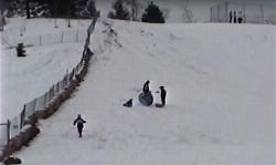
Flat Iron Mesa Park
Sandy, Utah
11.1 miles WSled near Sandy, Utah
Sled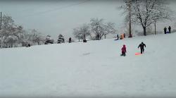
Sugar House Park
Salt Lake City, Utah
12.5 miles NWThere are a few shorter slopes around the park which are great for sledding and one big hill in the Southwest corner that will get you some real speed.
Sled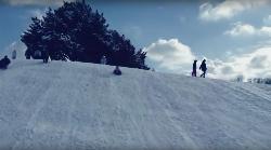
Murray Park
Murray, Utah
12.6 miles WSled near Murray, Utah
Sled
Lindsey Gardens
Salt Lake City, Utah
15.2 miles NWSled near Salt Lake City, Utah
Sled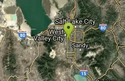
Bennion Park
Salt Lake City, Utah
17.2 miles WThe park is open from 7:00 a.m. to 10:00 p.m. It's a pretty flat and straight hill that's smaller on the North side but gets pretty big as it goes South.
Sled
300 East Lehi Lot
Lehi, Utah
19.2 miles SWThis is a huge lot with a lot of terrain. There's a couple of easily accessible hills and plenty more that could be played on.
Sled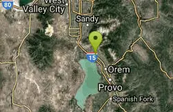
Evergreen Park
American Fork, Utah
19.5 miles SSled near American Fork, Utah
Sled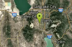
Vermillion Park
South Jordan, Utah
19.5 miles WSled near South Jordan, Utah
Sled
Shelley Elementary
American Fork, Utah
19.5 miles SWSled near American Fork, Utah
Sled
Western Hills Elementary
Kearns, Utah
19.6 miles WSled near Kearns, Utah
Sled
East Mueller Park
Bountiful, Utah
19.6 miles NWSled near Bountiful, Utah
Sled
Daybreak Elementary
South Jordan, Utah
20.2 miles WSled near South Jordan, Utah
Sled
West Ridge Golf Course
West Valley City, Utah
20.7 miles WGolf isn't free but sledding is. If you know the locations of the hill or hills here that are great for sledding, please leave a comment.
Sled
Oak Canyon Junior High
Lindon, Utah
21.3 miles SSled near Lindon, Utah
Sled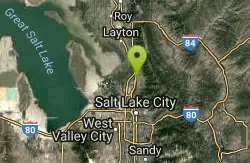
Bountiful City Park
Bountiful, Utah
21.7 miles NWLength: ~100-200ft Slope: ~45°
Sled
Orem Cemetary
Orem, Utah
22.0 miles SSled near Orem, Utah
SledNearby Campsites

Mill Creek Canyon
Salt Lake City, Utah
5.6 miles NWMill Creek is an out and back with over 1000 ft of elevation gain. The lower section of the ski trail gets a lot of foot traffic, but the upper section (above Elbow Fork) is generally very quiet....
Camp, Cross-country Ski, Snowshoe 1.6-14.1 mi
Mount Timpanogas
Provo, Utah
14.5 miles SMt. Timp, as the locals call it, is the 2nd highest mountain in the Wasatch range (only Mt. Nebo is higher). What sets "Timp" apart is its location. It towers over the Provo, Orem, Pleasant...
Camp, Hike, Horseback, Swim
Holbrook Trailhead
Bountiful, Utah
19.8 miles NWairsoft feaild woth bunkers
Airsoft, Backpack, Camp, Paintball, Snowshoe
Y-Mountain Summit Trail
Provo, Utah
27.4 miles SY Mountain is located directly east of Brigham Young University (BYU) in Provo, Utah, United States. The Slide Canyon/Y Mountain Trail leads to a large block Y located 1.2 miles (1.9 km) from a...
Camp, Hike 5.6 mi
Antelope Island Lakeside Trail
Syracuse, Utah
40.9 miles NWThe Lakeside Trail is a kid-friendly trail with great views and many bugs. This is a gorgeous scenic hike winding around part of the Great Salt Lake. The trail on Antelope Island that runs about...
Camp, Hike, Horseback
Antelope Island State Park
Syracuse, Utah
41.2 miles NWLocated just 41 miles north of Salt Lake City, Antelope Island State Park encompasses a vast selection of outdoor activities and spectacular scenery providing a peaceful nature experience. Experience...
Backpack, Camp, Hike, Horseback, Mountain Bike 4.7 mi
Fifth Water Hot Springs
Provo, Utah
41.3 miles SAKA Diamond Fork Hot Springs A beautiful drive and a 2.5 mile hike along the river will end you at an amazing set of hot springs that's well worth the trip. There's a variety of...
Backpack, Camp, Hike, Hot Springs, Mountain Bike, Swim
Hell Hole Lake
Evanston, Utah
42.8 miles EThe first 250 feet of this trail are on private property with access provided by Kayenta. The trail is actually the northern portion of Dry Wash. Sand and boulders litter the wash making hiking...
Camp, Hike, Horseback 2.9 mi
Pineview Reservoir
Eden, Utah
46.3 miles NLocated on the backside of the Wasatch Front, Pineview Reservoir in the Ogden River Canyon is home to stunning views of the water, sandy beaches, the Southern Skyline trail, paved ramps, and...
Camp, Canoe, Hike, Kayak, Mountain Bike, Swim


