


SOS
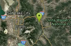
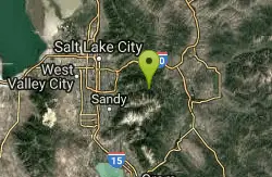
Park City, Utah
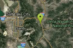
| Address: | ~Historic Union Pacific Rail Trail, Park City, UT 84060, USA |
| GPS: |
40°40'3.7"N 111°28'54.8"W Maps | Directions |
| State: | Utah |
| Trail Length: | 0.00 miles |
| MTB Difficulty: | Advanced |
| Trail Type: | Network |
| MTB Trail Type: | Singletrack |
Mountain Bike
SOS is an advanced .3 mile descent off of the Prospector Trail down to Prospector Park. It's a steep drop, so hang on tight! Courtesy of Singletracks.com
Never modify trail features. Ride trails when they're dry enough that you won't leave ruts. Speak up when you see others on the trail and always yield to hikers, horses, and others coming uphill. Always ride on the established trail.
Read More- Plan Ahead and Prepare
- Travel & camp on durable surfaces
- Dispose of waste properly
- Leave what you find
- Minimize campfire impacts
- Respect wildlife
- Be considerate of other visitors
Directions
From Park City, Utah
- Head northwest on Park Ave toward Heber Ave (16 ft)
- Turn right onto Heber Ave (0.1 mi)
- Turn left to stay on Heber Ave (174 ft)
- Turn right onto Deer Valley Dr (256 ft)
- At the traffic circle, take the 3rd exit and stay on Deer Valley Dr (0.9 mi)
- Turn right onto Bonanza Dr (0.5 mi)
- Turn right onto Kearns Blvd (0.9 mi)
- Turn right onto Wyatt Earp Way (0.1 mi)
- Turn left onto Trailside Ct (0.1 mi)

Other Mountain Bike Trails Nearby
Lost Prospector
Park City, Utah
0.9 miles SWLost Prospector is a well-constructed machine-built trail that makes up one big side of the Gambel Oaks trail system. Rocky in places and loamy in others, this trail provides some fantastic views...
Mountain Bike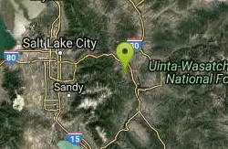
Boot Hill
Park City, Utah
1.1 miles WBoot Hill is an intermediate singletrack trail in Park City located near Monitor Drive, Snow Creek Drive, and Kearns Blvd.
Mountain Bike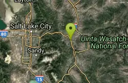
Round Valley
Park City, Utah
1.1 miles NENice network of intermediate singletrack in a open space preserve. Good veiws, some nice curvy sections of trail. Well maintained good training ride. Like most of the trails in Park City,...
Mountain Bike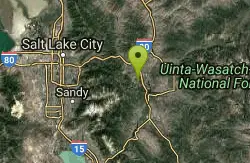
Solamere
Park City, Utah
1.1 miles SSolamere is a great downhill! Fast and relatively smooth downhill with sweeping switchbacks and a fun rock garden two or three straightaways into the ride. Drops you off on Solamere...
Mountain Bike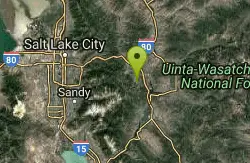
Masonic
Park City, Utah
1.4 miles SWMasonic is a twisty, techy oldschool-style descent off the top of the knob down to Lost Prospector. The trees and undergrowth grow in close to the narrow tread, and the challenging...
Mountain Bike
Prospector Area
Park City, Utah
1.5 miles STrailhead/entrance is off of Mellow Mountain Road. .75 miles of uphill to get to the top of the mountain. Once there, you have a couple of choices for your downhill... either Solamere...
Mountain Bike
Poison Creek
Park City, Utah
1.7 miles SWThe Poison Creek trail is a paved greenway that runs through the town of Park City. It connects to several other greenway trails, allowing you to easily get around town by bike without...
Mountain Bike
Jenni's
Park City, Utah
1.7 miles SWJenni's is a 5-mile singletrack trail that traverses the ski slopes of PCMR and descends down to the town of Park City. Much of the trail is bright and sunny and traverses across the...
Mountain Bike
Sweeney Switchbacks
Park City, Utah
1.7 miles SWTight, extremely technical switchbacks surrounded by aspens. Some of the switchbacks are so tight that I had to get my front end around, lock up my front brake and swing my back...
Mountain Bike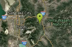
Crescent Mine Grade
Park City, Utah
1.7 miles SWThe Crescent Mine Grade is one of the longer sections of trail in Park City, descending almost 4 miles from Thayne's road, down into town. The CMG is built on an old mining train-grade,...
Mountain Bike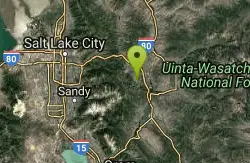
John's Trail
Park City, Utah
1.9 miles SWOne of the great Park City Mountain Resort trails. It can be accessed by lift service from PayDay or by riding up King Road or Sweeney's singletrack. Ride this twisting trail through...
Mountain Bike
Spiro
Park City, Utah
1.9 miles SWSpiro, like the nearby Crescent Mine Grade trail, is one of the longer individually-named trails in the Park City area. Running for about 3 miles from town up to Thaynes Canyon Road,...
Mountain Bike
Armstrong
Park City, Utah
1.9 miles WArmstrong is a 4-mile climb that begins near the Crescent Lift and climbs all the way up to Ham and the Mid-Mountain trail. While most of the trails at PCMR are two-way trails,...
Mountain Bike
PC Dirt Jumps
Park City, Utah
1.9 miles WThe Park City dirt jumps are a complex of, well, sculpted dirt jumps set up progression-style from little bumps for kids on strider bikes, all the way up to some of the biggest jumps...
Mountain Bike
Mid-mountain
Park City, Utah
1.9 miles WMid Mountain Loop can be summed up in one word, "extraordinary"!! Mid Mountain is an epic ride that begins in Park City and climbs the Spiro Trail, touches very briefly on the Powerline...
Mountain Bike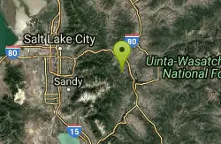
Park City Mountain Resort (PCMR)
Park City, Utah
2.0 miles SWThe Park City Mountain Resort/Old Town area accounts for most of the trails right above the town of Park City. While many of these trails can be accessed by chairlifts or shuttled on...
Mountain Bike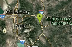
Snow Park Loop
Park City, Utah
2.1 miles SSnow Park loop at Deer Valley is one of those rare, blue ribbon singletrack loops that all mountain bikers are constantly searching for! Deer Valley has world renowned ski runs and...
Mountain Bike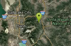
Eagle Trail
Park City, Utah
2.2 miles SWSoar like an eagle down this sloped singletrack trail in Park City. You will definitely pick up the speed and feel the wind against your face biking Eagle Trail as you coast through tall grass,...
Mountain Bike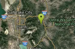
Trestle Trail
Park City, Utah
2.3 miles SWTrestle Trail is an advanced .66-mile descent that drops straight down below the Town Lift chairlift.
Mountain Bike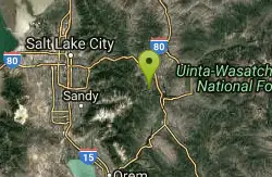
Gina's Daly Bypass
Park City, Utah
2.5 miles SGina's Daly Bypass is half singletrack, half gravel road. It connects from Gravedigger and Daly Grind down to Sweeney's and town.
Mountain BikeNearby Campsites
Spruces Campground
Salt Lake City, Utah
8.4 miles WCamping isn't free. See USDA.gov for details. If you know the coordinates of the sledding hill here, please comment.
Camp, Sled
Mill Creek Canyon
Salt Lake City, Utah
12.3 miles WMill Creek is an out and back with over 1000 ft of elevation gain. The lower section of the ski trail gets a lot of foot traffic, but the upper section (above Elbow Fork) is generally very quiet....
Camp, Cross-country Ski, Snowshoe 1.6-14.1 mi
Mount Timpanogas
Provo, Utah
18.3 miles SWMt. Timp, as the locals call it, is the 2nd highest mountain in the Wasatch range (only Mt. Nebo is higher). What sets "Timp" apart is its location. It towers over the Provo, Orem, Pleasant...
Camp, Hike, Horseback, Swim
Holbrook Trailhead
Bountiful, Utah
24.0 miles NWairsoft feaild woth bunkers
Airsoft, Backpack, Camp, Paintball, Snowshoe
Y-Mountain Summit Trail
Provo, Utah
29.9 miles SY Mountain is located directly east of Brigham Young University (BYU) in Provo, Utah, United States. The Slide Canyon/Y Mountain Trail leads to a large block Y located 1.2 miles (1.9 km) from a...
Camp, Hike
Hell Hole Lake
Evanston, Utah
34.4 miles EThe first 250 feet of this trail are on private property with access provided by Kayenta. The trail is actually the northern portion of Dry Wash. Sand and boulders litter the wash making hiking...
Camp, Hike, Horseback 4.7 mi
Fifth Water Hot Springs
Provo, Utah
40.9 miles SAKA Diamond Fork Hot Springs A beautiful drive and a 2.5 mile hike along the river will end you at an amazing set of hot springs that's well worth the trip. There's a variety of...
Backpack, Camp, Hike, Hot Springs, Mountain Bike, Swim 5.6 mi
Antelope Island Lakeside Trail
Syracuse, Utah
46.3 miles NWThe Lakeside Trail is a kid-friendly trail with great views and many bugs. This is a gorgeous scenic hike winding around part of the Great Salt Lake. The trail on Antelope Island that runs about...
Camp, Hike, Horseback
Antelope Island State Park
Syracuse, Utah
46.7 miles NWLocated just 41 miles north of Salt Lake City, Antelope Island State Park encompasses a vast selection of outdoor activities and spectacular scenery providing a peaceful nature experience. Experience...
Backpack, Camp, Hike, Horseback, Mountain Bike 2.9 mi
Pineview Reservoir
Eden, Utah
47.0 miles NLocated on the backside of the Wasatch Front, Pineview Reservoir in the Ogden River Canyon is home to stunning views of the water, sandy beaches, the Southern Skyline trail, paved ramps, and...
Camp, Canoe, Hike, Kayak, Mountain Bike, Swim


