


Sonoran Trail Fountain Hills
Fountain Hills, Arizona

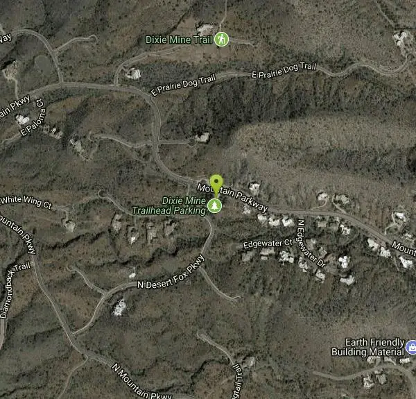
| Address: | ~14425 Mountain Parkway, Fountain Hills, AZ 85268, USA |
| GPS: |
33°38'7.8"N 111°46'6.7"W Maps | Directions |
| State: | Arizona |
| Trail Length: | 5.80 miles |
| Elevation Gain: | 862.00 feet |
| Hike Difficulty: | Intermediate |
| Trail Type: | Out & Back |
Pet Friendly
Hike
More Information
Add ResourceBe courteous, informed, and prepared. Read trailhead guidelines, stay on the trail, and don't feed the wildlife.
Read More- Plan Ahead and Prepare
- Travel & camp on durable surfaces
- Dispose of waste properly
- Leave what you find
- Minimize campfire impacts
- Respect wildlife
- Be considerate of other visitors
Directions
From Fountain Hills, Arizona
- Head northwest on E El Lago Blvd toward N Crystal Hills Dr (0.3 mi)
- Turn right onto N Fountain Hills Blvd (0.4 mi)
- Turn left onto E Palisades Blvd (0.5 mi)
- Turn right onto E Golden Eagle Blvd (2.9 mi)
- Turn left (135 ft)
Other Hiking Trails Nearby

Dixie Mine
Fountain Hills, Arizona
0.0 miles NMcDowell Mountain Regional Park 16300 McDowell Mountain Park Dr. MMRP Arizona 85255 Ph: 480-471-0173 Fax: 602-372-8507 mcdowellpark@mail.maricopa.gov Mailing...
Hike
Thompsons Peak
Fountain Hills, Arizona
0.0 miles NHike near Fountain Hills, Arizona
Hike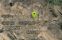
Sunrise Peak via Sunrise Trail
Scottsdale, Arizona
2.7 miles SHike near Scottsdale, Arizona
Hike
Fountain Park Trail
Fountain Hills, Arizona
3.7 miles SEFountain views, Four Peaks view, desert vegetation, close to coffee! The trail is well groomed and well marked. It parallels some house as you begin to go up the first hill. About 15...
Hike, Mountain Bike
Fountain Hills Park
Fountain Hills, Arizona
4.1 miles SEFountain Park is a 1.3 mile loop trail located near Phoenix, Arizona ( in Fountain Hills) and is good for all skill levels. The trail is primarily used for hiking and is accessible...
Hike
Tom's Thumb, Feldspar, and Marcus Landslide Loop
Scottsdale, Arizona
4.5 miles NWHike near Scottsdale, Arizona
Hike
Tom's Thumb Trail
Scottsdale, Arizona
4.5 miles NWTom's Thumb Trail is a popular trail on the McDowell Sonoran Preserve due to its unique thumb-like granite rock formation. This is a 4.7 out-and-back, intermediate trail because of its 1,200...
Hike, Mountain Bike, Rock Climb 2.2 mi
Marcus Landslide Trail
Scottsdale, Arizona
4.5 miles NWThe Marcus Landslide Trail is named after ASU professor Melvin Marcus, a renouned geographer, after the discovery and recognition of the interesting geographical area in 2002. More than 500,000...
Hike, Horseback, Mountain Bike, Rock Climb
Wagner-Granite-Bluff Trails
Scottsdale, Arizona
4.6 miles NEHike and Mountain Bike near Scottsdale, Arizona
Hike, Mountain Bike
Tortoise and Hilltop Trails
Fort McDowell, Arizona
4.6 miles NEBe on the lookout for wildlife like jackrabbits and lizards on the initial stretch of trail (Tortoise Trail) and for mountain bikers as this trail joins the Pemberton Trail for a bit as...
Hike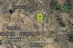
Wagner Trail
Scottsdale, Arizona
4.6 miles NEWagner Trail is a 2.2 mile, beginner to intermediate loop trail located in the McDowell Sonoran Preserve. The trail is well-marked and easy to follow; this wide, but rugged...
Hike, Horseback, Mountain Bike 0.6 mi
Horseshoe Trail
Scottsdale, Arizona
5.2 miles WHorseshoe trail is a short, fun singletrack with a lot of quick turns created by wash areas and rocks. It's a nice warm-up heading to Gateway Loop Trail. In some areas there are a lot of cactus,...
Hike, Horseback, Mountain Bike
Inspiration Point
Scottsdale, Arizona
5.3 miles WInspiration Point is a 5.7, moderate hike located on the McDowell Sonoran Preserve near Scottsdale, Arizona. You'll begin your hike at the Gateway area, where you can find a parking lot...
Hike, Mountain Bike
Gateway and Tom's Thumb Loop Trail
Scottsdale, Arizona
5.3 miles WStarting at the 104th St trailhead, head toward the Gateway loop trail. Turn right at the Gateway loop. Next take the Bell pass trail and be prepared for a steep climb. Once you hit...
Hike, Horseback, Mountain Bike
Gatewa-Prospector-Thompson Peak Road Trail
Scottsdale, Arizona
5.3 miles WHike near Scottsdale, Arizona
Hike
Tom's Thumb to Bell Pass
Scottsdale, Arizona
5.3 miles WHike and Mountain Bike near Scottsdale, Arizona
Hike, Mountain Bike
Tom's Thumb Trail South
Scottsdale, Arizona
5.3 miles WHike near Scottsdale, Arizona
Hike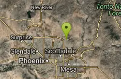
Horseshoe Loop Hike
Scottsdale, Arizona
5.3 miles WHike near Scottsdale, Arizona
Hike
Saguaro Loop and Nature Trail
Scottsdale, Arizona
5.3 miles WHike near Scottsdale, Arizona
Hike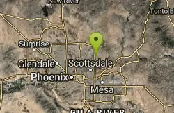
Indian Bend Bike Trail
Scottsdale, Arizona
7.4 miles SWIndian Bend Wash Greenbelt is a urban, concrete paved path, primarily used for biking and walking/jogging, in Scottsdale, Arizona. This point A to point B, 11 mile long trail takes you past parks,...
Hike, Mountain BikeNearby Campsites

Lower Salt River Nature Trail
Fort McDowell, Arizona
8.8 miles SEThe Lower Salt River Nature Trail is a scenic walk to take at the Tonto National Forest. This trail provides stunning views as you walk alongside the Salt River. This rustic trail is older and less...
Camp, Hike
Buckhorn Campground Nature Trail
Apache Junction, Arizona
14.1 miles SECamp and Hike near Apache Junction, Arizona
Camp, Hike
Verde Hot Springs
Camp Verde, Arizona
49.4 miles NVerde Hot Springs are a few natural hot spring pools located along the Verde River, near Sedona, Arizona. Once a resort, now all that remains are the foundations and the hot pools...
Camp, Hike, Hot Springs


