


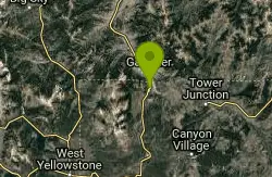
Snow Pass Trail
Yellowstone National Park Wyoming
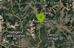
| Address: | Snow Pass Trl, Wyoming 82190, USA |
| GPS: |
44°57'33.4"N 110°42'44.1"W Maps | Directions |
| State: | Wyoming |
| Trails/Routes: | 2.0 mi |
National Park
Backpack and Hike
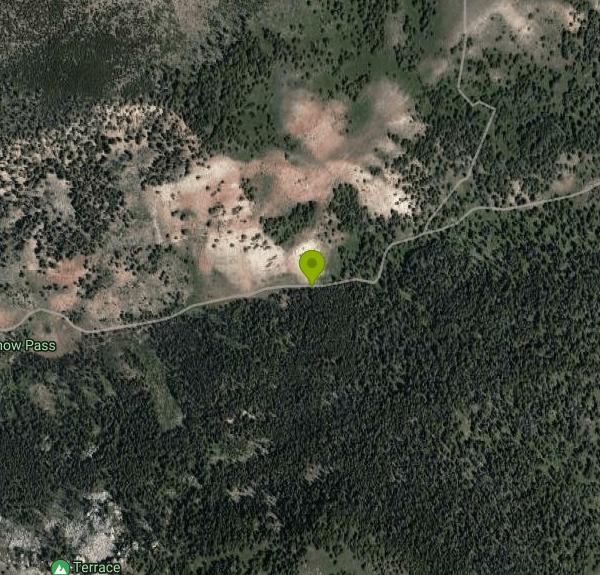
Snow Pass Trail is a beautiful day hike for visitors to Yellowstone looking to escape the crowds. Located a half mile south of the Mammoth Hot Springs Upper Terraces. Parking is available at a pullout by the Snow Pass Trail, or 1K2 trail head.
The hike on Snow Pass Trail is a moderately difficult 2.4 out-and-back trail with beautiful views. This tail has a total elevation gain of 700 feet, and has a series of very steep sections of trail. Hikers should be exprienced and prepared before taking this trail.
This area of Yellowstone is known for it's Hoodoos. Though not traditional Hoodoos, these large and impressive boulders make for a stunning contrast to the surrounding forest. The trail ends at Snow Pass, a stunning little valley surrounded by mountains. This secluded hike makes for a beautiful challenge to add to a day at Yellowstone.
Hikers should make sure to hike in groups of three or more, and be on the lookout for wildlife. Grizzly Bears frequent this area of Yellowstone, and hikers should carry bear spray in an easily accessible location and be sure to keep a safe distance from all wildlife.
More Information
Be courteous, informed, and prepared. Read trailhead guidelines, stay on the trail, and don't feed the wildlife.Read More
- Plan Ahead and Prepare
- Travel & camp on durable surfaces
- Dispose of waste properly
- Leave what you find
- Minimize campfire impacts
- Respect wildlife
- Be considerate of other visitors
Directions
From Yellowstone National Park Wyoming
- Head northwest on US-20 EParts of this road may be closed at certain times or days(19.1 mi)
- Turn right onto US-14 E/
US-16 E/ US-20 E Parts of this road may be closed at certain times or daysPass by Dairy Queen (on the left in 76.7 mi)(77.5 mi) - Turn left onto 12th St (0.5 mi)
- Turn right onto River View Dr (0.3 mi)
- Turn left onto WY-120 WEntering Montana(37.1 mi)
- Continue onto MT-72 N (21.0 mi)
- Turn left onto US-310 W (18.1 mi)
- Turn left onto US-212 W (6.8 mi)
- Turn right onto State Hwy 421 (9.3 mi)
- Continue onto Joliet Rd (8.8 mi)
- Turn right onto MT-78 N (0.8 mi)
- Turn right onto Old U.S. 10/
E Pike Ave (0.2 mi) - Turn left onto MT-78 N/
N 9th St Continue to follow MT-78 N(0.9 mi) - Turn left to merge onto I-90 W toward Butte (75.5 mi)
- Take exit 333 toward Yellowstone Nat'l Park (0.3 mi)
- Turn left onto US-89 S/
US Hwy 89 S (53.0 mi) - Turn left onto E Park St (256 ft)
- Turn right onto Robert Reamer Ave (0.2 mi)
- Turn right toward US-89 S (427 ft)
- Turn left onto US-89 SToll roadParts of this road may be closed at certain times or daysEntering WyomingDestination will be on the right(6.8 mi)
Trails
Distance ?
2.0 milesElevation Gain ?
647 feetReal Ascent ?
769 feetReal Descent ?
122 feetAvg Grade (4°)
6%Grade (-13° to 20°)
-23% to 37%Elevation differences are scaled for emphasis. While the numbers are accurate, the cut-away shown here is not to scale.
Other Hiking Trails and Backpacking Trails Nearby
Sepulcher Mountain Trail
Mammoth Hot Springs, Yellowstone National Park
1.1 miles NSepulcher Mountain Trail is an 11 mile loop trail from Mammoth Hot Springs to the peak of Sepulcher Mountain. This is a challenging hike with a 3,500 foot ascent to the 9,652 foot peak. The...
Hike 5.3 mi
Beaver Ponds Trail
Mammoth, Yellowstone National Park
1.1 miles NEBeaver Ponds Trail is a wonderful short hike accessible from Mammoth Hot Springs. The trail forms a loop between the two trailheads available at Mammoth Hot Springs. The loop is just over 5 miles...
Hike 0.1-5.2 mi
Mammoth Hot Springs
Mammoth, Yellowstone National Park
1.1 miles NEMammoth Hot Springs is a unique sight in Yellowstone National Park. The soft limestone in this area allowed the water to form colorful terraces. The extremely hot running water is clear and smooth,...
Camp, Hike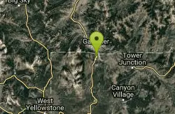
Mammoth/Gardiner Back Road
Mammoth Hot Springs, Yellowstone National Park
1.4 miles NEThe only road open in Yellowstone National Park is Highway 89 at Gardiner, Montana to park Headquarters at Mammoth Hot Springs and from Mammoth Hot Springs to Silver Gate and Cooke City, Montana.
Hike, Mountain Bike 4.0 mi
Lava Creek Trail
Mammoth Hot Springs, Yellowstone National Park
1.5 miles NELava Creek Trail is a 4.2 mile hike where hikers can enjoy walking along the scenic Lava Creek. The trail passes Undine Falls and the Gardner River. Undine Falls is a beautiful 60 foot...
Hike 4.0 mi
Bunsen Peak Trail
Mammoth Hot Springs, Yellowstone National Park
2.0 miles SBunsen Peak Trail is a 4.6 mile hike to the peak of Mount Bunsen. This is an out and back trail and is considered moderately difficult because of the 1,300 foot climb in elevation. ...
Hike 7.8 mi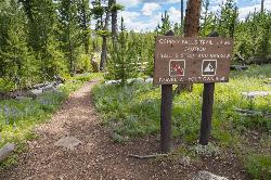
Osprey Falls Trail
Mammoth Hot Springs, Yellowstone National Park
2.0 miles SWOsprey Falls Trail is an 8 mile out and back trail near Mammoth Hot Springs that provides hikers with a variety of stunning views, including ravines and a waterfall. Hikers begin this hike...
Hike 7.9 mi
Rescue Creek Trail
Mammoth Hot Springs, Yellowstone National Park
4.2 miles NRescue Creek Trail is an 8 mile hike that crosses the Montana/Wyoming boarder. This double trail makes for a leisurely hike through beautiful hills and colorful yellow green grasslands. This trail,...
Hike 0.8 mi
Wraith Falls Trail
Mammoth Hot Springs, Yellowstone National Park
4.5 miles EWraith Falls Trail is a less than 1 mile there and back hike that can be taken in under an hour. This is a wonderful family friendly hike that is easy for hikers of all levels. The hike leads...
Hike 7.4 mi
Blacktail Deer Creek to Yellowstone River Trail
Mammoth Hot Springs, Yellowstone National Park
5.8 miles EBlacktail Deer Creek Trail is a 7 mile out and back trail that leads to the Yellowstone River. Hikers on this trail will enjoy seeing green open fields, boulder formations and waterfalls at the...
Hike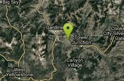
Forces of the Northern Range
Mammoth, Yellowstone National Park
7.1 miles EThis short 1/2 mile boardwalk located on the Blacktail Deer Plateau between Mammoth Village and Tower Junction will open your eyes and educate you about forces of nature that have sculpted the land...
Hike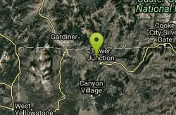
Hellroaring Creek Trail
Yellowstone National Park
13.6 miles EIf the name didn't scare you enough, the Hellroaring creek trail begins with an arduous descent down to the the Yellowstone River Suspension Bridge.The suspension bridge is a beautiful...
Camp, Hike, Swim 2.4 mi
Lost Lake Trail
Tower Junction, Yellowstone National Park
14.6 miles ELost Lake Trail is a 2.8 mile hike that can be completed in less than two hours. This is an easy hike with very little elevation change. Hikers can enjoy forests, meadows and a view of Lost Lake...
Hike 8.2 mi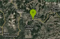
Garnet Hill Trail
Tower Junction, Yellowstone National Park
14.9 miles EGarnet Hill Trail is a 7.6 mile loop that follows an old, dirt stagecoach road. This trail passes through large meadows, dusty areas with sagebrush, forests and beside the Yellowstone River. This...
Hike 7.3 mi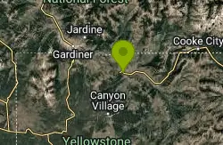
Agate Creek Trail
Tower Junction, Wyoming
15.5 miles EAgate Creek Trail is a moderately difficult trail through some of Yellowstone's most beautiful and isolated landscapes. This 7.3 mile hike starts at the Yellowstone River Picnic Area. Parking is...
Hike 0.3 mi
Yellowstone River Picnic Area Trail
Tower Junction, Yellowstone National Park
15.5 miles EThe Yellowstone River Picnic Area trail is 3.9 miles loop trail. It is called the Yellowstone Picnic Area trail because the beginning of the trail is in a picnic area.This hike features a...
Hike 16.9 mi
Specimen Ridge Trail (2K4)
Buffalo Ford, Wyoming
16.2 miles ESpecimen Ridge Trail is a challenging hike that requires navigational and technical skills to complete. This 17 mile hike is remote, and though it is marked by carins and blazes, it is often...
Hike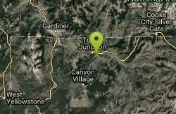
Tower Falls
Tower Junction, Yellowstone National Park
16.6 miles ETower Fall is a waterfall on Tower Creek in the northeastern region of Yellowstone National Park, in the U.S. state of Wyoming. Approximately 1,000 yards (910 m) upstream from the creek's...
Camp, Hike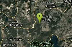
Ice Lake Trail
Norris, Yellowstone National Park
17.2 miles SThis is a short trail leading to a pretty, tree-lined lake, across ground covered by a lattice of fallen pine trunks from the 1988 fires. The entire trail went through areas burned by the fires of...
Hike 3.4 mi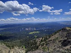
Dunraven Pass - Mount Washburn Trail
Canyon Village, Yellowstone National Park
17.5 miles SEHikers looking for a scenic hike to the peak Mount Washburn will be pleased hiking the Mount Washburn Trail via Dunraven Pass. This trail winds through quiet forests to the peak. The trailhead for...
HikeNearby Campsites
Mammoth Hot Springs
Mammoth, Yellowstone National Park
1.1 miles NEMammoth Hot Springs is a unique sight in Yellowstone National Park. The soft limestone in this area allowed the water to form colorful terraces. The extremely hot running water is clear and smooth,...
Camp, Hike
Mammoth Hot Springs Campground
Mammoth Hot Springs, Yellowstone National Park
1.5 miles NEMammoth Hot Springs Campground is the only campground in Yellowstone that is open to campers year-round. Campsites cannot be reserved and are available on a first come first served basis. It is...
Camp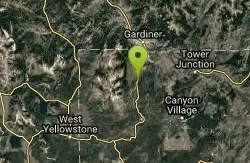
Indian Creek Campground Yellowstone
Mammoth Hot Springs, Yellowstone National Park
5.5 miles SIndian Creek Campground is a quiet and secluded wooded campground within Yellowstone National Park, ideal for tent campers. It’s close to lots of hiking and fishing, and only a few miles to...
Camp
Hellroaring Creek Trail
Yellowstone National Park
13.6 miles EIf the name didn't scare you enough, the Hellroaring creek trail begins with an arduous descent down to the the Yellowstone River Suspension Bridge.The suspension bridge is a beautiful...
Camp, Hike, Swim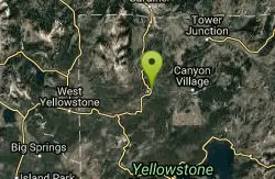
Norris Campground
Norris, Yellowstone National Park
15.3 miles SNorris campground is centrally located in Yellowstone National Park and offers a good spot for those planning to visit many of the most famous features in Yellowstone. Norris is a relatively short...
Camp
Tower Falls
Tower Junction, Yellowstone National Park
16.6 miles ETower Fall is a waterfall on Tower Creek in the northeastern region of Yellowstone National Park, in the U.S. state of Wyoming. Approximately 1,000 yards (910 m) upstream from the creek's...
Camp, Hike 1.5-3.8 mi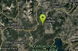
Little Gibbon Falls
Norris, Yellowstone National Park
17.5 miles SIce Lake and Little Gibbon Falls Loop is a 4.5 mile loop trail located near Yellowstone National Park, Wyoming. The trail is good for all skill levels and primarily used for hiking, but there are...
Camp, Canoe, Hike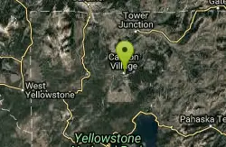
Canyon Campground
Canyon Junction, Yellowstone National Park
18.9 miles SECanyon Campground is a popular choice for visitors to Yellowstone National Park, and it's easy to see why. Located in the heart of the park, the campground offers easy access to some of the...
Camp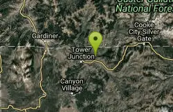
Slough Creek Campground
Tower Junction, Yellowstone National Park
19.8 miles ESlough Creek campground is a small but very popular campground on the Northeast Entrance Road. Most of the campsites are situated right on the banks of Slough Creek where fishing is a favorite...
Camp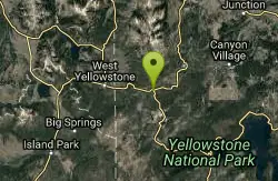
Madison Campground
Madison, Yellowstone National Park
23.0 miles SMadison Campground is named for its proximity to the Madison River, which runs through the area in a lush mountain setting rich in wildlife. Madison Campground is at an elevation of 6,800’ and...
Camp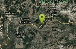
Pebble Creek Campground
Northeast Entrance, Yellowstone National Park
29.4 miles EPebble Creek is a popular campground for fishermen and those seeking a more quiet and smaller campground in Yellowstone National Park. The campsites can fill very early, so get there before 11 AM...
Camp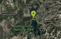
Fishing Bridge RV Campground
Lake Village, Yellowstone National Park
32.1 miles SEThe Fishing Bridge Recreational Vehicle Park is located near the mouth of the Yellowstone River as it leaves Yellowstone Lake. The RV park is named after the Fishing Bridge, a wooden vehicle bridge...
Camp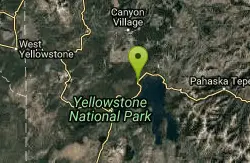
Bridge Bay
Lake Village, Yellowstone National Park
32.4 miles SEBridge Bay Campground was named for its proximity to Bridge Bay Marina on Yellowstone Lake. The area is quite scenic, with wooded areas, open meadows and some limited views of the lake. Because of...
Camp 14.8 mi
Biscuit Basin to Fairy Falls and Firehole Meadows
Old Faithful, Yellowstone National Park
34.5 miles SFreight Road trail is a almost 15 mile hike that leaves from Biscuit Basin or Fountain Flats Drive. This hike is a beautiful remote hike that passes several unique landmarks, breaking up this hike...
Backpack, Camp, Hike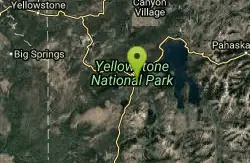
Grant Village
Grant Village, Yellowstone National Park
39.8 miles SGrant Village was built in 1984 and named after Ulysses S. Grant, president when Yellowstone became the world’s first national park in 1872. Located near the West Thumb of Yellowstone Lake,...
Camp, Canoe, Kayak
Big Springs
Island Park, Idaho
41.7 miles SWThere's also a great little walking trail along the river with placards that tell about the ecosystem and history of the area. There's about a 1/2 mile that's paved and then a 1/2 mile...
Camp, Hike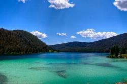
Wade Lake
Cameron, Montana
43.1 miles WCamp, Canoe, Kayak, and Swim near Cameron, Montana
Camp, Canoe, Kayak, Swim 6.9 mi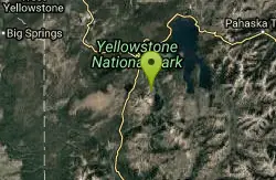
Heart Lake Trail
Grant Village, Yellowstone National Park
44.7 miles SThe trail is very clear and leads to a moderate eight mile hike to Heart Lake. This hike has many possibilities. Day hikers need to push their time to make sure they are on the trail early to allow...
Backpack, Camp, Hike, Hot Springs
Upper Coffee Pot Campground
Island Park, Idaho
45.7 miles SWUpper Coffeepot Campground stretches along a floatable section of Henry's Fork of the Snake River. A mixed growth lodgepole pine forest provides partial shade and summer wildflowers are...
Camp, Canoe 0.1 mi
Lewis Lake Campground
Grant Village, Yellowstone National Park
47.0 miles SLewis Lake is located in the southern part of Yellowstone National Park. It is 4 miles southeast of Shoshone Lake. Lewis Lake offers a plethora great water activities. This lake offers...
Camp, Canoe, Kayak


