


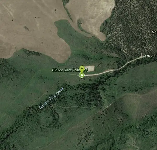
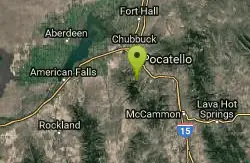
Slate Mountain/Gibson Jack Trail
Pocatello, Idaho
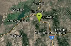
| Address: | Gibson Jack Trailhead, 9812 Gibson Jack Rd, Pocatello, ID 83204, USA |
| GPS: |
42°47'34.3"N 112°25'53.1"W Maps | Directions |
| State: | Idaho |
| Trail Length: | 14.00 miles |
| MTB Difficulty: | Intermediate |
| Trail Type: | Loop |
| Hike Difficulty: | Beginner |
Hike, Horseback, and Mountain Bike
The Gibson Jack trail offers great views of Southeastern Idaho and a favorite trail among moutain bikers. This trail is a continuation of the West Fork Mink Creek trail and takes travelers further into the mountain area. Along the way, there will be plenty of Aspen, pines, junipers, and sage brush which will offer some nice shade. There are a few meadows that can make a nice spot to stop for a rest and take in the nature.
If riding the monuntian bike trail, this route can be taken either clockwise or counter-clockwise. The more popular route is to follow the it in the clockwise direction. There are a few forks in the trail, the first comes at mile 3, and its best to stay to the left as the right trail ends up being very rocky and becoming a hike-your-bike trail. The next fork is at mile 5 and going to the right will follow the Slate Cut-off trail. This portion of the trail is downhill and very steep. Be careful as this portion ends up in a creek at the bottom, which can sink a tire pretty quickly if the rider is not prepared.
Overall the trail can be overgrown, which makes spotting rocks a little difficult. There are some creeks along the trail that may or may not need to be crossed over. This trail is beautiful in the fall because of all the leaves changing colors and the cooler temperatures.
More Information
Never modify trail features. Ride trails when they're dry enough that you won't leave ruts. Speak up when you see others on the trail and always yield to hikers, horses, and others coming uphill. Always ride on the established trail.
Read MoreBe courteous, informed, and prepared. Read trailhead guidelines, stay on the trail, and don't feed the wildlife.
Read More- Plan Ahead and Prepare
- Travel & camp on durable surfaces
- Dispose of waste properly
- Leave what you find
- Minimize campfire impacts
- Respect wildlife
- Be considerate of other visitors
Directions
From Pocatello, Idaho
- Head southeast on N 7th Ave toward E Wyeth St (0.2 mi)
- Turn right onto E Clark St (0.2 mi)
- Turn left onto N 4th Ave (0.3 mi)
- Turn right onto E Benton St (171 ft)
- Continue straight to stay on E Benton St (0.4 mi)
- Turn left onto S Arthur Ave (0.3 mi)
- Continue onto W Putnam St (0.1 mi)
- Continue onto S Main St (1.3 mi)
- Continue onto Bannock Hwy (2.6 mi)
- Turn right onto W Gibson Jack Rd (2.1 mi)
Other Mountain Bike Trails, Hiking Trails, and Horseback Trails Nearby
Gibson Jack/west Fork
Pocatello, Idaho
1.2 miles SWThe West Fork is a mix of single/doubletrack with some fun rock spots and good scenery throughout. After climbing about 1500' in elevation, it's all downhill on singletrack on the...
Mountain Bike 3.2 mi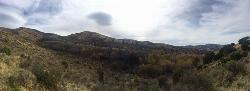
Kinney Creek Trail
Pocatello, Idaho
2.8 miles SEKinney Creek Trail is in the Caribou-Targhee National Forest near Pocatello. This is a 6.4 out-and-back trail that takes you to the Indian Mountain Summit. It gives you views of Idaho...
Hike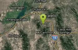
Cherry Springs
Pocatello, Idaho
3.4 miles SEJust a short distance from Pocatello, the Cherry Springs Nature Area has thick green vegetation, an abundance of birds and viewing other wildlife. Take a picnic and a camera and head out on the...
Hike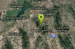
Slate Mountain Trail
Pocatello, Idaho
4.3 miles STrail is open to cross-country skiing, snowshoeing, mountain biking, horse riding, hiking. source: fs.usda.gov
Mountain Bike 0.2-9.7 mi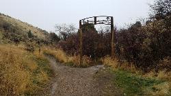
City Creek
Pocatello, Idaho
4.3 miles NThe City Creek Management Area (CCMA) Trail System is a vast network of trails maintained by the City of Pocatello. There are trails to go up and others to come down. Most trails come back to the...
Hike, Horseback, Mountain Bike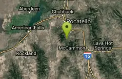
Valve House Draw
Pocatello, Idaho
4.8 miles SThis trail is a motorized, doubletrack trail, as well as a great place to go hiking. For the most part, the trail is all uphill through a forest. There are some technical sections of the route as...
Cross-country Ski, Hike, Horseback, Mountain Bike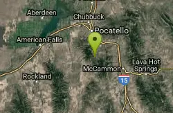
West Fork Mink Creek Trail
Pocatello, Idaho
4.9 miles SA popular trail in the Eastern Idaho area for horseback riding, hiking, and mountain biking. The trail is a little over three and a half miles of single track riding. For the majority of the trail...
Hike, Horseback, Mountain Bike
Cave Trail
Pocatello, Idaho
5.6 miles NMountain Bike near Pocatello, Idaho
Mountain Bike
South Fork Of Mink Creek Trail
Pocatello, Idaho
5.9 miles SCross Country Ski, Hike, Mountain Bike, and Snowshoe near Pocatello, Idaho
Cross-country Ski, Hike, Mountain Bike, Snowshoe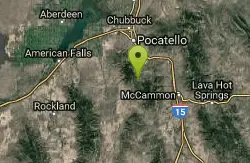
East Fork Mink Creek Trail
Pocatello, Idaho
5.9 miles SIf it's early in the season and you're anxious to dust off the skis, the East Fork Road is a good starting place. The East Fork road to Justise Park Rec Area joins the Bannock Highway about...
Cross-country Ski, Hike, Horseback, Mountain Bike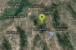
East Fork Crestline
Pocatello, Idaho
6.9 miles SEHead up the singletrack after about 0.6 miles look for a T which will take you to a paved road. Ride up the paved road by a campground and onto the East Fork ATV trail.East Fork ends...
Mountain Bike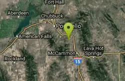
Driveway Canyon Trail
Inkom, Idaho
7.8 miles EMotorcycle traili. source: fs.usda.gov
Mountain Bike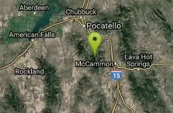
Scout Mountain Campground
Pocatello, Idaho
7.8 miles SEScout Mountain Campground is located on beautiful Scout Mountain at an elevation of 6,900 feet, just 13 miles south of Pocatello, Idaho. Scout Mountain is part of the Mink Creek area, a popular...
Camp, Hike
Garden Creek Gap
McCammon, Idaho
16.3 miles SGarden Creek Gap is the defile Garden Creek cuts through as it flows toward Marsh Creek on the east side of the Bannock Range after draining a sizable chunk of territory on the west side of those...
Cross-country Ski, Hike, Horseback, Rock Climb
Sportsman's Park American Falls Reservoir
Aberdeen, Idaho
20.6 miles NWThis beautiful 30-acre park is a multi-use area with facilities and activities for a variety of recreational uses. Situated adjacent to the American Falls Reservoir, it provides primary access to...
Camp, Canoe, Hike
Blackfoot, ID 83221, United States
Blackfoot, Idaho
27.8 miles NHike and Mountain Bike near Blackfoot, Idaho
Hike, Mountain Bike
Hell's Half Acre Northbound Rest Stop
Blackfoot, Idaho
36.2 miles NThis is a well maintained rest area with facilities to keep you happy as you travel through Idaho. This rest stop on Interstate 15 about 9 miles north of Blackfoot Idaho has nice picnic tables and...
Hike
Hell's Half Acre Southbound Rest Stop
Blackfoot, Idaho
36.3 miles NThis is a well maintained rest area with facilities to keep you happy as you travel through Idaho. This rest stop on Interstate 15 about 15 miles South of Idaho Falls has nice picnic tables and...
Hike
Firth River Bottoms
Firth, Idaho
37.5 miles NWhether you like to ride horses, picnic, camp, fish, learn about the past, or play baseball, this park has something for everyone. The Parks & Recreation Department and the IDaho Education...
Camp, Canoe, Hike 0.1 mi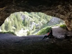
40 Horse Cave
Firth, Idaho
41.6 miles NEThe naming of the cave comes from a story of two men who were caught in a bad storm. Upon hiking, these two guys were able to find the cave. One of them commented to the other, "This cave could...
Cave, HikeNearby Campsites
Scout Mountain Campground
Pocatello, Idaho
7.8 miles SEScout Mountain Campground is located on beautiful Scout Mountain at an elevation of 6,900 feet, just 13 miles south of Pocatello, Idaho. Scout Mountain is part of the Mink Creek area, a popular...
Camp, Hike
Hawkins Reservoir Campground
Arimo, Idaho
20.0 miles S14 campsites on a small impoundment, which despite its size, attracts a great deal of wildlife. Spring through fall, plovers, sandpipers and geese frolic in the mudflats and swim in the waters....
Camp, Canoe
Sportsman's Park American Falls Reservoir
Aberdeen, Idaho
20.6 miles NWThis beautiful 30-acre park is a multi-use area with facilities and activities for a variety of recreational uses. Situated adjacent to the American Falls Reservoir, it provides primary access to...
Camp, Canoe, Hike
Pipeline Campground
American Falls, Idaho
24.1 miles W5 campsites on the Snake River near American Falls Reservoir. Fishing for trophy brown and rainbow trout. More than 30 species of migratory shorebirds rest at the reservoir. From the campground, you...
Camp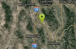
Downata Hot Springs
Downey, Idaho
33.1 miles SEDownata Hot Springs is a full-service hot springs resort south of Pocatello. During the summer, Downata offers a variety of activities for families including a large naturally-heated pool, four large...
Camp, Hot Springs, Swim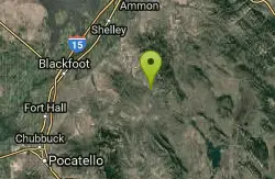
Blackfoot River Crossing at Trail Creek Road
Firth, Idaho
35.1 miles NEIn Soda Springs, ID 34 N for ~11 mi; R (E) on Blackfoot River Rd at mp 69.9; zero odometer; travel 10.4 mi; stay to the L as rd turns to gravel at mi 10.9; mi 13.7 pass Mill Canyon Campground; mi...
Camp
Firth River Bottoms
Firth, Idaho
37.5 miles NWhether you like to ride horses, picnic, camp, fish, learn about the past, or play baseball, this park has something for everyone. The Parks & Recreation Department and the IDaho Education...
Camp, Canoe, Hike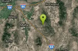
Sublett Creek Campground
Malta, Idaho
44.5 miles SW5500-foot elevation. 9 campsites on Sublett Creek, and 2 miles east of Sublett Reservoir. Access to Sublett Reservoir from the north shore.Campground can be used for picnicking and holds 40 people....
Camp, Canoe
Sealander Park
Idaho Falls, Idaho
46.6 miles NThe story of Sealander park begins with Carl Sealander. Leaving Sweden in 1893 at the age of seventeen, Carl worked in mining communities across Colorado and Utah before meeting his wife, Lizzie...
Camp


