


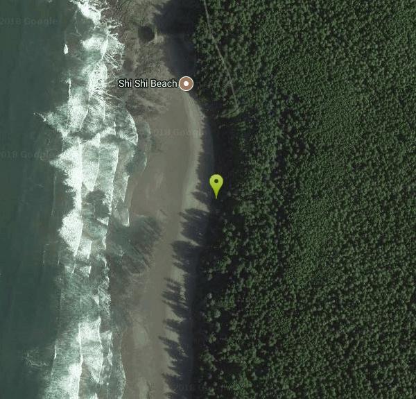
Shi Shi beach
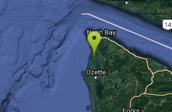
Clallam Bay, Washington
| GPS: |
48°16'24.6"N 124°40'45.8"W Maps | Directions |
| State: | Washington |
Camp and Hike
Revered through the ages, Shi Shi Beach has its share of disciples, from First Peoples to first-time visitors, naturalists, bird-watchers, hard-core hikers, beach bums, conservationists, politicians, and just plain ordinary folk. And Northwest hikers have consistently rated Shi Shi as one of the region's most beautiful beaches.
More Information
Be courteous, informed, and prepared. Read trailhead guidelines, stay on the trail, and don't feed the wildlife.
Read More- Plan Ahead and Prepare
- Travel & camp on durable surfaces
- Dispose of waste properly
- Leave what you find
- Minimize campfire impacts
- Respect wildlife
- Be considerate of other visitors
Directions
From Clallam Bay, Washington
- Head north on WA-112 W toward Frontier St (7.1 mi)
- Turn left onto Sekiu River Rd (0.8 mi)
- Continue onto 1000 Main Line Rd (2.4 mi)
- Turn right to stay on 1000 Main Line Rd (4.4 mi)
- Turn left (4.5 mi)
- Turn left (2.0 mi)
- Turn right (1.1 mi)
- Turn left (1.1 mi)
- Turn right (98 ft)
- Turn right (1.6 mi)
- Continue onto SW Boundary Rd (0.5 mi)
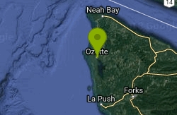
From Port Angeles follow US 101 west for 5 miles to the junction with State Route 112. Turn right (west) on SR 112, continuing for 64 miles to the community of Neah Bay. (Alternatively, take US 101 to Sappho and drive SR 113 north to SR 112 and then on to Neah Bay. This way is longer, but not as curvy.) Just past the Makah Tribal Museum is Washburn's, where you can purchase the required recreation pass. Continue west on Bay View Avenue for a scant mile, to the end of the straight road, then begin following brown signs for "Cape Flattery". Turn left on Fort Street for one block, then right on 3rd Street (unmarked). In another block (0.1 mile), turn left on Cape Flattery Road. (The sign is partway down the road.) Follow this road 2.5 miles, then turn left over the bridge onto Hobuck Road. Staying on the main paved road, follow signs for the fish hatchery. Pay close attention to the speed limit, which fluctuates between 15, 25, and 35 mph. Drive to the parking lot at the trailhead (day use only), located on your right at about 5 miles.
Other Hiking Trails Nearby
Cape Alava
Forks, Washington
8.3 miles SCape Alava Loop is two hikes in one: a forest stroll and a walk on the beach. For those who don't have time for a 9-mile loop, the short hike on a beautiful boardwalk through forest is just the...
Backpack, Hike 5.9-9.1 mi
Sand Point
Forks, Washington
8.3 miles SBackpack and Hike near Forks, Washington
Backpack, Hike


