Sequoia National Park
Sequoia National Park, California
| Address: | Generals Hwy, Sequoia National Park, CA 93262, USA |
| GPS: |
36°34'49.3"N 118°45'7.5"W Maps | Directions |
| State: | California |
Restrooms Picnic Tables Lakes Rivers Waterfalls Trails Rocks Wildflowers National Park
Backpack, Camp, Hike, Rock Climb, and Swim
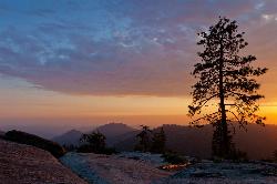
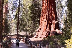
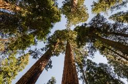
Walk through the park and you will feel like an ant as the Giant Sequoia trees tower over you. When people think of Sequoia National Park, they immediately think of the trees the park gets its name from. Besides these towering trees, the park offers something for every visitor.
Hike through the mountains and you will come to Moro Rock, which offers views of the Great Western Divide. With 400 laddered steps, you feel like you're standing on top of the world. The rock is also open to rock climbers, however during the summer the area is closed off for falcon nesting.
There are plenty of walking trails through the sequoias such as Giant Forest and Crescent Meadows. For many, Giant Forest takes visitors into the heart of the park. The forest includes both the world's tallest trees (Redwoods) and the world's largest trees (Sequoias). If visitors don't want to hike around, there are plenty of roads that still take you close to the trees and offer unbelievable sights.
Crescent Meadows includes many Sequoias and Redwoods, however the main draw for people to visit is to try and see the wildlife. The meadow is one of the best places in the park to view wildlife, including the black bear.
Within Sequoia National Park, the biggest attraction is General Sherman, the world's largest tree (measured by volumne). The tree itself is 275 ft tall and 36 ft in diameter at the base.
Adjacent to Sequoia National Park is Kings Canyon National Park, which is another great place to visit in the area.
More Information
Be courteous, informed, and prepared. Read trailhead guidelines, stay on the trail, and don't feed the wildlife.Read More
Directions
From Sequoia National Park, California
- Head south on CA-198 W (13.7 mi)
Other Rock Climbing Walls, Swimming Holes, Hiking Trails, and Backpacking Trails Nearby
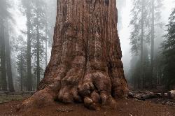
General Sherman Tree in Sequoia National Park
Three Rivers, California
0.1 miles NWithin Sequoia National Park, the biggest attraction is General Sherman, the world's largest tree. It is believed that the tree is about 2,000 years old, and was named after the Civil War...
Hike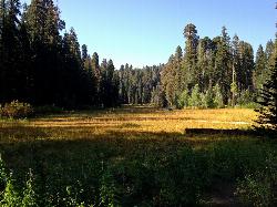
Crescent Meadow in Sequoia National Park
Sequoia National Park, California
1.8 miles SCrescent Meadows is a gentle and easy hiking area, making it perfect for families. Inside the meadow area, visitors will see many of the large Sequoias and Redwoods, as well as a variety of...
Camp, Hike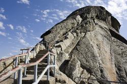
Moro Rock
Tulare, California
2.4 miles SHike through the mountains of Sequoia National Park and you will come to Moro Rock, which offers views of the Great Western Divide. With 400 laddered stpes, you will feel like you are standing on...
Hike, Rock Climb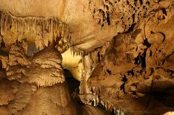
Crystal Cave
Three Rivers, California
4.2 miles WThough Sequoia National Park is known for its famous trees and beautiful mountains, it also is well known for its caves. Many of California's caves that are over a mile long can be found in...
Hike
Chimney Rock
Tulare County, California
9.5 miles NWOne of the best places to go rock climbing in Sequoia National Park! There are a variety of routes that can be climbed here, with the routes ranging from 5.8-5.10. There are six granite formations...
Rock Climb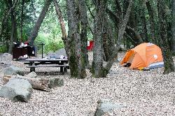
Hidden Falls Campground
Springville, California
22.8 miles SHidden Falls Campground is a small walk-in campground that is situated along the side of the Tule River. The drive to the campground is quite scenic. After you pass through the town of Springville...
Camp, Hike, Swim
Alder Creek Natural Slide
Camp Nelson, California
39.8 miles SSwim near Camp Nelson, California
Swim
Monache mountain
Inyokern, California
42.7 miles SEMonache Mountain is a 9,367 ft / 2,855 m mountain peak near Lone Pine, California, United States. Based on peakery data, it ranks as the 682nd highest mountain in California and the 5590th highest...
Camp, Hike, Mountain Bike
Kern River Area
Johnsondale, California
44.9 miles SSwim near Johnsondale, California
Swim
Bush Creek Campground
Kernville, California
45.1 miles SBush Creek Campground is conveniently situated between several swimming holes in the canyon. The swimming holes stem from the upper portion of Kern River. The campground offers 6 campsites with...
Camp, Kayak, Swim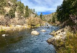
Limestone Campground
Kernville, California
45.4 miles SLimestone Campground is a great rustic campground beautifully situated near the Kern River and by a swimming hole. The campground is decorated with both oak and gray pine which serve as...
Camp, Kayak, SwimNearby Campsites

Crescent Meadow in Sequoia National Park
Sequoia National Park, California
1.8 miles SCrescent Meadows is a gentle and easy hiking area, making it perfect for families. Inside the meadow area, visitors will see many of the large Sequoias and Redwoods, as well as a variety of...
Camp, Hike
Hidden Falls Campground
Springville, California
22.8 miles SHidden Falls Campground is a small walk-in campground that is situated along the side of the Tule River. The drive to the campground is quite scenic. After you pass through the town of Springville...
Camp, Hike, Swim
Monache mountain
Inyokern, California
42.7 miles SEMonache Mountain is a 9,367 ft / 2,855 m mountain peak near Lone Pine, California, United States. Based on peakery data, it ranks as the 682nd highest mountain in California and the 5590th highest...
Camp, Hike, Mountain Bike
Bush Creek Campground
Kernville, California
45.1 miles SBush Creek Campground is conveniently situated between several swimming holes in the canyon. The swimming holes stem from the upper portion of Kern River. The campground offers 6 campsites with...
Camp, Kayak, Swim
Limestone Campground
Kernville, California
45.4 miles SLimestone Campground is a great rustic campground beautifully situated near the Kern River and by a swimming hole. The campground is decorated with both oak and gray pine which serve as...
Camp, Kayak, Swim


