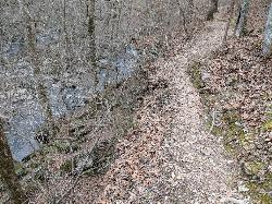
Savage Gulf Area
Beersheba Springs, Tennessee
| GPS: |
35°25'58.1"N 85°41'57.7"W Maps | Directions |
| State: | Tennessee |
Swim
More Information
Directions
From Beersheba Springs, Tennessee
- Head southwest on Dahlgren Ave toward Hege Ave (0.2 mi)
- Slight right onto TN-56 S (5.0 mi)
- Turn left onto Cumberland St (0.1 mi)
- Turn left onto Beersheba St (1.1 mi)

Other Swimming Holes Nearby

Smoky Mountain Central Area
Beersheba Springs, Tennessee
4.6 miles ESwim near Beersheba Springs, Tennessee
Swim
Smoky Mountain South Area
Beersheba Springs, Tennessee
4.6 miles ESwim near Beersheba Springs, Tennessee
Swim
Grundy Forest Area
Tracy City, Tennessee
17.4 miles SSwim near Tracy City, Tennessee
Swim
Fall Creek Falls State Park
Pikeville, Tennessee
25.5 miles NESwim near Pikeville, Tennessee
Swim
Rock Island State Park
Rock Island, Tennessee
26.6 miles NSwim near Rock Island, Tennessee
Swim
Chickamauga Creek
Soddy-Daisy, Tennessee
29.5 miles SEMany swimming holes along a trail, some beginning as close as 10 minutes walk. Great for families. This is a State Natural Area and CLOSES 7 PM (I think they lock the gate). A...
Swim
Carmac Falls
Smithville, Tennessee
35.7 miles NCLOSED. This is on private property and is only accessible to guests of Evins Mill. See details below.
Swim
Walls Of Jericho
Estillfork, Alabama
38.2 miles SWVery spectacular wild, scenic area with massive limestone amphitheatre in the Southern Cumberland Plateau (on the border between TN and AL) where water cascades 200 feet over...
Swim
Richland Creek
Dayton, Tennessee
38.6 miles ESwim near Dayton, Tennessee
Swim
Goochie Ford
Readyville, Tennessee
39.2 miles NWSwim near Readyville, Tennessee
Swim
Stones River Rentals
Christiana, Tennessee
42.2 miles NWSwim near Christiana, Tennessee
Swim
Piney River Area
Rockwood, Tennessee
49.8 miles NEThe Piney River area has a 10 mile through-trail that leads to several swimming holes. For good information about this area... Bathing suits: Probably optional -...
Swim


