


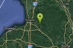
Salmon River Falls
Salamanca, New York
1.5 miles NE of Salamanca, New York
| GPS: |
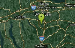
43°32'56.4"N 75°56'35.9"W Maps | Directions |
| State: | New York |
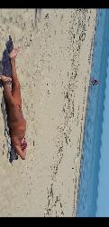
Swim
More Information
- Plan Ahead and Prepare
- Travel & camp on durable surfaces
- Dispose of waste properly
- Leave what you find
- Minimize campfire impacts
- Respect wildlife
- Be considerate of other visitors
Directions
From Salamanca, New York
- Head east on Wildwood Ave toward Seneca St (0.6 mi)
- Turn left to stay on Wildwood Ave (0.4 mi)
- Turn left onto US-219 N/Central AveContinue to follow US-219 N(5.3 mi)
- Continue straight onto NY-98 N (12.4 mi)
- Turn left onto NY-16 N/NY-98 N (3.2 mi)
- Turn right onto NY-98 N (9.4 mi)
- Turn right onto NY-243 E (1.1 mi)
- Turn left onto Fairview Rd (4.1 mi)
- Continue onto Co Rd 36 (0.2 mi)
- Turn right onto Pike Rd (4.0 mi)
- Continue onto Dewitt Rd (2.7 mi)
- Continue onto Main St (1.0 mi)
- Continue onto NY-19 N (0.4 mi)
- Turn right onto Griffith Rd (4.7 mi)
- Turn right onto NY-19A S/NY-436 E (0.3 mi)
- Turn left onto NY-436 E (3.5 mi)
- Turn left onto Short Tract Rd (1.7 mi)
- Turn left onto Oakland Rd (2.1 mi)
- Slight right onto River Rd (1.9 mi)
- Turn left to stay on River Rd (1.2 mi)
- Turn left to stay on River Rd (3.2 mi)
- Turn left onto NY-408 N (2.6 mi)
- Turn left onto Main St (262 ft)
- Turn right at the 1st cross street onto E State St (0.4 mi)
- Continue onto NY-408 N/Mt Morris Geneseo Rd (1.7 mi)
- Turn right onto the Interstate 390 N ramp to Rochester (0.3 mi)
- Merge onto I-390 N (26.4 mi)
- Take exit 12 for I-90/NY-253/Lehigh Station Rd toward Thruway (0.1 mi)
- Keep left, follow signs for Interstate 90 ThruwayToll road(0.7 mi)
- Keep left at the fork, follow signs for I-90 E/Albany and merge onto I-90 EToll road(79.6 mi)
- Take exit 36 to merge onto I-81 N toward WatertownPartial toll road(27.3 mi)
- Take exit 34 for NY-104 toward Mexico (0.3 mi)
- Turn right onto NY-104 E (3.3 mi)
- Turn left onto County Rte 22 (4.4 mi)
- Turn right onto NY-13 S (0.1 mi)
- Turn left at the 1st cross street onto Cemetery St (0.2 mi)
- Continue onto County Rte 22 (4.3 mi)
- Turn right onto Falls RdDestination will be on the right(1.4 mi)
to add photos & videos and suggest edits
Edit Review
Delete Review

Other Swimming Holes Nearby
Add Location
Lakeview Wma
Saugerties, New York
20.1 miles NWThe Lakeview State Wildlife Management Area, on the eastern shore of Lake Ontario, has about 5 miles of undeveloped sand beach. This is a little known beach area and a traditionally...
Swim
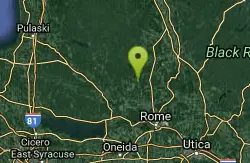
Point Rock
Utica-Rome, NY, New York
22.4 miles SESwim near Utica-Rome, NY, New York
Swim
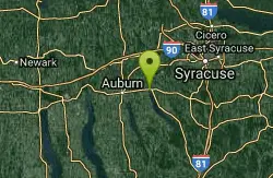
Skaneateles
Skaneateles, New York
48.3 miles SWSwim near Skaneateles, New York
Swim
Rattlesnake Gulf
Utica-Rome, NY, New York
48.4 miles SCLOSED. This is now private property with No Trespassing posted. This is about a 2 mile round trip hike to 25 foot waterfall which splits and has swimming hole at bottom of right hand channel. The...
Swim


