


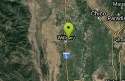
Sacramento National Wildlife Refuge
Willows, California
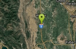
| GPS: |
39°25'48.6"N 122°11'10.2"W Maps | Directions |
| State: | California |
Hike
A National Wildlife Refuge Complex is an administrative grouping of two or more refuges, wildlife management areas or other refuge conservation areas that are primarily managed from a central office location. Refuges are grouped into a complex structure because they occur in a similar ecological region, such as a watershed or specific habitat type, and have a related purpose and management needs. Typically, a project leader or complex manager oversees the general management of all refuges within the complex and refuge managers are responsible for operations at specific refuges.
More Information
Add ResourceBe courteous, informed, and prepared. Read trailhead guidelines, stay on the trail, and don't feed the wildlife.
Read More- Plan Ahead and Prepare
- Travel & camp on durable surfaces
- Dispose of waste properly
- Leave what you find
- Minimize campfire impacts
- Respect wildlife
- Be considerate of other visitors
Directions
From Willows, California
- Head west on Biggs-Willows Rd/E Wood St toward N Tehama St (108 ft)
- Turn left at the 1st cross street onto N Tehama St (1.0 mi)
- Continue onto Hwy 99W (5.5 mi)
- Turn left onto Rd 8013Destination will be on the left(0.3 mi)
Located ~75 minutes north of Sacramento, next to Interstate 5. For northbound travelers, exit I-5 at Road 68/Princeton (Exit #595). Turn right at the stop sign. Next, turn north (left) at the Road 68 and Highway 99W interchange and travel ~1.5 miles on 99W to the entrance. For southbound travelers, exit I-5 at Road 57 (Exit #601). Turn east over the offramp to Highway 99W. Turn south (right) on 99W and drive ~4.5 miles to the entrance.

Other Hiking Trails Nearby
The Gravel Pits
Willows, California
7.5 miles NThis semi-remote section of the Sacramento between Redding and Red Bluff could hardly be described as a creek, but it makes an interesting float that can help you decide whether you like big water...
Canoe, Hike
Delevan National Wildlife Refuge
Colusa, California
9.4 miles SEThe Delevan National Wildlife Refuge is one of five refuges in the Sacramento Refuge Complex in the Sacramento Valley of north-central California. The 5,797-acre refuge is approximately 80 miles...
Hike
Blue Gum Grove
Willows, California
11.5 miles NGum Grove Park is Seal Beach's 10-acre nature park, featuring native shrubs and wildlife along with mature Eucalyptus trees. Gum Grove Park sits between Seal Beach's "The Hill" neighborhood...
Hike
Colusa National Wildlife Refuge
Colusa, California
18.3 miles SEColusa National Wildlife Refuge is one of five refuges in the Sacramento Refuge Complex located in the Sacramento Valley of north-central California. The refuge is about 70 miles north of the...
Hike
Stony Gorge Reservoir
Elk Creek, California
21.1 miles NWStony Gorge Reservoir is landscaped with sandy beaches set against a backdrop of low foothills covered with oak and chaparral. Surrounded by stretches of bStony Gorge Reservoir Kayakingrush and...
Camp, Canoe, Hike, Swim
Bidwell Park
Chico, California
31.3 miles NEBidwell Park was established July 20, 1905 through the donation by Annie Bidwell of approximately 2,500 acres of land to the City of Chico. Since that time, the City has purchased additional land,...
Hike, Horseback, Mountain Bike, Swim
Sutter National Wildlife Refuge
Meridian, California
33.2 miles SESutter National Wildlife Refuge, the southern-most refuge in the Sacramento Refuge Complex, is located in the Sacramento Valley of California, about 50 miles north of the metropolitan area of...
Hike


