Round Mountain Loop
Williams, Arizona
| Address: | ~Fire Rd 105, Williams, AZ 86046, USA |
| GPS: |
35°3'24.3"N 112°3'11.9"W Maps | Directions |
| State: | Arizona |
| Trail Length: | 10.00 miles |
| Trail Type: | Loop |
| MTB Trail Type: | Fire Road |
Mountain Bike
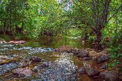
This ride follows a little used forest road that passes through virtually every type of ponderosa pine habitat that one could find on the south Kaibab. The scenery here is diverse. Along the roadside you will see "dog hair" thickets of spindly ponderosa pine saplings, groups of medium-sized "black-jack" Ponderosa and more open communities of tall "yellow pine" ponderosa. In spite of all the different names and appearances, they are all the same tree species. There are even a few areas of the forest in this area that are lush with undergrowth which is a rarity in northern Arizona.The route itself is interesting too. There are a number of ups and downs with some fun curves to add spice to the ride. There's even a dip or two through a rocky creek bed. Watch for wildlife along the way. The Round Mountain Loop adds up to an interesting ride that will keep you wondering what's around the next bend. source: fs.usda.gov Courtesy of Singletracks.com
More Information
Add ResourceNever modify trail features. Ride trails when they're dry enough that you won't leave ruts. Speak up when you see others on the trail and always yield to hikers, horses, and others coming uphill. Always ride on the established trail.
Read MoreDirections
From Williams, Arizona
- Head east on Grand Canyon Ave/Historic Rte 66/W Railroad Ave toward S 4th St (151 ft)
- Turn right onto S 4th St (0.3 mi)
- Continue onto S Perkinsville Rd (8.0 mi)
- Turn left onto Fire Rd 110/White Horse RdContinue to follow Fire Rd 110(6.8 mi)
- Turn right onto Fire Rd 11 (4.1 mi)
- Turn right onto Fire Rd 105Destination will be on the left(59 ft)

Other Mountain Bike Trails Nearby

Sunflower Flat
Williams, Arizona
5.4 miles NThis ride is actually two rides in one. The first follows a secondary road through flat open forest country with a short detour to one of the best views on the forest. The second traces...
Mountain Bike
Sycamore Rim Trail
Parks, Arizona
7.9 miles NEMost people come to this ride for the view of Sycamore Canyon at the overlook, but the scenery along the way is worth the trip, too. The ride starts out in a ponderosa pine forest where...
Mountain Bike
Stage Station Loop
Williams, Arizona
12.0 miles WThis is a pleasant ride over rolling terrain along a primitive road that winds through ponderosa pine forests, pinyon and juniper stands and open grasslands. The scenery consists of...
Mountain Bike
Cockscomb Trail
Sedona, Arizona
15.8 miles SEAs with most trails in Sedona, a recreation pass is required to park your car at the trailhead. There is a kiosk at a nearby parking area. From the Cockscomb trailhead, ride to the left...
Mountain Bike
Dawa Loop
Sedona, Arizona
16.6 miles SESometimes you are traveling with kids or neophyte mountain bikers and are wondering where to take them. The following route describes a fun and fairly easy practice trail. Can't...
Mountain Bike
Devil Dog Loop #117
Williams, Arizona
16.6 miles NWThe Devil Dog Loop starts out on FR 108 and turns almost immediately onto the unpaved 1922 alignment of Route 66 (now FR 45). At 0.7 miles into the ride, FR 45 branches off to the south...
Mountain Bike
Mescal Trail
Sedona, Arizona
17.5 miles SEMany of the newer trails and best riding in the Sedona area are in the Boynton Pass area. The route described with the accompanying TOPO map includes all or part of Chuckwagon, Mescal,...
Mountain Bike
Long Canyon
Sedona, Arizona
17.8 miles SEThis is an easy "learner" ride. There are many fairly tricky rides in the Sedona area, so flag this one if you want any easy ride or if you have young or learning mountain bikers with...
Mountain Bike
Upper Dry Creek Area Trails
Sedona, Arizona
17.9 miles SEThe Upper Dry Creek Area Trails are easily accessible from West Sedona and include a lot of Sedona classics like Chuckwagon, Mescal, and Aerie. While this trail system offers gorgeous...
Mountain Bike
Chimney Rock Trail
Sedona, Arizona
18.7 miles SEThere is an upper and lower Chimney Rock Trail. Tie them both together and you have a short and painless 3.16 mile figure eight loop. The Upper Chimney Rock Trail is 1.79 miles around...
Mountain Bike
North Urban Trail System - West
Sedona, Arizona
18.7 miles SEThe North Urban Trail System is an interconnected series of trails along the red rock front country at the north edge of Sedona. The western portion, described here, includes Lower...
Mountain Bike
Girdner Trail
Sedona, Arizona
18.9 miles SEThis trail runs in a North/South direction into yet another area of Sedona filled with short trails. This area is known as 'Seven Canyons' and is north of Hwy 89A, West of Dry Creek rd...
Mountain Bike
Chuck Wagon
Sedona, Arizona
19.1 miles SEChuck Wagon was adopted for mountain biking in the spring of 2012. It incorporates the original Chuck Wagon trail with what was once known locally as "Gunslinger." It is laid out in...
Mountain Bike
Special Ed
Sedona, Arizona
19.1 miles SETechy fast flowing undulating trail. You can form a loop with other trails in teh area but this trails isn not on any map
Mountain Bike
North Urban Trail System - East
Sedona, Arizona
19.3 miles SEThe North Urban Trail System is an interconnected series of trails north of Sedona along the red rock front country. These trails extend from the Jim Thompson Trailhead on the east end...
Mountain Bike
Herkenham Trail
Sedona, Arizona
19.3 miles SEThis singletrack flows down through a canyon underneath a small power line. It is full of tight corners, small drops, loose gravel here and there, rocks, sand, cactus, great views- all...
Mountain Bike
Ridge Trail
Sedona, Arizona
20.0 miles SEWith all of the trails available to ride around Sedona, it is easy to overlook some nice but lower profile trails south of AZ-89A in Sedona West. One benefit of riding these trails is...
Mountain Bike
Airport Mesa Trail Network
Sedona, Arizona
20.1 miles SEThere are networks of trails on all sides of Sedona. This network of trails is in the area south of Hwy 89A and north of Oak Creek. There are several possible routes and trail...
Mountain Bike
Jim Thompson
Sedona, Arizona
20.2 miles SEThis trail is best ridden west to east unless you like a serious climb. Either way, you'll be treated to some great scenery. Much of the trail is wide and covered with loose rocks....
Mountain Bike
Spring Valley Loop
Williams, Arizona
20.4 miles NThe Spring Valley Loop offers a ride on remote roads and trails with good views and abundant wildlife. Since the route serves as a cross country ski trail in winter, it offers the fat...
Mountain BikeNearby Campsites

Cave Springs
Sedona, Arizona
18.3 miles ECave Springs Campground is a scenic campground that sits in Oak Creek Canyon. Cave Springs is nestled perfectly in the town of Sedona, giving the campground the notorious Sedona red views. Uniquely,...
Camp, Hike, Swim
Chavez Crossing
Sedona, Arizona
21.5 miles SEChavez Crossing is a campground in Sedona, Arizona. It sits perfectly nestled in Arizona's most beautiful red rock attractions along with the grand summer sunsets. If that didn't sound...
Camp, Hike, Swim
Beaver Creek Dispersed Camping
32.2 miles SE
Free dispersed camping on the cliffs above Beaver Creek.
Camp
Beaver Creek Campground
Camp Verde, Arizona
33.0 miles SECamp, Canoe, Kayak, and Swim near Camp Verde, Arizona
Camp, Canoe, Kayak, Swim 0.4 mi
Clear Creek Campground
Camp Verde, Arizona
40.8 miles SEWest Clear Creek flows along the boundary of this desert canyon country camp and is a popular place for hiking, swimming, wading and fishing. Cool water species such as smallmouth bass and green...
Camp, Hike, Swim 0.1-7.8 mi
Wolf Creek Falls
Sedona, Arizona
47.7 miles SWWolf Creek Falls is a wonderful space to explore and be immersed in nature. With it's six miles of trails, beautiful waterfalls and two campgrounds this is the perfect place to spend a...
Camp, Hike, Swim


