


Rexburg Area Ice Caves
Rexburg, Idaho
Cave
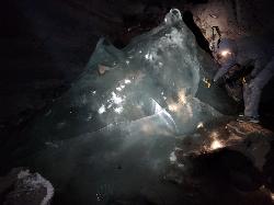
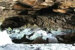
Not to be mistaken with the Civil Defense Caves (which are near by), the Ice Caves are about an hour North outside of Rexburg. The Ice Caves were originally formed as lava tubes. The shape of the caves traps cold winter air in the cave and forms large areas of ice on the floor and beautiful ice crystals on the walls and ceiling. The ice remains frozen year round and makes for an awesome time. The ice caves are a few hundred yards deep and require good footwear, warm clothes and a flashlight to navigate. There is often a good amount of water near the entrance. There's a bridge of rocks across the area but you may get a little wet getting in the cave. There are areas where you'll need a rope to be able to ascend portions of ice. Please do not light fires or introduce any other heat source into the caves.
- Plan Ahead and Prepare
- Travel & camp on durable surfaces
- Dispose of waste properly
- Leave what you find
- Minimize campfire impacts
- Respect wildlife
- Be considerate of other visitors
Directions
From Rexburg, Idaho
- Head north on S 3rd W toward W 1st S (0.2 mi)
- Turn left onto ID-33 W/
W Main St (0.9 mi) - Turn right to merge onto US-20 E toward St Anthony (3.1 mi)
- Take exit 337 toward North Rexburg (0.3 mi)
- Turn left onto N Salem Hwy (8.5 mi)
- Continue onto N 1900 E/
N 2000 Rd W/ Red Rd Continue to follow N 2000 Rd W/(18.5 mi)Red Rd - Turn right (1.9 mi)
- Slight right (0.5 mi)
- Slight right (0.7 mi)
- Slight rightDestination will be on the right(43 ft)
Head north out of town, as if you’re driving to the sand dunes. The turn off is just approximately 28 miles past Walmart (when I drove it, my odometer said exactly 28.2 miles). You will know you have arrived at the turn-off when you cross over a cattle guard (a big grated metal thing that crosses the road), and see a white sign on the right side of the road that says, “Entering Clark County.”
jamadeus
8/8/17 6:08 pm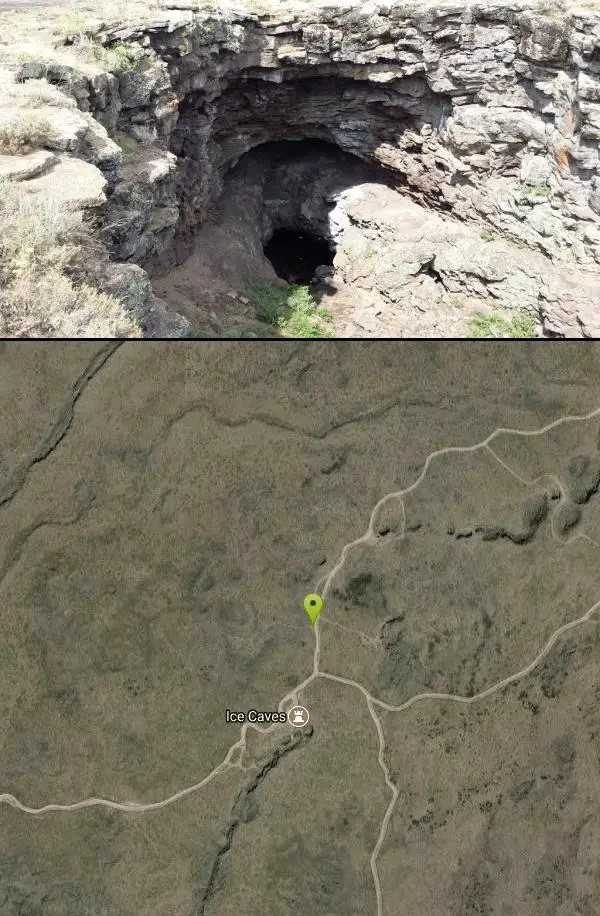 20230808 200427 added by endovereric

 20230808 195516 added by endovereric
 20230808 200232 added by endovereric
 20230808 200331 added by endovereric
 20230808 200451 added by endovereric
 20230808 200714 added by endovereric
 20230808 202803 added by endovereric
 20230808 203058 added by endovereric
 20230808 203351 added by endovereric
 20230808 203529 added by endovereric
 Ice Cave From Trail courtesy of John And Chris↗
 20230808 204250 added by endovereric

Other Caves Nearby
Civil Defense Caves
Rexburg, Idaho
6.3 miles SThe caves are large lava tubes. The name comes from the cold war era when they were anticipated as a safe area in the case of an attack. The entrance is pretty bouldery and does require a small...
Cave 0.6-2.0 mi
North Menan Butte ('R' Mountain)
Menan, Idaho
33.0 miles SThe North Menan Butte is more commonly known to the locals and college students as R Mountain. Many kids know it better as Ou'R' Mountain. The butte is a rare and unique geological area and provides...
Camp, Cave, HikeNearby Campsites

Pine Butte / The Caldera
St. Anthony, Idaho
1.5 miles NWThis is about as close to an oasis as you can get in the deserts of Idaho. It's an old volcano in the middle of the sagebrush desert. As soon as you start down the path, you can feel the air...
Camp, Hike, Horseback 4.8 mi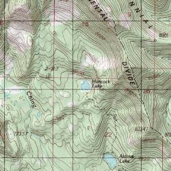
Aldous Lake and Hancock Lake
Kilgore, Idaho
18.3 miles NA pair of alpine lakes near Kilgore, Idaho. Good road all the way to the trailhead. Easy to moderate 1.5mi hike to the first lake (Aldous) and another mile of moderate hiking to Hancock. Beautiful...
Backpack, Camp, Hike, Horseback, Swim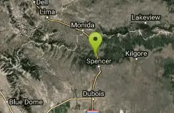
Stoddard Creek
Spencer, Idaho
23.5 miles NWStoddard Creek Campground is located just 1 mile off I-15 and 17 miles north of the town of Dubois, Idaho. Visitors come to the area to enjoy the abundance of trails, wildlife viewing opportunities...
Camp 0.9 mi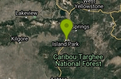
Buffalo River Campground
Island Park, Idaho
25.3 miles NEThe float here is nice and easy. It's a great early season float. Later in the season the shallow spots will force you to walk a good chunk of the float. The water is super clear and often pretty...
Camp, Canoe, Kayak, Swim 0.8-1.3 mi
Warm Slough Campground
Rexburg, Idaho
26.0 miles SThis is a pretty popular campsite that fills up pretty quick on busy weekends. Campsites are fairly spread out and there is no official donation box (as of July 2015). A couple of the campsites...
Airsoft, Camp, Canoe
Warm River Campground
Ashton, Idaho
26.2 miles EWarm River Campground is located nine miles northeast of Ashton, Idaho, along the slow-moving Warm River at an elevation of 5,200 feet. Willows line the riverbanks and pine trees offer partial...
Camp 0.3-0.6 mi
Bear Gulch
Ashton, Idaho
26.6 miles EBear Gulch is an abandoned ski hill out of operation since 1969. While the vegetation is beginning to take over, there's still some great sledding to be had. It's just far enough into the...
Camp, Cross-country Ski, Hike, Sled
Upper Coffee Pot Campground
Island Park, Idaho
27.6 miles NEUpper Coffeepot Campground stretches along a floatable section of Henry's Fork of the Snake River. A mixed growth lodgepole pine forest provides partial shade and summer wildflowers are...
Camp, Canoe 0.1-0.5 mi
Eagle Park
Rexburg, Idaho
28.3 miles SEagle Park is a little urban oasis. Once you drive in to this cottonwood forest along the river, you may forget that you're still inside Rexburg city limits. You can camp, picnic, throw rocks in...
Camp, Hike, Mountain Bike, Sled
Beaver Dick Park
Rexburg, Idaho
29.4 miles SBeaver Dick is a park 4.5 miles west of Rexburg, Idaho on Hwy 33. It's a 9.5 acre park that passes next to the west bank of the Henry Fork of the Snake River; it's a popular...
Camp, Canoe, Disc Golf, Swim
Porcupine Creek
Ashton, Idaho
31.1 miles EPorcupine Creek is a hunting, fishing, camping, and swimming spot near Ashton, Idaho in Fremont County within Targhee National Forest. It's surrounded by forests, meadows, and a creek...
Camp, Swim
Big Springs
Island Park, Idaho
32.3 miles NEThere's also a great little walking trail along the river with placards that tell about the ecosystem and history of the area. There's about a 1/2 mile that's paved and then a 1/2 mile...
Camp, Hike 0.6-2.0 mi
North Menan Butte ('R' Mountain)
Menan, Idaho
33.0 miles SThe North Menan Butte is more commonly known to the locals and college students as R Mountain. Many kids know it better as Ou'R' Mountain. The butte is a rare and unique geological area and provides...
Camp, Cave, Hike 17.5 mi
Tear Drop Lake
Ashton, Idaho
33.6 miles ENestled in the Targhee National Forest just off of Ashton's Fish Creek Road, this tear drop shaped lake is a family adventure waiting to happen. The lake isn't very big but it is teeming with...
Camp, Canoe, Hike, Kayak, Mountain Bike, Swim
Horseshoe Lake
Ashton, Idaho
35.5 miles EHorseshoe Lake is hidden back in the Targhee National Forest. It's a beautiful lake with plenty of lily pads. The road to get there is well maintained and there are many options for pull-outs...
Camp, Canoe, Dive, Swim
Sheep Falls on Fall River
Ashton, Idaho
37.3 miles EThe lesser known Sheep Falls on Fall River is a local treasure off of Cave Falls road. There are primitive campsites and beautiful views for a great picnic spot. The water splits and comes down in...
Camp
Jefferson County Lake (AKA Rigby Lake)
Rigby, Idaho
37.9 miles SRigby Lake has long been a favorite swimming hole for those in the area. The county has taken it well under its wing and made it a buzzing spot on any warm summer day. Along with the long standing...
Camp, Canoe, Dive, Kayak, Sled, Swim 0.5-3.5 mi
Webster's Dam
Ririe, Idaho
39.3 miles SAlso known as Manmade Falls or the Woodmansee Dam, Webster Dam is an abandoned dam located deep in Moody Creek canyon, the dam was abandoned when sediment built up behind the dam which then...
Camp, Hike, Mountain Bike
Twin Bridges Park
Rexburg, Idaho
39.6 miles STwin Bridges is a campground 12 miles South East of Rexburg on S. 600 E. It is maintained by Madison County Parks Department. It is a 27 acre park of pristine land rich with wildlife on the Snake...
Camp, Canoe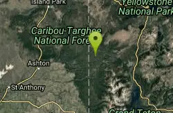
Cave Falls of Yellowstone
Ashton, Idaho
40.7 miles EThis campgrond is situated on the banks of Fall River in Wyoming along the south border of Yellowstone National Park. Cave Falls Campground has 23 single site units and a terrific area for...
Camp, Hike


