


Rattle Rock / The Gauntlet
Menan, Idaho
| GPS: |
43°48'55.7"N 112°0'40.0"W Maps | Directions |
| State: | Idaho |
| Field Type: | Public Land |
Paintball Permitted
Airsoft and Paintball
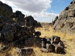
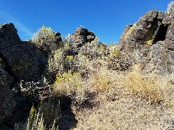
Rattle Rock is a much different arena than the flat or even hilly woods associated with rec ball or wooden scrap barriers like many established fields. You won't find any trees, spools, or straw bales here. This collapsed lava tube has created a gauntlet with 20 foot rock climbable rock walls on either side. Though wildfires in 2013 wiped out all of the large sagebrush and crumbled some of the manmade rock barriers, there's still plenty there to have a great time. There's still a lot of manmade rock walls, caves, and tunnels; at one time, there were over 40. A couple of the high vantage points have walls built around them to act as a turret. Surprisingly great place to play. If you're really adventurous, it can easily become an interesting bouldering/paintballing mix. There are plenty of Rattlesnakes out in desert and Rattle Rock is far from the exception. It's a good idea to walk the field and make sure all your opponents are human before you start playing. You'll want to check out the tunnels and caves as well. You wouldn't want to dive in there and find the spot already taken. Some people have played out here a lot and never seen a rattlesnake on the field but be cautious, safe, and play at your own risk.
If you continue down the road a bit more to the Southeast, there's a popular shooting spot that sometimes shoots towards The Gauntlet. Make sure there's nobody shooting your direction before you start to play. You may also consider putting a sign or something up over there to let people that may come know that you're up in the hill and would prefer not to be shot at.
More Information
Add Resource- Plan Ahead and Prepare
- Travel & camp on durable surfaces
- Dispose of waste properly
- Leave what you find
- Minimize campfire impacts
- Respect wildlife
- Be considerate of other visitors
Directions
From Menan, Idaho
- Head east on E Menan Lorenzo Hwy toward N 3565 E (0.3 mi)
- Turn left onto N 3600 E (6.3 mi)
- Continue onto N 3600 E/Twin Butte Rd (1.1 mi)
- Turn left onto E Butte Rd (1.1 mi)
- Turn left onto ID-33 W (3.1 mi)
- Turn left onto Menan Butte RdDestination will be on the left(1.0 mi)
At the point designated on the map, there's a fork in the road and a great spot to park. Then walk up the hill to the east and it will drop into the collapsed lava tube. The tube goes north for a 100 yds or so. There's pretty obvious ends to the field.
endovereric
4/2/14 10:13 pm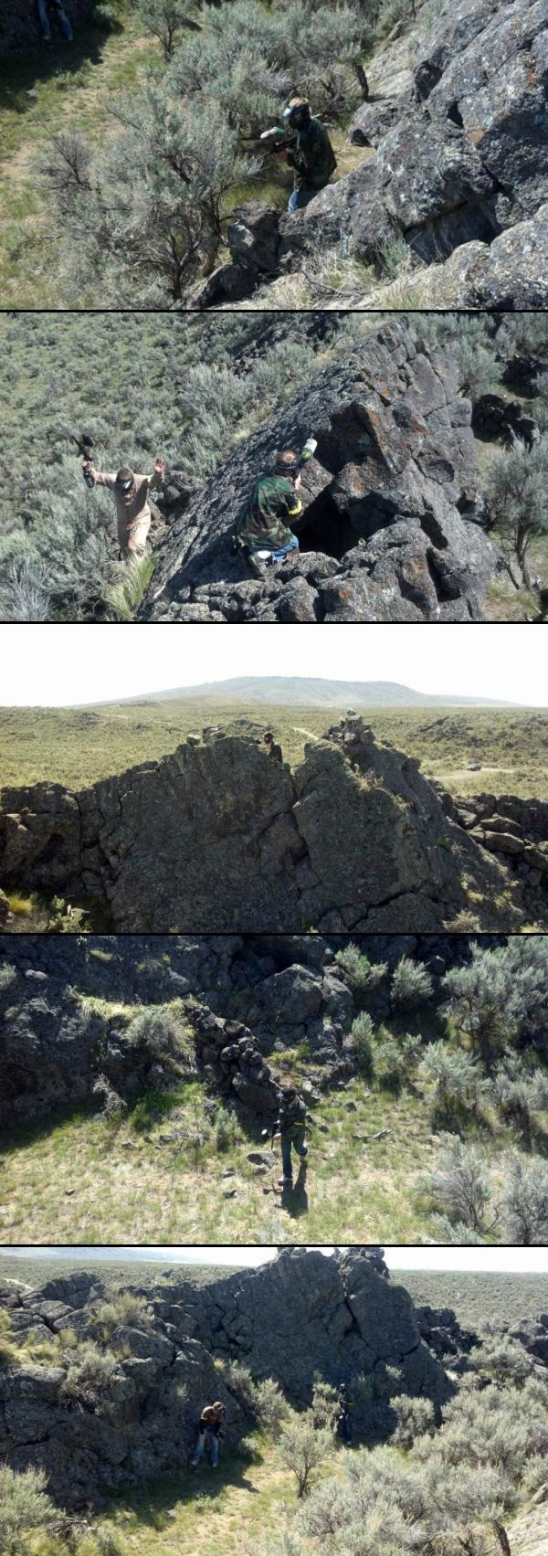


Other Paintball Fields and Airsoft Fields Nearby
Lava Hill
Menan, Idaho
2.0 miles WThis is a great little spot. Each team starts at one side of the collapsed lava tube. You can see each other really well from that point. Then you take the hill and get the other guys off it. It...
Airsoft, Paintball 0.8-1.3 mi
Warm Slough Campground
Rexburg, Idaho
8.1 miles NEThis is a pretty popular campsite that fills up pretty quick on busy weekends. Campsites are fairly spread out and there is no official donation box (as of July 2015). A couple of the campsites...
Airsoft, Camp, Canoe 1.0-1.3 mi
Lorenzo Bridge
Rexburg, Idaho
9.2 miles SEThis is the old site of the Lorenzo Boat Launch, which has moved to the other side of the river a little further downstream. This spot sees very little traffic. There are beautiful, yet...
Airsoft, Hike, Paintball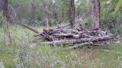
Ririe River Island (AKA Twin Bridges)
Rexburg, Idaho
15.6 miles SEGo into the campground WHERE PAINTBALLING IS NOT ALLOWED. Park there and cross the creek on the North side of the park. You'll have to cross the river using the rocks that are there so not too...
Airsoft, Paintball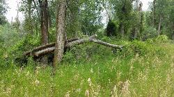
On the banks by Heise
Ririe, Idaho
19.6 miles SEOn the banks of the river near Heise. Plenty of trees and ground cover.
Airsoft, Paintball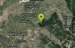
Bighole Mountains / Moody
Ririe, Idaho
23.0 miles SEThis is a little unofficial campground with a plenty of shade for your basecamp and a wooded field with great boundaries. There's 2 roads that split and merge giving you very simple...
Airsoft, Paintball
River Rush
Ashton, Idaho
30.5 miles NEPaintball near Ashton, Idaho
Paintball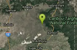
Sand Creek Frenzy
Ashton, Idaho
33.1 miles NEThere are some woods back there and it is secluded. There are many places you can play just watch out for campers.
Paintball
Ashton Hill
Ashton, Idaho
36.6 miles NEFairly thick forest. Considerable underbrush. Lots of places in the area to play.
Airsoft, Paintball
The Pit
Ashton, Idaho
43.0 miles NEThis location is great because there is no one around only locals know of this area and you can shoot anything out there. Watch out for target shooters there! Also stay away from the main road.
Airsoft, PaintballNearby Campsites

North Menan Butte ('R' Mountain)
Menan, Idaho
2.3 miles SEThe North Menan Butte is more commonly known to the locals and college students as R Mountain. Many kids know it better as Ou'R' Mountain. The butte is a rare and unique geological area and provides...
Camp, Cave, Hike
Beaver Dick Park
Rexburg, Idaho
5.3 miles EBeaver Dick is a park 4.5 miles west of Rexburg, Idaho on Hwy 33. It's a 9.5 acre park that passes next to the west bank of the Henry Fork of the Snake River; it's a popular...
Camp, Canoe, Disc Golf, Swim 0.8-1.3 mi
Warm Slough Campground
Rexburg, Idaho
8.1 miles NEThis is a pretty popular campsite that fills up pretty quick on busy weekends. Campsites are fairly spread out and there is no official donation box (as of July 2015). A couple of the campsites...
Airsoft, Camp, Canoe
Jefferson County Lake (AKA Rigby Lake)
Rigby, Idaho
9.7 miles SERigby Lake has long been a favorite swimming hole for those in the area. The county has taken it well under its wing and made it a buzzing spot on any warm summer day. Along with the long standing...
Camp, Canoe, Dive, Kayak, Sled, Swim 0.1-0.5 mi
Eagle Park
Rexburg, Idaho
10.8 miles EEagle Park is a little urban oasis. Once you drive in to this cottonwood forest along the river, you may forget that you're still inside Rexburg city limits. You can camp, picnic, throw rocks in...
Camp, Hike, Mountain Bike, Sled
Twin Bridges Park
Rexburg, Idaho
15.7 miles SETwin Bridges is a campground 12 miles South East of Rexburg on S. 600 E. It is maintained by Madison County Parks Department. It is a 27 acre park of pristine land rich with wildlife on the Snake...
Camp, Canoe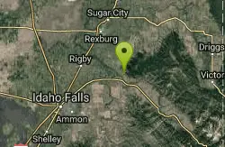
Paramount Wall / Blanche Rock
Ririe, Idaho
21.7 miles SESitting high above the road, the routes at Paramount offer great exposure and relief from the afternoon summer sun. Chuck Oddette, Steve Reiser and Jed Miller established the routes from 1989...
Camp, Horseback, Rock Climb
Kelly Island Campground
Ririe, Idaho
21.9 miles SEThis is a BLM campground with 14 campsites for RVs or tents and 1 group campsite. Daily Rates $5-20 Showers No Bathrooms Vault...
Camp 0.5-3.5 mi
Webster's Dam
Ririe, Idaho
22.2 miles EAlso known as Manmade Falls or the Woodmansee Dam, Webster Dam is an abandoned dam located deep in Moody Creek canyon, the dam was abandoned when sediment built up behind the dam which then...
Camp, Hike, Mountain Bike
Big Hole Dispersed Campsites
Ririe, Idaho
22.5 miles SEA dispersed campsite is simply an unestablished and unmaintained area where people camp. Often, this means that there is a campfire or other basic campsite feature to identify the site and that's...
Camp
Table Rock Campground
Ririe, Idaho
24.7 miles SETable Rock / Poison Flat Campground is located at the Caribou-Targhee National Forest which occupies over 3 million acres and stretches across southeastern Idaho, from the Montana, Utah, and Wyoming...
Camp
Wolf Flats Recreation Area
Ririe, Idaho
25.0 miles SEWolf Flats is a completely free, dispersed, undeveloped camping area with 25 locations to camp. Some areas are large enough to accommodate groups of 50 people.
Camp
Sealander Park
Idaho Falls, Idaho
27.1 miles SThe story of Sealander park begins with Carl Sealander. Leaving Sweden in 1893 at the age of seventeen, Carl worked in mining communities across Colorado and Utah before meeting his wife, Lizzie...
Camp
Moody Meadows
Driggs, Idaho
28.9 miles EGood place for kids, they can ride bikes in the meadow, play in the stream, and camping is off of the road. Hiking, motorbiking, and horseback riding trails are abundant in the area.
Camp
Pine Butte / The Caldera
St. Anthony, Idaho
32.4 miles NThis is about as close to an oasis as you can get in the deserts of Idaho. It's an old volcano in the middle of the sagebrush desert. As soon as you start down the path, you can feel the air...
Camp, Hike, Horseback
Firth River Bottoms
Firth, Idaho
36.3 miles SWhether you like to ride horses, picnic, camp, fish, learn about the past, or play baseball, this park has something for everyone. The Parks & Recreation Department and the IDaho Education...
Camp, Canoe, Hike
Warm River Campground
Ashton, Idaho
40.7 miles NEWarm River Campground is located nine miles northeast of Ashton, Idaho, along the slow-moving Warm River at an elevation of 5,200 feet. Willows line the riverbanks and pine trees offer partial...
Camp
Fall Creek Falls
Swan Valley, Idaho
41.0 miles SEFalls Campground is located next to the Snake River near beautiful Swan Valley, only 45 miles east of Idaho Falls, Idaho. Mixed growth cottonwood trees provide partial shade, and grassy meadows with...
Camp, Cave, Hike, Kayak, Swim
Falls Campground
Victor, Idaho
41.9 miles SEFalls Campground is located next to the Snake River near beautiful Swan Valley, only 45 miles east of Idaho Falls, Idaho. Mixed growth cottonwood trees provide partial shade, and grassy meadows...
Camp 0.3-0.6 mi
Bear Gulch
Ashton, Idaho
42.8 miles NEBear Gulch is an abandoned ski hill out of operation since 1969. While the vegetation is beginning to take over, there's still some great sledding to be had. It's just far enough into the...
Camp, Cross-country Ski, Hike, Sled


