


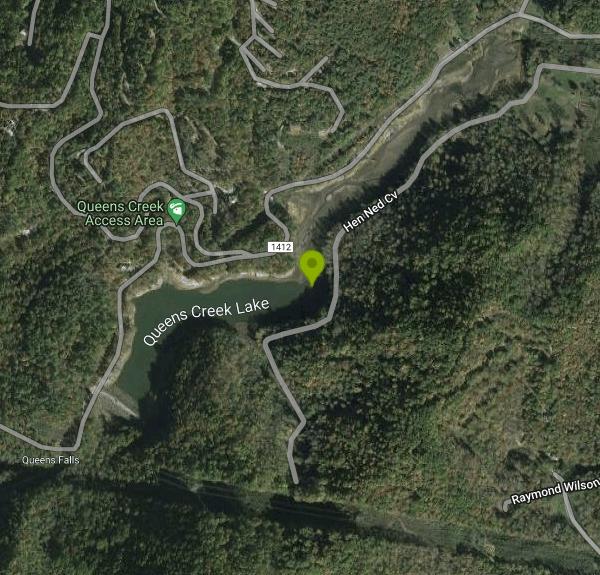
Queens Creek Lake
Nantahala, North Carolina
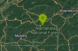
| Address: | Queens Creek Lake, North Carolina 28781, USA |
| GPS: |
35°16'40.2"N 83°39'9.5"W Maps | Directions |
| State: | North Carolina |
Swim
Queens Creek Lake is a beautiful secluded reservoir in Natahala George. This picturesque winding lake is surrounded by mountains covered with trees. The mountains and sky often mirror themselves into the smooth lake and create stunning scenes. The slow change of colors in the fall create a variety of colorful views that make this a beautiful place to visit in a variety of seasons.
Queens Creek Lake is known for being a quality fishing spot, especially for catching Trout. Fishers need licenses and to follow all local fishing rules and regulations.
On warmer days Queens Creek Lake is also a great spot for swimming. This secluded area creates a wonderful place to cool off without crowds. There is a small playground area and one picnic table available for visitors.
Queens Creek Lake is also a great place to access Winding Stairs Road, a scenic road that goes up the mountain for a steep and scenic drive.
More Information
- Plan Ahead and Prepare
- Travel & camp on durable surfaces
- Dispose of waste properly
- Leave what you find
- Minimize campfire impacts
- Respect wildlife
- Be considerate of other visitors
Directions
From Nantahala, North Carolina
- Head southwest on US-19 S/
US-74 W (1.4 mi) - Turn left onto Wayah Rd (4.5 mi)
- Turn left onto 1412/
Winding Stairs Rd (2.8 mi) - Turn left onto Winding Stairs Rd (0.9 mi)
- Turn left onto Camp Branch Rd (151 ft)
- Turn right onto Hen Ned CvDestination will be on the right(0.5 mi)
Other Swimming Holes Nearby
Fingerlake
Almond, North Carolina
8.2 miles NEFingerlake overlooks Fontana Lake near Almond, NC. Fingerlake is the perfect place to cool off on a hot day. Fingerlake has a day use area that is open to the public from dawn to dusk from April to...
Canoe, Kayak, Swim
Fires Creek Area
Wake Forest, North Carolina
17.1 miles SWSwim near Wake Forest, North Carolina
Swim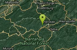
Deep Creek Area
Wallace, North Carolina
18.2 miles NESwim near Wallace, North Carolina
Swim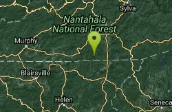
Boone Area
Otto, North Carolina
19.6 miles SESwim near Otto, North Carolina
Swim
Big Laurel Falls
Otto, North Carolina
19.6 miles SESwim near Otto, North Carolina
Swim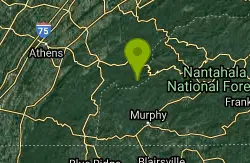
Davis Branch
Tellico Plains, Tennessee
25.0 miles WDavis Branch is a beautiful campground located in Tennesse by the beautiful Tellico River. Here you can camp, hike, and explore the river. The campground has six different campsites all offering...
Camp, Hike, Swim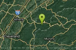
Baby Falls Area
Tellico Plains, Tennessee
29.7 miles WSwim near Tellico Plains, Tennessee
Swim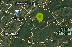
Baby Falls
Tellico Plains, Tennessee
29.7 miles WThe Tellico River is the home of the Baby Falls waterfall/swimming hole. Although it is beautiful at all times of the year, fall has been said to be one of the most beautiful and favorite times for...
Hike, Kayak, Swim, Whitewater
Midnight Hole
Tuckasegee, North Carolina
29.9 miles ESwim near Tuckasegee, North Carolina
Swim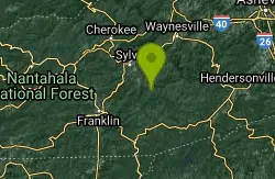
Big Creek
Tuckasegee, North Carolina
29.9 miles ESwim near Tuckasegee, North Carolina
Swim 3.8 mi
Ramsey Cascades
Gatlinburg, Tennessee
33.7 miles NEHike, Kayak, Swim, and Whitewater near Gatlinburg, Tennessee
Hike, Kayak, Swim, Whitewater
Cashiers Area
Woodleaf, North Carolina
33.8 miles SESwim near Woodleaf, North Carolina
Swim
Little Pigeon River
Gatlinburg, Tennessee
34.4 miles NELocated near the Dollywood Amusement park and the attractions of Gatlinburg, Tennessee, the swimming holes located off the Little Pigeon River banks are easy to access. The area can get busy at...
Swim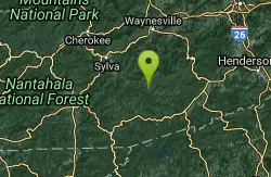
Bear Creek Area
Tuckasegee, North Carolina
36.0 miles ESeveral swimming holes in lakes along RT 281 southeast of Sylva and Cullowhee. For details... Bathing suits: Optional at most places, very remote
Swim
Big Creek Area
Tuckasegee, North Carolina
36.0 miles ESeveral swimming holes near the NE border of the Great Smoky Mtns N. P. in the Big Creek Recreation Area on the TN-NC border. NOTE: The National Park Service will not allow you to...
Swim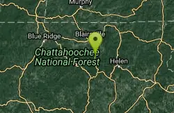
Vogle State Park
Blairsville, Georgia
38.4 miles SWVogel State Park is a 233-acre or 94 hectares state park located at the base of Blood Mountain in the Chattahoochee National Forest. It became one of the first two parks in Georgia when it founded a...
Camp, Canoe, Swim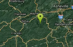
Sunburst
Canton, North Carolina
40.6 miles ESwim near Canton, North Carolina
Swim 1.4 mi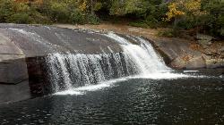
Turtleback Falls
Lake Toxaway, North Carolina
40.9 miles ETurtleback Falls was named for its domed shape, similar to the back of a turtle. It's also called "umbrella falls" for the same reason. Visitors slide down Turtleback as the...
Backpack, Hike, Swim 1.0 mi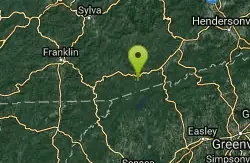
Hidden Falls
Lake Toxaway, North Carolina
41.2 miles EHidden Falls is a serene family-friendly swimming hole in Pisgah National Forest just down river from the towering Rainbow Falls. It's on the Horsepasture River "hidden" just a few...
Hike, Swim
Cosby Campground
Cosby, Tennessee
41.4 miles NECamp and Swim near Cosby, Tennessee
Camp, SwimNearby Campsites

Mt. LeConte Lodge
Sylva, North Carolina
23.4 miles EHigh atop Mt. LeConte in the Great Smoky Mountains National Park, LeConte Lodge® is the highest guest lodge in the eastern United States. It is situated on an open glade just below the summit of...
Camp, Hike, Horseback, Rock Climb
Cades Cove Campground
Townsend, Tennessee
23.5 miles NOver 2 million visitors annually come to enjoy the scenic beauty of Cades Cove and its many historic structures. Popular activities here include hiking, biking, touring the 11-mile Cades Cove loop...
Camp
Davis Branch
Tellico Plains, Tennessee
25.0 miles WDavis Branch is a beautiful campground located in Tennesse by the beautiful Tellico River. Here you can camp, hike, and explore the river. The campground has six different campsites all offering...
Camp, Hike, Swim
War Woman Dell Wildlife Management Area
Clayton, Georgia
32.3 miles SEWarwoman Dell Nature Trail and Becky Branch Falls Trail is a 0.8 mile out and back trail located near Clayton, Georgia that features a waterfall and is good for all skill levels. The trail is...
Camp, Hike, Horseback
Vogle State Park
Blairsville, Georgia
38.4 miles SWVogel State Park is a 233-acre or 94 hectares state park located at the base of Blood Mountain in the Chattahoochee National Forest. It became one of the first two parks in Georgia when it founded a...
Camp, Canoe, Swim
Cosby Campground
Cosby, Tennessee
41.4 miles NECamp and Swim near Cosby, Tennessee
Camp, Swim


