


Quail Trail
Goodyear, Arizona
| Address: | ~14501-14995 W Trailhead Dr, Goodyear, AZ 85338, USA |
| GPS: |
33°22'54.8"N 112°22'49.1"W Maps | Directions |
| State: | Arizona |
| Trail Length: | 1.00 miles |
| MTB Difficulty: | Beginner |
| Trail Type: | Point A to B |
| Hike Difficulty: | Beginner |
| Trails/Routes: | 1.0 mi |
Pet Friendly
Hike, Horseback, and Mountain Bike
Quail Trail is the access trail from the Nature Center to the main trail system. It is a pretty steep climb, but smooth and steady. Courtesy of trailforks.com
Quail Trail is a spur trail in the Estrella Mountain Regional Park. It connects the Nature Center trailhead to the Baseline Trail. Quail Trail is a spur trail in the Estrella Mountain Regional Park. It connects the Nature Center trailhead to the Baseline Trail. $6 entry fee per car. Courtesy of AllTrails.com
More Information
Add ResourceNever modify trail features. Ride trails when they're dry enough that you won't leave ruts. Speak up when you see others on the trail and always yield to hikers, horses, and others coming uphill. Always ride on the established trail.
Read MoreBe courteous, informed, and prepared. Read trailhead guidelines, stay on the trail, and don't feed the wildlife.
Read More- Plan Ahead and Prepare
- Travel & camp on durable surfaces
- Dispose of waste properly
- Leave what you find
- Minimize campfire impacts
- Respect wildlife
- Be considerate of other visitors
Directions
From Goodyear, Arizona
- Head west on W Western Ave toward S Litchfield Rd (157 ft)
- Turn left at the 1st cross street onto S Litchfield Rd (0.7 mi)
- Turn right onto MC 85 (1.2 mi)
- Turn left onto S Bullard Ave (2.0 mi)
- Turn right onto W Vineyard Ave (0.4 mi)
- Turn left onto Casey Abbot Dr N (1.0 mi)
- Continue onto S 143rd Dr (0.2 mi)
- Turn right onto W Casey Abbott Rd S (0.6 mi)
- Turn left onto W Trailhead DrDestination will be on the left(0.1 mi)

Trails
Distance ?
1.0 milesElevation Gain ?
160 feetReal Ascent ?
224 feetReal Descent ?
64 feetAvg Grade (2°)
3%Grade (-6° to 9°)
-11% to 15%Elevation differences are scaled for emphasis. While the numbers are accurate, the cut-away shown here is not to scale.
Other Mountain Bike Trails, Hiking Trails, and Horseback Trails Nearby

Baseline Trail
Goodyear, Arizona
0.6 miles EThe Baseline trail is a 2.6 mile loop at Estrella Mountain Regional Park. This listing is based on access from a spur trail (33.378981, -112.371072) off of the Gila trail. Access is...
Hike
Rainbow Valley to Toothaker Loop Trail
Goodyear, Arizona
0.9 miles SEEstrella Mountain Regional Park has many trails within it, a great beginner to intermediate friendly trail is the Rainbow Valley to Toothaker Loop Trail. This 6.6 mile hike is mostly flat with a few...
Hike, Horseback, Mountain Bike
Dysart Trail
Goodyear, Arizona
0.9 miles SE$6 entry fee per car.
Hike, Horseback, Mountain Bike
Estrella Mountain Park
Goodyear, Arizona
0.9 miles SENice mix of singletrack and doubletrack. One way loops, long loop and tech loop. A few mild climbs and some mild rock gardens, just let it ride. There is a lot of loose rocks on the...
Mountain Bike 3.6 mi
Toothaker Trail
Goodyear, Arizona
0.9 miles SEToothaker is an easy roller coaster of a trail. It crosses numerous washes ranging from small to large and can be a tad loose and/or rocky in some sections. The end reward is a nice view of Rainbow...
Hike, Horseback, Mountain Bike 13.8 mi
Butterfield to Gadsen Loop Trail
Goodyear, Arizona
1.0 miles SEAs with other trails in Estrella, the trail is wide and the surface tends to be rather benign, varying from mostly smooth, to occasionally strewn with small rocks, sandy in the washes. Butterfield...
Hike, Horseback, Mountain Bike 2.9 mi
Coldwater Trail
Goodyear, Arizona
1.1 miles SEThe Cold Water Trail #27 is a seldom visited, remote backcountry destination along the backdrop of the rugged Verde Rim with healthy mixed vegetation and unique geology. The trail was originally used...
Hike, Horseback, Mountain Bike 8.3 mi
Estrella Mountains Competitive Track
Tolleson, Arizona
3.9 miles EThe third competitive track in the Maricopa County Regional Park system, located in Estrella Mountain Regional Park, was completed in February 2000. The track consists of two loops totaling 13 miles....
Hike, Horseback, Mountain Bike
Black jack
Goodyear, Arizona
4.3 miles SWExtreme terrain, advance riders only.
Mountain Bike 4.8 mi
Lost Creek Petroglyph Trail
Buckeye, Arizona
11.5 miles NWStarting at Verrado's trailhead, the trail heads a short ways to a petroglyph site. While a little rocky at times, the trail is easy. To deter vandals, a very necessary fence with barbed-wire has...
Hike, Mountain Bike
Verrado
Buckeye, Arizona
11.6 miles NWTechnical, good climbs, lots of open roads to add cardio loops as well.
Mountain Bike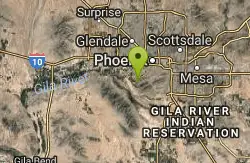
South Mountain Park / National Trail
Phoenix, Arizona
13.1 miles ENational trail can be acended or decended. Both require expert skills and fitness. You cannot and will not find a climb this technical, challenging and fun in AZ. It will kick your...
Mountain Bike 12.6 mi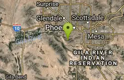
National Trail
Phoenix, Arizona
14.1 miles ENational Trail is the gem of South Mountain and home to the infamous Waterfall. It’s a local favorite as well as a destination trail for MTB snowbirds. Like most trails in the Sonoran...
Hike, Mountain Bike
Alta Trail And Bajada Trail
Phoenix, Arizona
14.1 miles EHike near Phoenix, Arizona
Hike
South, Bajada, Mule Deer Loop Trail
Waddell, Arizona
14.5 miles NWSouth - Bajada - Mule Deer Loop is a 4.1 mile loop trail located near Waddell, Arizona that offers the chance to see wildlife. The trail is rated as moderate and is accessible from...
Hike, Horseback, Mountain Bike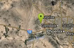
White Tanks Regional Park Trails
Waddell, Arizona
14.5 miles NWI have not ridden these trails yet, but I was surprised that they were not listed yet on the ST's database. There are 28 miles of multi-use trails in the park, not including the park's...
Mountain Bike
Goat Camp Trail
Buckeye, Arizona
14.8 miles NWGoat Camp Trail is a well-liked mountain biking and hiking trail in White Tank Mountain Regional Park. This is a 16 mile out-and-back trail that is rated as advanced due to the length, as well as the...
Hike, Mountain Bike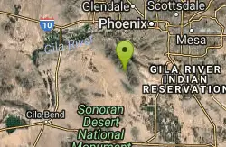
Quartz Peak Trail
15.0 miles SE
Hike near
Hike
Black Rock Loop Trail
Waddell, Arizona
15.6 miles NWBlack Rock Trail is a 1.3 mile loop trail located near Waddell, Arizona and is good for all skill levels. The trail is primarily used for hiking and is accessible year round. Black...
Hike
Wildlife Trail
Waddell, Arizona
15.7 miles NWA short trail which terminates at a small pond.
Hike, HorsebackNearby Campsites

Lower Salt River Nature Trail
Fort McDowell, Arizona
42.9 miles EThe Lower Salt River Nature Trail is a scenic walk to take at the Tonto National Forest. This trail provides stunning views as you walk alongside the Salt River. This rustic trail is older and less...
Camp, Hike
Buckhorn Campground Nature Trail
Apache Junction, Arizona
44.3 miles ECamp and Hike near Apache Junction, Arizona
Camp, Hike


