


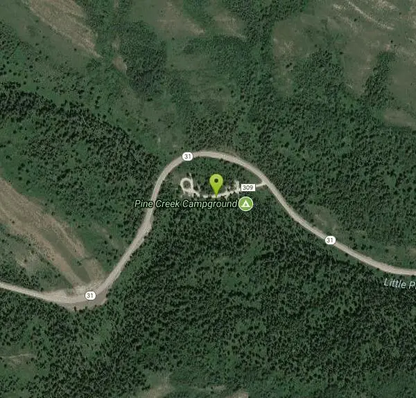
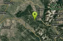
Pine Creek Campground
Victor, Idaho

Camp
The Pine Creek Campground has 10 single units and has restrooms.
More Information
Add Resource- Plan Ahead and Prepare
- Travel & camp on durable surfaces
- Dispose of waste properly
- Leave what you find
- Minimize campfire impacts
- Respect wildlife
- Be considerate of other visitors
Directions
From Victor, Idaho
- Head south on N Main St toward E Center St (26 ft)
- Turn right at the 1st cross street onto ID-31 W/W Center StContinue to follow ID-31 W(6.1 mi)
- Turn left onto Forest Rd 309Destination will be on the left(446 ft)
From Victor, ID head west on Idaho State Highway 31 for 4 miles. Campground is on the left side of highway.
Other Arenas Nearby
Red Creek Via Spooky Trail
Victor, Idaho
1.4 miles WTrail starts on the Spooky trail segment. About 1.2 up you'll see a trail on your left. This is where you will be coming out at. Continue straight. At about 2.6 from the car you'll...
Mountain Bike 1.2 mi
Spooky
Victor, Idaho
1.4 miles WTrail serves as the stem to Red Creek or access to Corral Creek as well as other possibilities in the big hole mountains. Nice fun singletrack to run as an out n back if your time is...
Mountain Bike
Allen Canyon-Pole Canyon Trail (014)
Victor, Idaho
2.1 miles EThis trail is locally known as the Pole Canyon Trail. Just South of Victor, ID, the Allen Canyon-Pole Canyon Trail (014) is a popular destination for local motorbikers, horseback...
Mountain Bike
Grove Creek to Drake Creek
Victor, Idaho
2.4 miles NGreat loop trail that connects several trails through the area. This trail was recently rerouted, and so will have plenty of new switchbacks to take as riders climb the mountain. Originally this...
Mountain Bike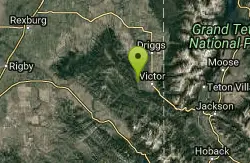
Rocky Peak Via Spooky Trail
Victor, Idaho
2.7 miles NYou will start up Spooky trail which is the only trail in the parking area. There is a trail junction on your left about 1.2-1.5 just keep going straight. At about 2.6 from TH you'll...
Mountain Bike
Sheep Driveway
Irwin, Idaho
3.1 miles SOHVs, mountain biking, day hiking, horse riding. source: fs.usda.gov
Mountain Bike
Henderson Canyon
Victor, Idaho
4.7 miles NTrail begins as dirt road/double track with numerous "cow" trails breaking off of road. Some of these trails see more tire tracks than others.
Mountain Bike
Trail Canyon Trail
Ririe, Idaho
4.7 miles WThe Trail Canyon trail begins at Trail Canyon Parklot, T8s R43e Sec28 and ends at Intersect Trail 5251,t8s R43e Sec28. source: fs.usda.gov
Mountain Bike
West Pine Creek Trail
Ririe, Idaho
4.7 miles WNon-motorized use. source: fs.usda.gov
Mountain Bike
Teton Springs Trail
Victor, Idaho
4.9 miles ECLOSED. This trail is no longer accessible to the public. There is a new company which owns the resort and the loop land. Teton Springs Loop is a loop for cross-country skiing and snowshoeing. The...
Cross-country Ski, Snowshoe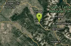
Pioneer Park Nordic Trail
Victor, Idaho
5.4 miles EDistance: 3 miles (4.5km) Trail Map: Pioneer_Park_2015.pdf Grooming Report: http://tvtap.org/nordic-grooming
Cross-country Ski, Snowshoe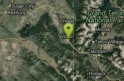
Victor Bike Park
Victor, Idaho
5.4 miles EThe Victor Bike Park is home to a progressive jump line, pumptrack, and more stunts.
Mountain Bike
Mike Harris Campground
Victor, Idaho
7.0 miles EMike Harris Campground is located along scenic Teton Pass, just 5 miles from Victor, Idaho at an elevation of 6,200 feet. Visitors enjoy fishing, exploring local trails and sightseeing in this...
Camp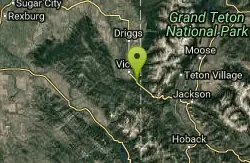
Rush Hour
Victor, Idaho
7.0 miles ETrail is a fun little out n back. 2 miles one way. Only gain about 340' in elevation throughout the trail. Perfect small workout trail and good intro to singletracks in the area. Trail turns...
Mountain Bike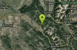
North/South Rainey Creek Trails
Irwin, Idaho
7.2 miles SMotorcycle trail. source: fs.usda.gov
Mountain Bike
Big Hole Crest Trail
Driggs, Idaho
7.4 miles NThis is a tough ride. Definately for advanced riders. Lots of climbing and descending. The trail at either end is well used and really fun. Not too much technical riding, just fun...
Mountain Bike
Twin Creek Trail
Driggs, Idaho
9.2 miles NThe Twin Creek trail is 2.3 miles long. It begins at Trail 6195 and ends at Trail 6219. source: fs.usda.gov
Mountain Bike
South Fork Snake River Trail
Ririe, Idaho
10.7 miles WGo left at the trail head. It heads down about a mile and a half on double track. Then you'll come to a creek crossing. After the crossing the trail heads across a gate. Head left...
Mountain Bike
Bovine
Driggs, Idaho
11.1 miles NBovine trail is part of a larger system. You can use it to access more trails or make it your end destination from other trailheads. It is a steep climb but returns the favor with a fast downhill....
Mountain Bike
Horseshoe Trails
Driggs, Idaho
11.1 miles NMountain Bike near Driggs, Idaho
Mountain Bike
Nearby Campsites
Mike Harris Campground
Victor, Idaho
7.0 miles EMike Harris Campground is located along scenic Teton Pass, just 5 miles from Victor, Idaho at an elevation of 6,200 feet. Visitors enjoy fishing, exploring local trails and sightseeing in this...
Camp
Darby Canyon Camping
Alta, Wyoming
11.6 miles NEThere's no official campgrounds up the canyon but there are several dispersed campsites with existing fire lays. Please adhere to principles of Leave No Trace. Use existing fire lays and leave...
Camp 5.6-8.3 mi
Palisades Creek Trail / Lakes and Waterfall Canyon
Irwin, Idaho
12.1 miles SPalisades Creek Trail is located about 50 miles southeast of Idaho Falls and about 60 miles west of Jackson Hole WY in Swan Valley Idaho. The four mile hike up to lower Palisades Lake or the 6.2 mile...
Backpack, Camp, Hike, Horseback, Mountain Bike
Falls Campground
Victor, Idaho
12.5 miles SWFalls Campground is located next to the Snake River near beautiful Swan Valley, only 45 miles east of Idaho Falls, Idaho. Mixed growth cottonwood trees provide partial shade, and grassy meadows...
Camp
Fall Creek Falls
Swan Valley, Idaho
12.5 miles SWFalls Campground is located next to the Snake River near beautiful Swan Valley, only 45 miles east of Idaho Falls, Idaho. Mixed growth cottonwood trees provide partial shade, and grassy meadows with...
Camp, Cave, Hike, Kayak, Swim
Moody Meadows
Driggs, Idaho
14.9 miles NWGood place for kids, they can ride bikes in the meadow, play in the stream, and camping is off of the road. Hiking, motorbiking, and horseback riding trails are abundant in the area.
Camp
Calamity Campground
Irwin, Idaho
16.9 miles SCalamity Campground is located just 55 miles east of Idaho Falls, Idaho. This is the perfect area to access the Palisades Reservoir and enjoy the water activities available there. The water here is...
Camp, Canoe, Hike, Kayak, Mountain Bike, Swim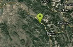
Bear Creek Campground at Palisades
Irwin, Idaho
17.0 miles SPalisades Reservoir is ideal for water skiing in the summer and features many picnic spots and boat docks. The area forest service hosts nine campgrounds containing 181 family units. Boat launch...
Camp, Hike, Horseback, Mountain Bike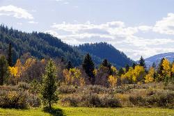
Big Elk Campground
Irwin, Idaho
17.9 miles SBig Elk Creek Campground is a very versitile campground with plenty of activities to keep busy. Campgrounds are available, with three group sites that include picnic tables and campfire rings. There...
Camp 13.8 mi
Big Elk Creek
Irwin, Idaho
17.9 miles SBig Elk Creak Campground is a very versitile campground with plenty of activities to keep busy. Campgrounds are available, with three group sites that include picnic tables and campfire rings. There...
Backpack, Camp, Canoe, Hike, Horseback, Kayak
Reunion Flat Campground
Alta, Wyoming
18.0 miles NECamp near Alta, Wyoming
Camp
Teton Canyon Campground
Alta, Wyoming
19.1 miles NETeton Canyon is the start of several great adventures, including the Alaska Basin Trail, Table Rock, Devil's Stairs, and the Teton Crest. The campground offers a perfect basecamp to get an...
Camp 3.8-6.4 mi
Table Rock / Table Mountain
Driggs, Idaho
19.2 miles NEAt 11,300 feet, Table Mountain is possibly the most beautiful climb this side of the Tetons and offers what may well be the very best view of the Grand Tetons. It's just far enough away...
Camp, Hike
Table Rock Campground
Ririe, Idaho
19.6 miles WTable Rock / Poison Flat Campground is located at the Caribou-Targhee National Forest which occupies over 3 million acres and stretches across southeastern Idaho, from the Montana, Utah, and Wyoming...
Camp
Badger Creek
Tetonia, Idaho
20.2 miles NBadger Creek is a stream located just 13.6 miles from Ashton, in Teton County, in the state of Idaho, United States, near France, ID. Whether you’re spinning, baitcasting or fly fishing your...
Camp, Cross-country Ski, Hike, Mountain Bike, Rock Climb
Wolf Flats Recreation Area
Ririe, Idaho
20.3 miles WWolf Flats is a completely free, dispersed, undeveloped camping area with 25 locations to camp. Some areas are large enough to accommodate groups of 50 people.
Camp 13.2-13.5 mi
Bear Creek Hot Springs
Irwin, Idaho
20.6 miles SBear Creek Hot Springs is a 15 mile out and back trail with a hot spring at the end. The trail is not well marked and is only recommended for very experienced outdoorsmen and primarily used for...
Backpack, Camp, Hike, Horseback, Hot Springs, Mountain Bike
Big Hole Dispersed Campsites
Ririe, Idaho
21.2 miles WA dispersed campsite is simply an unestablished and unmaintained area where people camp. Often, this means that there is a campfire or other basic campsite feature to identify the site and that's...
Camp 0.5-3.5 mi
Webster's Dam
Ririe, Idaho
21.4 miles NWAlso known as Manmade Falls or the Woodmansee Dam, Webster Dam is an abandoned dam located deep in Moody Creek canyon, the dam was abandoned when sediment built up behind the dam which then...
Camp, Hike, Mountain Bike 1.3-4.3 mi
Phelps Lake
Jackson, Wyoming
22.0 miles EThe Phelps Lake trail, located in Teton National Park, Wyoming, is in one of the most scenic locations of the park. Usually overshadowed by nearby Jenny Lake, it can often be missed by visitors of...
Backpack, Camp, Dive, Hike, Swim


