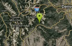
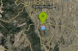
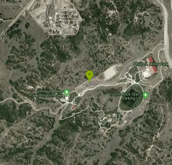
Phillip S. Miller Park
Castle Rock, Colorado
| Address: | ~210 E Wolfensberger Rd, Castle Rock, CO 80109, USA |
| GPS: |
39°22'8.1"N 104°52'59.2"W Maps | Directions |
| State: | Colorado |
| Trail Length: | 6.00 miles |
| MTB Difficulty: | Intermediate |
| Trail Type: | Loop |
| MTB Trail Type: | Singletrack |
Mountain Bike
Park at the Miller Activity Center parking lot (or start on sidewalk just off the Plum Creek Parkway entrance) and join the trail at the base of the "mini incline" stairs (200 steps to the top of the hill). The trail continues past the steps and the singletrack starts. Stay to the right as the first left will take you to the top of the mini incline. Follow the singletrack as it twists and winds around the hills of this 220 acre Town Park. Don't forget to stop and look around as the views from the tops of the hills are impressive and provide a great overlook to Castle Rock and the surroundings area. The trail has very few straight sections, so use caution on the blind corners when going up or down the switchbacks. The trail has some short but steep climbs but nothing that a fit, regular mountain biker can't power up. The reward is worth it for the views and the fun and quick downhills. There are few trail intersections, so getting lost on this trail will be tough. In the future, a shortcut will be added at the north end of the park to cross over Wolfensberger to access Ridgeline Open Space trails. Courtesy of Singletracks.com
More Information
Add ResourceNever modify trail features. Ride trails when they're dry enough that you won't leave ruts. Speak up when you see others on the trail and always yield to hikers, horses, and others coming uphill. Always ride on the established trail.
Read More- Plan Ahead and Prepare
- Travel & camp on durable surfaces
- Dispose of waste properly
- Leave what you find
- Minimize campfire impacts
- Respect wildlife
- Be considerate of other visitors
Directions
From Castle Rock, Colorado
- Head north on Cantril St toward Third St (92 ft)
- Turn left at the 1st cross street onto Third St (0.2 mi)
- Turn right at the 3rd cross street onto Wilcox St (0.1 mi)
- Turn left at the 2nd cross street onto Fifth St (0.1 mi)
- Continue onto Park St (0.5 mi)
- Turn left after McDonald's (on the left) (0.5 mi)
- Turn left onto Auburn Dr (0.5 mi)
- Turn left onto W Plum Creek Pkwy (0.2 mi)
- Turn right (282 ft)
- Turn right (0.3 mi)
Other Mountain Bike Trails Nearby
Memmen Ridge Open Space
Castle Rock, Colorado
1.8 miles EThis is a very nice close to town peaceful trail with great views and good trails.
Mountain Bike
Dawson's Butte
Castle Rock, Colorado
5.5 miles SIt's a simple loop from the parking lot--you can't get lost if you stay on the main trail. There are a bunch of detours on bridle trails--leave them to the equestrians. The...
Mountain Bike
Columbine Open Space
Castle Rock, Colorado
6.0 miles SThere are two lollipop loops from the parking lot. Both are very much beginner trails. The South loop is a one mile ride and the North loop is One and a half miles. Both have moderate...
Mountain Bike
Glendale Open Space Trail
Castle Rock, Colorado
8.5 miles NAdjacent to I-25, the 160-acre property has native chokecherry and wild plum shrubs along an intermittent stream. The trail winds up into Gambel oak shrubland and onto a grassland plain...
Mountain Bike
Bayou Gulch Bike Park
Parker, Colorado
9.2 miles NEThis is a bike park. There are two "loop" tracks, one beginner and one intermediate, as well as 3 intermediate flow trails.
Mountain Bike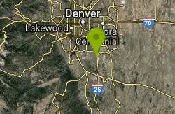
Bluffs Regional Park Trail
Lone Tree, Colorado
11.0 miles NThis is a multi-use trail made of crushed gravel. There are no technical features at all, but it is good for a lunchtime lap or for a couple of laps after work. It's also good for...
Mountain Bike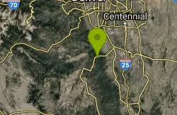
Devil's Head Stretch
Sedalia, Colorado
11.2 miles WDevil's Head Stretch is a multi-use trail that is full of moto-carved rollers, berms, dips, chutes, and off-shoots. It is densely populated with dirt-bikes on the weekends.This trail...
Mountain Bike
Highlands Point
Highlands Ranch, Colorado
11.4 miles NThe section of trails at Highlands Point can be accessed from Mountain Vista High School or via the East-West Regional trail parking lot on Griggs rd. Note that all but two of these...
Mountain Bike
East-West Regional Trail
Littleton, Colorado
11.7 miles N-- "This is the first leg of the East-West Regional Trail that will connect Chatfield State Park with the Town of Parker. The trail winds through grasslands and oak bluffs including...
Mountain Bike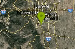
Plum Creek Park
Littleton, Colorado
13.0 miles NWThis is the shortest single track ever but it is a good trail for beginners and practice for the big stuff. It is a little sandy and slightly downhill. There ar5e a few small turns but...
Mountain Bike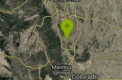
Greenland Open Space
Larkspur, Colorado
13.1 miles SThe trail configuration is a lollipop. Majority of the trial is double track with a few single track sections. There is nothing technical on this trail. There is about 500 feet of...
Mountain Bike
Colorado Trail: Waterton To South Platte
Littleton, Colorado
14.0 miles NW*Note: Waterton Canyon will be closed for for two extended periods in 2010 and 2011: 8/2/2010 - 12/3/2010 and 2/28/2011 - 12/31/2011. Alternate access to the first section of the...
Mountain Bike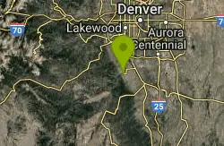
Indian Creek Loop
Littleton, Colorado
14.1 miles NWThe first and last 6 miles of this trail are on the gravel road that goes through Waterton Canyon, meaning your total off-road trail distance will be about 17 miles (29 miles total)....
Mountain Bike
Colorado Trail
Littleton, Colorado
14.1 miles NWAmazing singletrack, killer views, and lung busting elevation - what more could you ask for? Portions of the Colorado Trail are off limits to bikes so you'll need to detour around each...
Mountain Bike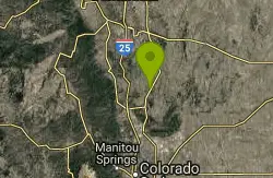
Lincoln Mountain
Larkspur, Colorado
15.3 miles SEThis is typical Douglas County Open Space, with wide singletrack, most of which is technically easy. After a short hop out from the parking area, there are two lollipops. To the south...
Mountain Bike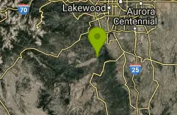
North Fork
Littleton, Colorado
15.6 miles WThis is a new machine-made singletrack, that largely runs on the side of mtn's. Can be done either as out/back, with folks usually starting at the bottom next to the South Platte...
Mountain Bike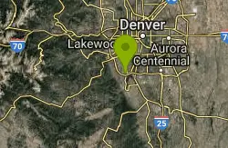
Dirt Jumps
Littleton, Colorado
17.6 miles NWthese jumps are under the first set of tress you'll see. There are some good jumps in there i wouldn't make the trip if you live farther then 5 miles.
Mountain Bike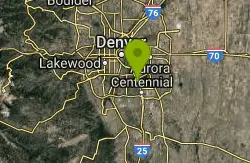
Cherry Creek
Denver, Colorado
17.9 miles NAlthough technically, this is a bike path, there are extended sections of singletrack that dart in and out of it with some surprisingly technical spots. For maximum...
Mountain Bike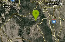
Colorado Trail: Green Mountain
Pine, Colorado
20.1 miles WThis is the trail Leah and I have been looking for since we moved to Colorado. Sweet, smooth singletrack, beautiful scenery, and a good mix of climbs and descents. This is easily my...
Mountain Bike
Chair Rocks
Pine, Colorado
20.1 miles WThe first five and a half miles of this route follow the Colorado Trail. Find the signs that show you to the trail and head north for about a mile where the trail crosses the road...
Mountain Bike