


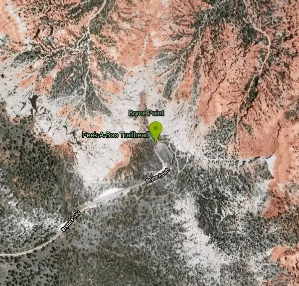
Peek-a-boo Loop
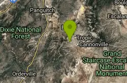
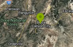
Bryce, Utah
| Address: | Peek-A-Boo Trailhead, Bryce Point, Bryce, UT 84764, USA |
| GPS: |
37°36'15.7"N 112°9'25.3"W Maps | Directions |
| State: | Utah |
| Trails/Routes: | 3.1 mi |
National Park
Hike
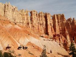
Peek-a-boo Loop Trail is one of the more strenuous hikes available in Bryce Canyon. The unique challenge this loop provides has beautiful views that are well worth the hike. This three-mile loop can be accessed using a clearly marked trail from Bryce Point. This trail can be found on the North side of the Bryce Point parking lot.
The decent from Bryce Point to Peek-a-boo Loop Trail is rapid, making this trail more difficult than most in the park. The trail is about 2 miles, making the entire hike about 5 miles.
There are no restrooms or water stations along the trail, however the bottom of the loop is shaded with green trees, giving a wonderful respite from the heat of the sun.
From Peek-a-boo Loop Trail hikers have a wonderful view of the Bryce Amphitheater. Throughout the loop you can see several incredible rock formations, Hoodoos, both up close and in the distance.
Because Peek-a-boo Loop is a distance from any popular trailhead in Bryce it is one of the quietest hikes available, with very little traffic from other hikers. Hikers on the trail may run into mules and horses, as this is the only hiking trail open to riders. Horse and mule rides can be scheduled through Bryce Canyon Park Services.
Peek-a-boo Loop is the perfect trail for hikers looking for a challenging, quiet and scenic hike.
More Information
Be courteous, informed, and prepared. Read trailhead guidelines, stay on the trail, and don't feed the wildlife.
Read More- Plan Ahead and Prepare
- Travel & camp on durable surfaces
- Dispose of waste properly
- Leave what you find
- Minimize campfire impacts
- Respect wildlife
- Be considerate of other visitors
Directions
From Bryce, Utah
- Head southwest toward UT-63 (0.3 mi)
- Turn left onto UT-63 (0.7 mi)
- Turn left onto Bryce Point Rd (1.9 mi)
- Turn leftDestination will be on the left(302 ft)

Trails
Distance ?
3.1 milesReal Ascent ?
791 feetReal Descent ?
1,540 feetGrade (-55° to 20°)
-142% to 37%Elevation differences are scaled for emphasis. While the numbers are accurate, the cut-away shown here is not to scale.
Other Hiking Trails Nearby
Hat Shop
Bryce, Utah
0.0 miles EHat Shop Trail is a moderately difficult hike with the view of some delicately balanced rock formations. These rock formations are where the Hat Shop Trail got its name. Huge gray boulders can be...
Hike 1.2 mi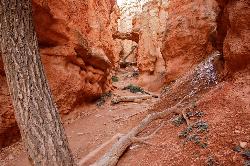
Navajo Trail
Bryce, Utah
1.4 miles NNavajo Trail explores the main amphitheater of Bryce Canyon National park in a short but winding hike. The hike begins at Sunset Point and splits off into a loop. The loop can be taken in either...
Hike 0.5-5.4 mi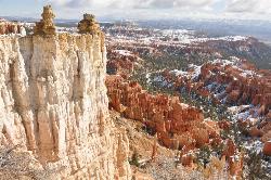
Rim Trail
Bryce, Utah
1.7 miles NRim Trail is a wonderful way for hikers to explore the breathtaking views of Bryce Canyon from above the canyon. The trail curves around the park allowing hikers to view the spectacular, red rock...
Hike 1.8 mi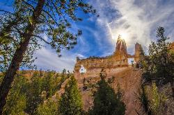
Tower Bridge
Bryce, Utah
1.7 miles NTower Bridge is a unique and uncrowded trail in Bryce Canyon. Tower Bridge gets its name from the prominent rock formation the trail leads to. The rock formation resembles London Bridge and is a...
Hike 2.3 mi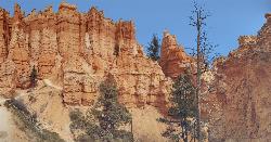
Queens Garden Trail
Bryce, Utah
1.7 miles NThe Queen's Garden Trail is the hike to see the wonders of Bryce Canyon's main amphitheater from all angles. Starting at Sunrise Point, you'll have a great view from the rim before...
Hike 7.6 mi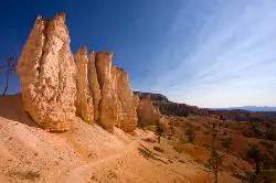
Fairyland Loop Trail
Bryce, Utah
3.1 miles NFairyland Loop Trail is one of the most scenic hikes available in Bryce Canyon. Hiking this loop allows you to see many of Bryce Canyon’s well-known sights from several...
Hike 4.1 mi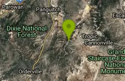
Swamp Canyon Overlook and Trail
Bryce, Utah
3.3 miles WSwamp Canyon Trail is a wonderful, lesser-explored trail of moderate difficulty. Hikers in this area can expect to see some of Bryce Canyon’s famous rock formations, while also experiencing the...
Hike 0.1-0.3 mi
Mossy Cave
Tropic, Utah
4.7 miles NEMossy Cave Trail is perfect for Bryce Canyon Visitors who want to experience the wonderful rock formations, like the Hoodoos, without steep and strenuous climbing. This trail is just over a mile and...
Hike 1.0 mi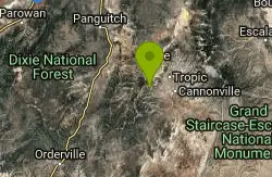
Bristlecone Loop
Kanab, Utah
10.0 miles SWBristlecone Loop is a one-mile trail from Rainbow Point. Rainbow Point is located at the southern end of Bryce Canyon National Park and is the highest point in the park. The spectacular views...
Hike 8.1 mi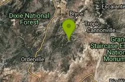
Riggs Spring Loop Trail
Kanab, Utah
10.1 miles SWRiggs Spring Loop Trail is the perfect trail for hikers wishing to escape to the wilderness. This is one of the least trafficked trails in Bryce Canyon and one of the most forested. The ponderosa...
Hike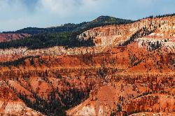
Dixie National Forest
Cedar City, Utah
28.6 miles WDixie National Forest is an often forgotten/hidden gem in Cedar City. It is over 2 million acres of beautiful red rock canyons and trees. Dixie Forest isn't only limited to rocks and...
Backpack, Camp, Hike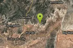
Montezuma Mines
Kanab, Utah
28.9 miles SA bunch of sand caves/mines. There are some pits with old ladders, and at least one pit in particular that you can descend with a rope.
Cave, Hike 12.1 mi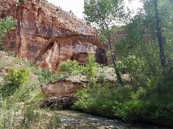
Escalante River
Escalante, Utah
33.6 miles EHike and Horseback near Escalante, Utah
Hike, Horseback 1.1 mi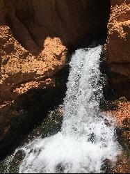
Cascade Falls
Cedar City, Utah
33.7 miles WCascade Falls, located outside of Cedar City, Utah, is a beautiful waterfall that is just a 1.2 mile hike round trip, ending at Cascade Falls. It is somewhat of a hidden local hotspot that not...
Hike 7.4 mi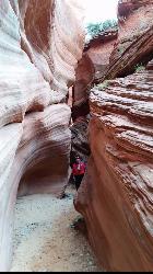
Red Slot Canyon AKA Peek-a-boo
Kanab, Utah
38.6 miles SWThis great little slot canyon is officially Red Slot Canyon but is also referred to as Peekaboo Canyon. It is not to be confused with Peek-a-boo Canyon near Spooky Gulch. It's not really very...
Hike 0.8 mi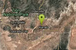
Moqui Caverns
Kanab, Utah
40.4 miles SWLocated near the small town of Kanab, Utah, The Moqui Caverns are a rare sight to behold. With bright flourescent rocks, Moqui Caverns is one of the more unique hikes not only in the state of Utah,...
Cave, Hike 5.7 mi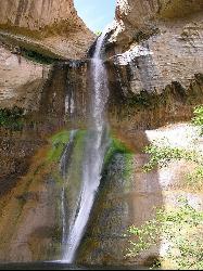
Lower Calf Creek Falls
Boulder, Utah
42.6 miles ELower Calf Creek Falls is a beautiful and popular destination located in the Grand Staircase-Escalante National Monument in southern Utah. The falls are a series of cascading waterfalls that flow...
Hike, Swim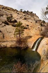
Upper Calf Creek Falls
Boulder, Utah
43.0 miles NEHike and Swim near Boulder, Utah
Hike, Swim
Riverside Walk
Springdale, Utah
48.6 miles SWThe Virgin River has many moods, from quiet and slow to a raging torrent. This beautiful, shaded walk meanders through forested glens, following the path of the stream ever deeper into the...
Hike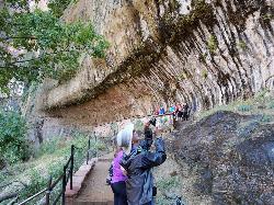
Weeping Rock
Springdale, Utah
48.8 miles SWExpect to get wet on this short hike! Weeping Rock gets its name from the continuous "weeping" of water that seeps through sandstone and drips from the cliffs above. Seasonal flowers...
HikeNearby Campsites
Sunset Campground
Bryce, Utah
1.5 miles NWSunset Campground is one of Bryce Canyon's two main campgrounds. It consists of 101 campsites linked together with three loops, loops A B and C. There are 20 tent-only campsites, 80 tent and RV...
Camp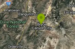
North Campground
Bryce, Utah
2.2 miles NNorth Campground is one of the two main campgrounds in Bryce Canyon National Park. The campground is open to RV and tent campers. Thirteen RV sites available for reservation and 86 RV and tent sites...
Camp
Dixie National Forest
Cedar City, Utah
28.6 miles WDixie National Forest is an often forgotten/hidden gem in Cedar City. It is over 2 million acres of beautiful red rock canyons and trees. Dixie Forest isn't only limited to rocks and...
Backpack, Camp, Hike
Calf Creek Campground
Boulder, Utah
42.6 miles ECamp, Dive, and Swim near Boulder, Utah
Camp, Dive, Swim


