


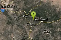
Payson Area
Cornville, Arizona
Swim
In the rivers around Payson, northeast of Phoenix, in the Tonto N. F., there are numerous fabulous swimming holes...Courtesy of swimmingholes.org
Bathing suits: Some optional (some are very remote)
Some arenas here include: Ellison Creek Falls, Christopher Creek Gorge, Hell's Gate, Haigler Canyon, Tonto National Bridge State Park, Fossil Creek, Fossil Springs, and Verde Hot Springs.
More Information
- Plan Ahead and Prepare
- Travel & camp on durable surfaces
- Dispose of waste properly
- Leave what you find
- Minimize campfire impacts
- Respect wildlife
- Be considerate of other visitors
Directions
From Cornville, Arizona
- Head east on E Cornville Rd toward S Loy Rd (9.0 mi)
- Turn right onto the ramp to Phoenix (0.2 mi)
- Merge onto I-17 S (5.5 mi)
- Take exit 287 for AZ-260 toward AZ-89A/Cottonwood/Payson (0.3 mi)
- Turn left onto AZ-260 E/Finnie Flat Rd (signs for Camp Verde/Payson) (0.3 mi)
- At the traffic circle, take the 2nd exit and stay on AZ-260 E/Finnie Flat RdContinue to follow AZ-260 E(33.7 mi)
- Turn right onto AZ-260 E/AZ-87 S (23.5 mi)
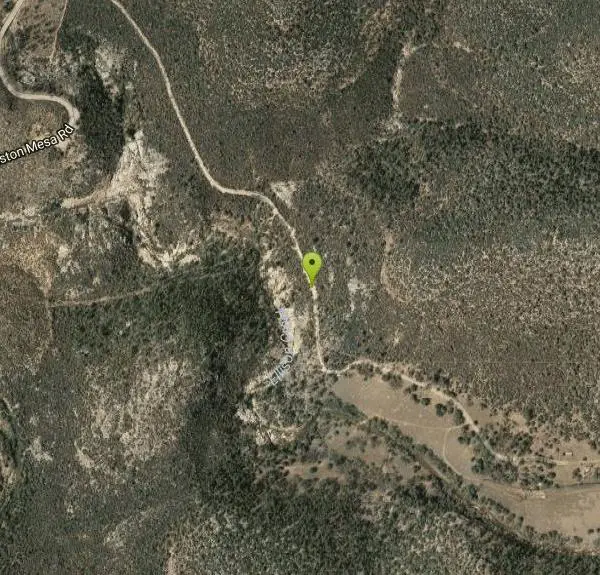
- Turn left onto Houston Mesa Rd/Nf-199 (4.8 mi)
- Slight left onto Houston Mesa Rd (3.7 mi)
- Turn rightDestination will be on the right(0.7 mi)
From Phoenix, take RT 87 northeast to Payson. All directions below are given from Payson.
HELLS GATE [HELL]: It's a long, hot, steep and strenuous 13 mile roundtrip hike (better plan an overnight backpack) down to Hell's Gate in the Hells Gate Wilderness in the Tonto N. F.. Trail Description . Take plenty of water. The hike out is very steep uphill. Hells Gate is said to be well worth the effort if you are a backpacker. Rock-walled canyons with stream-side vegetation in the desert and swimming holes to enjoy. Some nice level places to camp too. To get here from Payson, go east on RT 260 for 11 miles to Little Green Valley. Turn south (right) on FR 405A and drive 1/2 mile south to trailhead LAT, LON (TRAILHEAD): lat=34.27988, lon=-111.13405(source: web site) (accuracy:approximate). LINK TO GOOGLE MAP. The trailhead is marked and easily accessible by car.
The hike: Pass through the gate and hike along the old road. The road climbs steeply over a ridge and then follows a fence line. Stay on the road, do not go through any of the gates on the fence. After 1 mile the road forks -- take the left one and follow along the creek. The trail crosses the creek about 7 times. After 2 miles the trail comes to a corral. From the corral the trail turns right and climbs a very steep hill to the ridge line. There is a fork on top of the ridge; take the left one and continue on the trail as it descends and climbs several small mountains to the top of Hellsgate Ridge, where it enters the wilderness (4 miles).
The trail in this section is sometimes a trail and sometimes and old jeep road. The two criss-cross each other several times. So if you miss the trail the road will get you to the same place but it was usually steeper. From the wilderness boundary the trail descends for the next 2.5 miles. After 1.5 miles you will come to a large stock tank. The trail gets a bit vague once you reach the creek, but a trail continues on the other side, going west a couple of hundred yards to where Haigler Creek joins Tonto Creek. The banks are rather brushy, but there are a handful of good camping spots near the confluence and the verdant areas along the creeks are inviting places. LAT, LON (SWIM HOLE): lat=-34.21606,-111.09615, lon=-111.13405(source: web site) (accuracy:approximate). LINK TO GOOGLE MAP. Pretty confident. Not verified. Updated 12/2012.
HAIGLER CANYON [HAIG]: Campground in Tonto N. F. with several swimming holes around the campground and in nearby canyons. No further information. To get here from Payson take RT 260 east about 24 miles then turn east (right) onto East Colcord Rd. (FR 291). Go about 4 miles then turn south (right) onto Chamberlain Trail (FR 200) and go about 7 miles to the Haigler Canyon Campground (Dirt roads may be difficult after rain. Roads winding with drop offs.). The swimming holes are near here. LAT, LON: lat=34.2194849, lon=-110.96290(source: web site) (accuracy:approximate). LINK TO GOOGLE MAP. Pretty confident. Not verified. Updated 12/2012.
TONTO NATURAL BRIDGE S. P. [TONT]: Swimming place in Pine Creek in State Park. Swimming is not allowed under the Natural Bridge. People do swim downstream in Pine Creek. No lifeguard - swimming is at your own risk. STATE PARK WEB SITE check to be sure it is open before you go. There is an entrance fee. To get here: From Payson head north on RT 87 for about 2.5 miles then, at the traffic circle, take the 2nd exit onto RT 260 W/RT 87 N. Go about 8.6 miles then turn west (left) at FR 583 and continue a short way to the state park. LAT, LON :lat=34.3207, lon=-111.4565(source: DeLorme) (accuracy:approximate). LINK TO GOOGLE MAP. Very confident. Not verified. Updated 11/09.
Courtesy of swimmingholes.org
Other Swimming Holes Nearby
Ellison Creek Falls
Payson, Arizona
0.5 miles NWEllison Creek provides 4 beautiful waterfalls in this area, each with their own swimming and diving opportunities. There are even fishing spots where trout can be caught. Since the falls are close to...
Dive, Hike, Swim 0.8 mi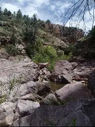
Christopher Creek Gorge
Payson, Arizona
12.9 miles EChristopher Creek Gorge is a fun swimming or canyoneering destination located in Christopher Creek, just outside of Payson, Arizona. To get there, you have to hike from the Christopher...
Canyoneer, Hike, Swim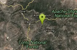
Hell's Gate
Payson, Arizona
13.5 miles SEThis Wilderness was established in 1984, and contains approximately 37,440 rough acres with a major canyon and perennial stream extending its entire length. Deep pools of water may be separated by...
Backpack, Camp, Hike, Swim 1.1 mi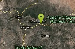
Christopher Creek Campground
Payson, Arizona
13.8 miles EChristopher Creek is a popular campground situated just east of Payson, nestled between the Christopher Creek river, and the town of the same name. This site is used for both overnight and day-use...
Camp, Canyoneer, Cross-country Ski, Hike, SwimEast Clear Creek
Happy Jack, Arizona
15.2 miles NEEast Clear Creek is a river that stretches through the Mogollon Rim area of Arizona. It provides water to the surrounding desert landscape, fishing opportunities, and various areas to hike,...
Canyoneer, Hike, Swim 1.9 mi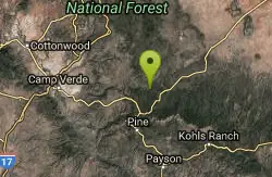
Maxwell Trail No. 37
Happy Jack, Arizona
16.0 miles NWThe Maxwell Trail leads over the Mongollan Rim down the canyon into West Clear Creek. Although still somewhat steep, it is an easier hike than shorter neighboring Tramway trail, which shares its...
Hike, Swim 0.6-2.9 mi
Tramway Trail No. 32
Happy Jack, Arizona
16.5 miles NWTramway Trail is a very short but very steep hike down the ridge of the Colorado Plateau to the nearby West Clear Creek. The trail crosses over the sharp edge of the Mogollan Rim, and descends to the...
Hike, Rock Climb, Swim 1.6-3.6 mi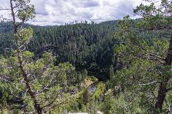
Kinder Crossing Trail #19
Happy Jack, Arizona
16.8 miles NEKinder Crossing Trail #19 travels down to the beauty of East Clear Creek, and then extends up until reaching FR 137; but many people use the trail to reach the creek waters and play in the water. The...
Hike, Swim 0.1-3.8 mi
Fossil Springs Trail No. 18
Pine, Arizona
17.1 miles WLocated within the Fossil Springs Wilderness, this trail leads down a canyon to the springs for which it is named. At the trailhead, there are several hikes, some of which are available for...
Hike, Horseback, Swim 2.2-6.1 mi
Fossil Creek Dam (Toilet Bowl)
Pine, Arizona
17.1 miles WHidden within the vast Arizona desert is an oasis of a river that brings the surrounding banks to life around it. This is Fossil Creek--one of Arizona's two designated "Wild and...
Dive, Hike, Swim 4.0 mi
Woods Canyon Lake
Payson, Arizona
18.9 miles EWoods Canyon Lake is a fishing lake near Payson, Arizona located near the Mogollon Rim. The lake has a hike that loops around it, and several other hikes nearby to look at the particularly scenic...
Camp, Hike, Swim 4.6 mi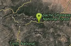
Gordon Creek Falls
Payson, Arizona
19.1 miles EGordon Creek Falls is a relatively unknown little oasis in the middle of the Arizona desert--specifically, outside of the city of Payson. The falls come from Gordon Creek, which winds its way through...
Hike, Swim 1.1 mi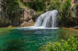
Fossil Creek Waterfall
Pine, Arizona
19.6 miles WFossil Creek is one of Arizona's two designated "Wild and Scenic" rivers. The waterfall is the most popular place to visit to cool off and see the natural beauty. Located between...
Hike, Swim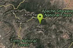
Haigler Canyon Campground
Payson, Arizona
20.1 miles SEThis campground was constructed in 2007 and offers 2 day-use sites and 2 campground areas with 14 overnight sites. This campground boasts a diversity of trees. Fishing for rainbow trout is a popular...
Camp, Hike, Swim 3.0 miBlodgett Basin Trail No. 31
Camp Verde, Arizona
27.6 miles NWBlodgett Basin Trail is one of a select few trails that shows off the riparian desert beauty unique to West Clear Creek Wilderness. The trail stretches from Bull Pen Trailhead through the canyon and...
Backpack, Hike, Swim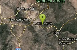
Bullpen Day Use Area
Camp Verde, Arizona
27.8 miles NWBullpen has something for everyone. Whether you park here and use the trail head to start on one of several hikes that lead down West Clear Creek, or stay nearby to use the picnic areas and...
Backpack, Dive, Hike, Swim 16.9 mi
West Clear Creek Trail No. 17
Camp Verde, Arizona
27.8 miles NWWest Clear Creek Trail No. 17 is a great way to reach the running waters of West Clear Creek. By far the most accessible and popular, it starts from the Bull Pen Ranch parking lot and winds down the...
Backpack, Hike, Swim 0.4 mi
Clear Creek Campground
Camp Verde, Arizona
30.2 miles WWest Clear Creek flows along the boundary of this desert canyon country camp and is a popular place for hiking, swimming, wading and fishing. Cool water species such as smallmouth bass and green...
Camp, Hike, Swim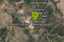
Beaver Creek Campground
Camp Verde, Arizona
33.2 miles NWCamp, Canoe, Kayak, and Swim near Camp Verde, Arizona
Camp, Canoe, Kayak, Swim 7.1 mi
The Crack at Wet Beaver Creek
Rimrock, Arizona
33.4 miles NWThe Crack is a popular swimming hole found by hiking the Bell Trail down to Wet Beaver Creek. After following the trail for about 3.5 miles away from the parking lot, take a detour to the left just...
Dive, Hike, Horseback, SwimNearby Campsites

Horton Springs
Payson, Arizona
10.4 miles EHorton Springs is a spring on the Mogollon Rim that leads into Horton Creek. There are campsites near the springs, and several hiking trails in the area that lead to the spring itself. Between the...
Backpack, Camp, Hike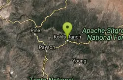
Upper Tonto Creek Campground
Payson, Arizona
10.4 miles EUpper Tonto Creek Campground is a beautiful place to camp at the intersection of Tonto and Horton Creeks. In addition to camping, this is a popular destination to both fish and hike. The campground...
Camp, Hike
Hell's Gate
Payson, Arizona
13.5 miles SEThis Wilderness was established in 1984, and contains approximately 37,440 rough acres with a major canyon and perennial stream extending its entire length. Deep pools of water may be separated by...
Backpack, Camp, Hike, Swim 1.1 mi
Christopher Creek Campground
Payson, Arizona
13.8 miles EChristopher Creek is a popular campground situated just east of Payson, nestled between the Christopher Creek river, and the town of the same name. This site is used for both overnight and day-use...
Camp, Canyoneer, Cross-country Ski, Hike, Swim 4.0 mi
Woods Canyon Lake
Payson, Arizona
18.9 miles EWoods Canyon Lake is a fishing lake near Payson, Arizona located near the Mogollon Rim. The lake has a hike that loops around it, and several other hikes nearby to look at the particularly scenic...
Camp, Hike, Swim
Aspen Campground
Payson, Arizona
19.0 miles EAspen Campground is a large campground near Payson, Arizona. Between the proximity to Woods Canyon Lake and the seclusion of the encompassing Apache-Sitgreaves National Forest, this is a...
Camp
Haigler Canyon Campground
Payson, Arizona
20.1 miles SEThis campground was constructed in 2007 and offers 2 day-use sites and 2 campground areas with 14 overnight sites. This campground boasts a diversity of trees. Fishing for rainbow trout is a popular...
Camp, Hike, Swim
Sinkhole Campground
Payson, Arizona
22.5 miles ESinkhole Campground is a camping area near Willow Springs Lake. There are also hikes, mountain biking trails, and fishing opportunities nearby. There are 26 campsites in total at this...
Camp, Hike, Mountain Bike
Verde Hot Springs
Camp Verde, Arizona
24.0 miles WVerde Hot Springs are a few natural hot spring pools located along the Verde River, near Sedona, Arizona. Once a resort, now all that remains are the foundations and the hot pools...
Camp, Hike, Hot Springs 0.4 mi
Clear Creek Campground
Camp Verde, Arizona
30.2 miles WWest Clear Creek flows along the boundary of this desert canyon country camp and is a popular place for hiking, swimming, wading and fishing. Cool water species such as smallmouth bass and green...
Camp, Hike, Swim
Beaver Creek Campground
Camp Verde, Arizona
33.2 miles NWCamp, Canoe, Kayak, and Swim near Camp Verde, Arizona
Camp, Canoe, Kayak, Swim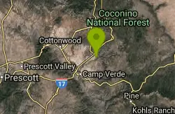
Beaver Creek Dispersed Camping
34.1 miles NW
Free dispersed camping on the cliffs above Beaver Creek.
Camp
Chavez Crossing
Sedona, Arizona
44.3 miles NWChavez Crossing is a campground in Sedona, Arizona. It sits perfectly nestled in Arizona's most beautiful red rock attractions along with the grand summer sunsets. If that didn't sound...
Camp, Hike, Swim


