North Fork Falls
Colfax, California
| Address: | Texas Hill Rd, California, USA |
| GPS: |
39°15'40.9"N 120°40'50.3"W Maps | Directions |
| State: | California |
Waterfalls Rocks Ponds
Camp, Hike, and Swim
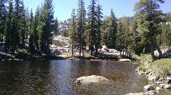
A very popular hike in the summer time, North Fork Falls offers a pleasant break from the city while enjoying the beautiful Sierra Nevada mountains. Hike into the forest and visitors will find a secluded pool with plenty of cliffs and waterfalls. Sit in the pool and enjoy the crystal clear water or climb up 10 -25 ft tall cliffs and enjoy some cliff jumping. There are two main pools, the upper and lower. In order to get into the upper pool, visitors will either need to jump from one of the several cliffs or hike/scramble over the rocks to reach the pool. The lower pool has lower cliffs and can be easily accessed by people of all ages.
More Information
Add ResourceBe courteous, informed, and prepared. Read trailhead guidelines, stay on the trail, and don't feed the wildlife.
Read MoreDirections
From Colfax, California
- Head south on N Main St toward Grass Valley St (115 ft)
- Turn left at the 1st cross street onto Grass Valley St (0.1 mi)
- Turn right onto S Auburn St (0.3 mi)
- Turn left onto CA-174 E (463 ft)
- Turn left onto Canyon Way (signs for I-80 E/Reno) (377 ft)
- Merge onto I-80 E via the ramp to Reno (22.7 mi)
- Take exit 158A toward Emigrant Gap (0.2 mi)
- Turn right toward Emigrant Gap Rd/Texas Hill Rd (108 ft)
- Turn right onto Emigrant Gap Rd/Texas Hill RdContinue to follow Texas Hill RdDestination will be on the left(4.1 mi)
The falls and pools are reached by following the river a quarter-mile downstream from the North Fork Campground. The trail begins near site 10. The trail parallels the river and then drops down below the falls, providing easy access.Courtesy of outdoorproject.com
Other Swimming Holes and Hiking Trails Nearby

Heath Falls Overlook Trail
Truckee, California
13.4 miles EHike and Swim near Truckee, California
Hike, Swim
Palisades Creek Trail
Truckee, California
13.4 miles EThe Palisades Creek Trail is a difficult hike that can be done in a day, but is better enjoyed as an overnight trip. This trail has showcases some beautiful waterfalls along the way as well as...
Hike, Swim 0.1 mi
Edwards Crossing
Nevada City, California
16.9 miles WEdwards Crossing is a popular and easily accessible swimming hole on the Yuba River. The swimming hole is named for Edwards Crossing Bridge which can be viewed from there. The river here is...
Hike, Swim
Tahoe Area
Olympic Valley, California
22.3 miles ESwim near Olympic Valley, California
Swim
Shirley Canyon
Olympic Valley, California
23.3 miles EHike near Olympic Valley, California
Hike 4.1 mi
Shirley Lake Canyon Trail
Olympic Valley, California
23.9 miles EShirley Lake is a pretty and pure lake located in Squaw Valley. The Shirley Lake Canyon Trail goes up into the rugged and lovely Sierra Mountains. You begin the trail in Squaw Valley Village and...
Hike, Swim 5.6 mi
Quarry Trail
Cool, California
30.2 miles SWThis is a hike along the river and an old, historic railway. The trail leads you to a a beautiful amphitheater carved from limestone.You are surrounded by beautiful nature and peaceful...
Hike 1.2-2.7 mi
Lake Clementine Trail Loop
Auburn, California
30.5 miles SWLocated in Auburn, California, Lake Clementine Trail Loop is a hike along the North Fork American River is an easy to moderate trail with an elevation gain of 785 ft. It's wheelchair...
Camp, Canoe, Hike, Kayak, Mountain Bike, Swim 1.5 mi
Skunk Harbor
Carson City, Nevada
41.2 miles EThis hike starts from the 28 freeway and follows a forest service road. There are a couple of points where you can get some nice views from the trail. There are some mountain biking trails that can...
Hike 0.4 mi
Glen Alpine Falls
South Lake Tahoe, California
42.0 miles SEAs you drive up to the falls, take a look around. The views are spectacular. The drive can feel long, but the waterfall is peaceful and worth the drive. This waterfall is considered one of the...
Hike
Zephyr Cove Park
Glenbrook, Nevada
43.2 miles SEZephyr Cove Park is located 4.6 miles off highway 50 in Nevada. This park is a great place to have your summer activities; it includes Picnic tables for groups and couples, Barbecue...
Camp, Canoe, Disc Golf, Hike, Horseback, Kayak, Swim
Reno Area
McGill, Nevada
49.5 miles ESwim near McGill, Nevada
Swim
Wingfield Park
Reno, Nevada
49.5 miles EWingfield Park is a oasis of outdoor activity in the middle of bustling Reno. The park provides a variety of activities including swimming, white water kayaking,and river rafting, river tubing,...
Kayak, SwimNearby Campsites

Lake Clementine Trail Loop
Auburn, California
30.5 miles SWLocated in Auburn, California, Lake Clementine Trail Loop is a hike along the North Fork American River is an easy to moderate trail with an elevation gain of 785 ft. It's wheelchair...
Camp, Canoe, Hike, Kayak, Mountain Bike, Swim
Zephyr Cove Park
Glenbrook, Nevada
43.2 miles SEZephyr Cove Park is located 4.6 miles off highway 50 in Nevada. This park is a great place to have your summer activities; it includes Picnic tables for groups and couples, Barbecue...
Camp, Canoe, Disc Golf, Hike, Horseback, Kayak, Swim


