


84 Mountain Bike Trails near Tarrywile Park
first prev 1 2 3 4 5 next lastShowing Mountain Bike Trails within 50 miles Distance miles of 70 Southern Blvd, Danbury, CT 06810, USA City, Zip, or Address
Bennetts Pond
Ridgefield, Connecticut
3.9 miles SBennett's Pond in Ridgefield, CT is a hidden treasure just two minutes away from the madness of Route 7, in which you will find both gradual and sick climbs. Slick singletrack...
Mountain Bike
Farringtons Woods
Danbury, Connecticut
4.6 miles WSingletrack mixed with fire-trails,hiking trails and ATV's areas with jumps. Some technical sections.
Mountain Bike
Collis P Huntington State Park
Redding, Connecticut
5.9 miles SEState Map: http://www.ct.gov/dep/lib/dep/stateparks/maps/huntington.pdfHuntington/The Hunt/Huny has something for everyone, beginners and experts alike. Lots of natural stunts, some...
Mountain Bike
Gurski Farm
Brookfield, Connecticut
7.1 miles NELots of double track and trails that kind of go off to no where. Good for a quickie and if you want to bring the kids and get them acclimated to trail riding. Lots of pricker bushes...
Mountain Bike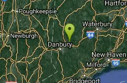
Dingle Brook Trail
Brookfield, Connecticut
7.6 miles NENetwork of old ATV trails and now Equestrian Trails. Good work out.
Mountain Bike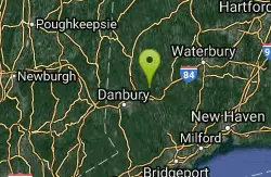
Upper Paugussett State Forest
Newtown, Connecticut
8.6 miles NETrail along the water from the boat ramp is ueber technical but gets worse once past the "Kissing Oaks" (two oak trees that have grown into one another). From there, you can follow the...
Mountain Bike
Funny Farm North
Newtown, Connecticut
8.7 miles ENice little single track loops between the Housatonic Railroad tracks and Queen Street. Other the other side, take Old Farm Road down to the Ristricted Area Sign and look for a trail...
Mountain Bike
Michael Ciaiola Conservation Area
Patterson, New York
9.2 miles NWOften rocky, swampy and hilly
Mountain Bike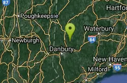
Sunny Valley
Bridgewater, Connecticut
9.3 miles NENetwork of trails offering serious climbs and very technical singletrack.
Mountain Bike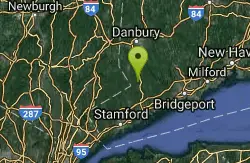
Wilton Woods
Wilton, Connecticut
10.3 miles SSmall but fun network of technical single track. Small but fun network of technical single track.
Mountain Bike
George C. Waldo State Park
Southbury, Connecticut
10.4 miles NEFamily Friendly: trying to do some of the ramps would be fun for kids. Dogs: Leashed Once you park, go through the gate and the red trail starts on the left shortly after you go into the...
Mountain Bike
Monroe Rail Trail
Monroe, Connecticut
10.6 miles ERail Trail. Some Single Track branching off but nothing but little outtakes. Fun for family riding.
Mountain Bike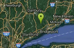
Trout Brook Valley
Weston, Connecticut
11.0 miles SELots of really technical single track and a few fire roads. Closed during the Winter. Some trails are off limits to bikes.
Mountain Bike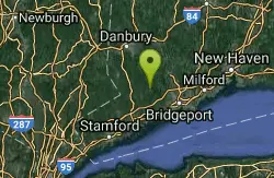
Blue Trail
Easton, Connecticut
11.6 miles SEStart at parking lot and work your way through the rocks. Easy to moderate.
Mountain Bike
Lower Paugussett State Forest
Newtown, Connecticut
13.5 miles EBlue trail does a 6.5 mile loop of extremely technical trail. Other trails interconnect through here including a forest/logging road, as well as connections to the Iriquois Gas Line...
Mountain Bike
Trumbull Rail Trail
Trumbull, Connecticut
13.9 miles SEFirst section of the rail trail, 3 miles, is unpaved. Next 3 miles is paved and there are plans to continue the trail to the Monroe Town line but there is a missing bridge which is...
Mountain Bike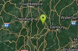
Ninham
Carmel Hamlet, New York
14.3 miles WThere is no map of the area and it's easy to get lost. Lots and lots of trails. Some of them are extremly technical and difficult. This place is not for beginners. As difficult and...
Mountain Bike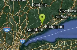
Cranberry Park
Norwalk, Connecticut
15.3 miles SMulti use trail in a medium sized park. watch for other trail users, and their dogs, ride the perimeter and have fun, not a ton of technical stuff but some normal New England riding,...
Mountain Bike
Steep Rock
Washington, Connecticut
15.6 miles NFrom Judd's Bridge, follow the road towards Washington and Steep Rock, go straight on the road that is perpendicular to the bridge. Follow it up into a curve and on the left there is a house with...
Hike, Mountain Bike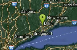
Pequonnock River Valley State Park / Trumbull
Trumbull, Connecticut
15.8 miles SEThis place goes by many names, Trumbull, Old Mine Park, and Pequonnock River Valley. Trumbull is an XC and Freeriding paradise. The park is connects in the north to a three mile rail...
Mountain Bike


