


35 Mountain Bike Trails near Suttle Lake Loop
first prev 1 2 next lastShowing Mountain Bike Trails within 50 miles Distance miles of Geo McAllister, Sisters, OR 97759, USA City, Zip, or Address
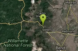
Butte Loops Trail
Sisters, Oregon
2.8 miles EThis trail consists of two loops: Upper Loop and Lower loop. The Lower Loop is on the low west flank of Black Butte and the Upper Loop circles Black Butte. source: fs.usda.gov...
Mountain Bike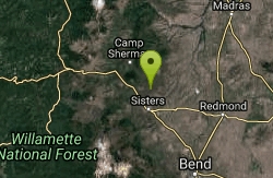
Stevens Canyon Loop
Sisters, Oregon
7.2 miles ESingle track, 20 mile loop, adopted from an old motocross loop.
Mountain Bike
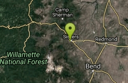
Peterson Ridge Loop
Sisters, Oregon
9.2 miles SEX-country riders will love this system. Basically this is an 18 mile loop with no less than 12 ‘connector’ trails running between the two sides, PT West &...
Mountain Bike 1.2-7.3 mi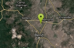
Juniper Trails
Redmond, Oregon
22.0 miles SEJuniper Trails is a wonderful destination for mountain bikers of all skill levels. The miles of trails are broken into longer and shorter loops. Beginners can feel confident riding on the main...
Mountain Bike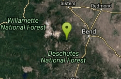
North Fork
Bend, Oregon
25.5 miles SOne of the most scenic rides around the Bend area. *Special note; this is a one way, up hill ride only, so is to be used as access to other trails farther up the mountain. From the...
Mountain Bike
Cole loop
Culver, Oregon
25.5 miles EClimb the cole loop.
Mountain Bike
Farewell
Bend, Oregon
25.7 miles SIf you climb the North Fork trail, Farewell is a killer descent down the other side of the river, ending up back at Tumalo Falls Trailhead. The singletrack is super flowy, with some...
Mountain Bike
Phil's Area
Bend, Oregon
26.2 miles SUpdate 7/22/13 by mtbgreg1:The Phil's Area Trail System is the go-to trail system for mountain biking in Bend. Even the other trails in the region that aren't actually part of the...
Mountain Bike
Tumalo Trail System
Bend, Oregon
26.2 miles SMassive trail system located west of Bend in the national forest.
Mountain Bike
Tumalo Creek
Bend, Oregon
26.2 miles SThe Tumalo Creek Trail is 3.5 miles one-way and parallels Skyliner road. Starting at the Skyliner trailhead, the trail runs up near the road on the ridge side to the Tumalo Falls...
Mountain Bike
Skyliners
Bend, Oregon
26.2 miles SSkyliners is a 3.2-mile intermediate singletrack trail that runs from the Skyliner's trailhead to a junction with Whoops and Ben's trail, which is the corner of the Phil's Area Trail...
Mountain Bike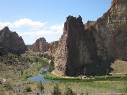
Smith Rock State Park
Terrebonne, Oregon
26.6 miles ESmith Rock is Oregon’s premier rock climbing destination, and one of the best sport climbing areas in the United States. This world-renowned sport climbing mecca has more than once been at...
Hike, Mountain Bike, Rock Climb
Ben's Lower
Bend, Oregon
28.0 miles SEBen's is about 7 miles long one-way, and is split into basically two portions. The lower portion is all two-way, flowy cross country trail, but the upper section of Ben's is...
Mountain Bike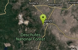
Phil's Trail
Bend, Oregon
28.1 miles SESince this is the namesake for the entire trail system and the oldest trail in the area, I kind of expected a blown-out doubletrack. That is entirely NOT the case! COTA has done an...
Mountain Bike
Swampy Lakes Trail
Bend, Oregon
28.3 miles SThe Swampy Lakes Trail is a popular way for mountain bikers to get back to Tumalo Falls when doing the North Fork/Metolius-Windigo/Dutchman-Swampy loop around the Bend Municipal...
Mountain Bike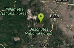
Swampy Dutchman Trail
Bend, Oregon
28.3 miles SThis trail travels from Swampy Lakes Sno-Park to Dutchman Sno-Park. It is a cross country ski/snowmobile trail that is used as a mountain bike trail in the summer. source:...
Mountain Bike
C.O.D.
Bend, Oregon
28.3 miles SThis trail roughly parallels Century Drive, but it is WAY more fun than riding pavement! This is great Bend singletrack: mostly buff, dry, dusty singletrack. It connects to the Storm...
Mountain Bike
Sector 16
Bend, Oregon
28.4 miles SThe Sector 16 trail runs for 3.7 miles one-way from the Swede Ridge area to the Whoops Trail. This intermediate singletrack circles around a large, square parcel of private land, so be...
Mountain Bike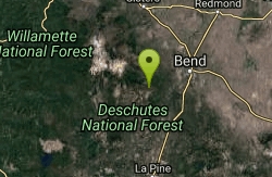
Whoops
Bend, Oregon
28.5 miles SWhoops is a renowned flow/jump trail in the Bend area that connects to Ben's of the Phil's Area on the Eastern End and then the Swede Ridge loop on the Western End (with a connection...
Mountain Bike
Larsen Trail
Bend, Oregon
29.0 miles SThe Larsen Trail runs for 3 miles one-way from Kiwa Springs to the Tiddlywinks Trail. It parallels USFS road 4130 for most of the way. Intermediate difficulty.
Mountain Bike


