


95 Mountain Bike Trails near Red Creek Via Spooky Trail
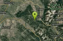
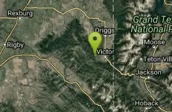
Showing Mountain Bike Trails within 50 miles Distance miles of 242 ID-31, Victor, ID 83455, USA City, Zip, or Address
Spooky
Victor, Idaho
0.0 miles SWTrail serves as the stem to Red Creek or access to Corral Creek as well as other possibilities in the big hole mountains. Nice fun singletrack to run as an out n back if your time is...
Mountain Bike
Grove Creek to Drake Creek
Victor, Idaho
2.9 miles NEGreat loop trail that connects several trails through the area. This trail was recently rerouted, and so will have plenty of new switchbacks to take as riders climb the mountain. Originally this...
Mountain Bike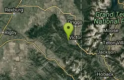
Rocky Peak Via Spooky Trail
Victor, Idaho
3.3 miles NEYou will start up Spooky trail which is the only trail in the parking area. There is a trail junction on your left about 1.2-1.5 just keep going straight. At about 2.6 from TH you'll...
Mountain Bike
Trail Canyon Trail
Ririe, Idaho
3.4 miles WThe Trail Canyon trail begins at Trail Canyon Parklot, T8s R43e Sec28 and ends at Intersect Trail 5251,t8s R43e Sec28. source: fs.usda.gov
Mountain Bike
West Pine Creek Trail
Ririe, Idaho
3.4 miles WNon-motorized use. source: fs.usda.gov
Mountain Bike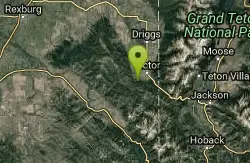
Allen Canyon-Pole Canyon Trail (014)
Victor, Idaho
3.5 miles EThis trail is locally known as the Pole Canyon Trail. Just South of Victor, ID, the Allen Canyon-Pole Canyon Trail (014) is a popular destination for local motorbikers, horseback...
Mountain Bike
Sheep Driveway
Irwin, Idaho
3.9 miles SEOHVs, mountain biking, day hiking, horse riding. source: fs.usda.gov
Mountain Bike
Henderson Canyon
Victor, Idaho
4.7 miles NTrail begins as dirt road/double track with numerous "cow" trails breaking off of road. Some of these trails see more tire tracks than others.
Mountain Bike
Victor Bike Park
Victor, Idaho
6.7 miles EThe Victor Bike Park is home to a progressive jump line, pumptrack, and more stunts.
Mountain Bike
North/South Rainey Creek Trails
Irwin, Idaho
7.1 miles SMotorcycle trail. source: fs.usda.gov
Mountain Bike
Big Hole Crest Trail
Driggs, Idaho
7.5 miles NThis is a tough ride. Definately for advanced riders. Lots of climbing and descending. The trail at either end is well used and really fun. Not too much technical riding, just fun...
Mountain Bike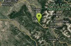
Rush Hour
Victor, Idaho
8.4 miles ETrail is a fun little out n back. 2 miles one way. Only gain about 340' in elevation throughout the trail. Perfect small workout trail and good intro to singletracks in the area. Trail turns...
Mountain Bike
Twin Creek Trail
Driggs, Idaho
9.0 miles NThe Twin Creek trail is 2.3 miles long. It begins at Trail 6195 and ends at Trail 6219. source: fs.usda.gov
Mountain Bike
South Fork Snake River Trail
Ririe, Idaho
9.4 miles WGo left at the trail head. It heads down about a mile and a half on double track. Then you'll come to a creek crossing. After the crossing the trail heads across a gate. Head left...
Mountain Bike
Bovine
Driggs, Idaho
10.6 miles NBovine trail is part of a larger system. You can use it to access more trails or make it your end destination from other trailheads. It is a steep climb but returns the favor with a fast downhill....
Mountain Bike
Horseshoe Trails
Driggs, Idaho
10.6 miles NMountain Bike near Driggs, Idaho
Mountain Bike
North Mahogany Trail #220
Tetonia, Idaho
10.6 miles Nhe N. Mahogany Trail is open to Motorbikes, Mountain bikes, Horses, and Hikers. Motorbikes and Horseback riders are the most common visitors, but the trail is becoming increasingly...
Mountain Bike
Horseshoe Canyon
Tetonia, Idaho
10.7 miles NHorseshoe Canyon is one of the closest trail systems to the town of Driggs, Idaho. This network doesn't have a ton of climbing or descending, but the smooth, swooping singletrack with a...
Mountain Bike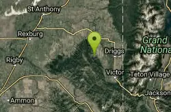
Southbound
Driggs, Idaho
10.7 miles NTrail starts by going up the Channel lock trail. At the top of Channel Lock go right onto the Southbound trail. Trail will loop back to Channel lock which you take back to your car. Trail is...
Mountain Bike
Channel Lock
Driggs, Idaho
10.7 miles NTrail is a little over 1 mile uphill. Recommended route up to access the larger Horseshoe canyon trail system. Makes a nice downhill with twists. Gets its name from the deep ruts made from cows....
Mountain Bike


