


17 Mountain Bike Trails near Natural Bridge Trail
first prev 1 next lastShowing Mountain Bike Trails within 50 miles Distance miles of Howard Eton Trail, Yellowstone National Park, WY 82190, USA City, Zip, or Address
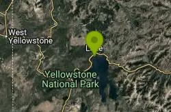
Old Lake Road Bike Trail
Yellowstone National Park, Wyoming
2.2 miles NENear Lake Hotel in Yellowstone is a old road bed that provides mountain bikers with a beautiful lakeside ride. Old Lake Road Bike Trail is about a mile long trail with parking lots available on...
Mountain Bike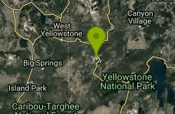
Fairy Creek Trail
Madison, Yellowstone National Park
19.8 miles WThe trail is well-compacted gravel, of car width. There is absolutely no technical features, it is flat and smooth.This is a ride for all the family, and is about the scenery and...
Mountain Bike 4.0 mi
Fountain Freight Road Bike Trail
19.8 miles W
Fountain Freight Road Bike Trail is a four mile stretch of paved road along Fairy Falls Trail. This stretch of trail is no longer open to vehicles but allows bikes. Despite being paved, it is...
Mountain Bike 2.6 mi
Lone Star Geyser Trail
Old Faithful, Yellowstone National Park
19.9 miles SWLone Geyser Star Trail is a hiking and mountain biking trail that leads through the forest to the colorful Lone Star Geyser. The Geyser here has beautiful white, yellow and orange colors in the...
Hike, Mountain Bike 1.2 mi
Old Faithful Lower General Store to Morning Glory Pool Bike Trail
Yellowstone National Park, Wyoming
20.1 miles WThe biking trail from Old Faithful General Store to Morning Glory Pool is an easy paved bike trail with incredible views of the Upper Geyser Basin and a stunning destination. The trail to Morning...
Mountain Bike 2.8 mi
Mount Washburn Bike Trail
Devils Den, Wyoming
20.3 miles NMount Washburn Bike Trail follows Chittenden Service Road for 2.5 miles to the top of Mount Washburn. This steep climb up the mountain provides a challenging elevation gain of 1500 feet. Mount...
Mountain Bike 8.4 mi
Bunsen Peak Loop Bike Trail
Yellowstone National Park, Wyoming
31.2 miles NWBunsen Peak Loop Bike Trail is a challenging trail that follows several service roads around Bunsen Peak. This 10 mile loop has a total elevation change of 1,120 feet, with several miles of the trail...
Mountain Bike
Mammoth/Gardiner Back Road
Mammoth Hot Springs, Yellowstone National Park
33.5 miles NWThe only road open in Yellowstone National Park is Highway 89 at Gardiner, Montana to park Headquarters at Mammoth Hot Springs and from Mammoth Hot Springs to Silver Gate and Cooke City, Montana.
Hike, Mountain Bike
Rendezvous Loop
West Yellowstone, Montana
34.2 miles WGentle rolling hills that wind though tall stands of lodgepole pine and open meadows. Easy ride with great potential for speed.
Mountain Bike 3.8 mi
Abandoned Railroad Bed Bike Trail
Gardiner, Montana
37.3 miles NThe Abandoned Railroad Bed Bike Trail, otherwise known as Shortline Trail, is a easily accessible bike trail found just inside the North Entrance of Yellowstone National Park. This bike trail follows...
Mountain Bike 17.5 mi
Tear Drop Lake
Ashton, Idaho
40.3 miles SWNestled in the Targhee National Forest just off of Ashton's Fish Creek Road, this tear drop shaped lake is a family adventure waiting to happen. The lake isn't very big but it is teeming with...
Camp, Canoe, Hike, Kayak, Mountain Bike, Swim
Boundary Trail
Island Park, Idaho
42.4 miles WBoundary Trail, (Trail #272 and #244) is a 37 mile loop trail that allows stock travel, mountain bike, motorcycle and ATV travel. This trail can be reached by several trailheads,...
Mountain Bike
Flat Canyon Trail
Island Park, Idaho
44.0 miles SWNon-motorized use. souce: fs.usda.gov
Mountain Bike
Targhee Creek Trail
Island Park, Idaho
44.1 miles WSpecial attractions along the trail include five alpine lakes amid the mountains, abundant wildlife, wildflowers, and great scenic views of the mountains and valley floor. The Targhee...
Mountain Bike
Coffee Pot Rapids Trail
Island Park, Idaho
46.0 miles WHiker and fisherman parking is available at the campground entrance. Coffee Pot Rapids trail is 2.2 miles in length, is a non-motorized trail that follows the Henry's Fork of the Snake...
Mountain Bike 5.8 mi
Box Canyon Trail
Island Park, Idaho
47.9 miles WVarious species of tress and wildflowers can be seen on the trail, as well as songbirds, waterfowl and occasional wildlife. The trail is open for the following uses: Motorcycle Trail Riding, Off...
Hike, Mountain Bike
Sawtell Peak Trail
Island Park, Idaho
49.7 miles WThis trail offers great views of the valley floor, mountain peaks and wildlife. source: fs.usda.gov
Mountain Bike


