


56 Mountain Bike Trails near East Crosier
first prev 1 2 3 next lastShowing Mountain Bike Trails within 50 miles Distance miles of 3346 Glacier Dr, Estes Park, CO 80517, USA City, Zip, or Address
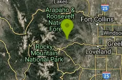
Crosier Mountain
Drake, Colorado
3.0 miles NE*This is a sensitive trail. Please excercise caution to minimize erosions effects. It is a mulit-user trail. There are 3 forks to this trail, and they join up near the summit. The...
Mountain Bike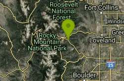
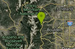
Pole Hill
Estes Park, Colorado
4.9 miles SPole Hill is made up of several loops. It definitely helped that we had a GPS device while we were riding.It is a 4x4 trail but there are plenty of technical sections due to the many...
Mountain Bike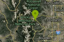
Lion Gulch
Estes Park, Colorado
6.3 miles STricky, technical ride. Fairly short, only 6 miles or so, but lots of rocks making for tough climbing on the way up, which translates into a fun downhill on the way back. Some real...
Mountain Bike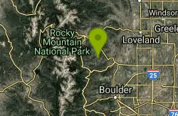
Coulson Gulch
Lyons, Colorado
12.6 miles SThis is a sweet descent down to the North Saint Vrain River, then the trail follows the river upstream a couple of miles. It is easy to follow. When you get to the bottom, take a right....
Mountain Bike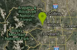
Eden Valley Spur
Loveland, Colorado
12.7 miles EEden Valley Spur is an out and back singletrack trail in the Bobcat Ridge open space west of Fort Collins. A half mile west of the trailhead, the Spur heads south from the intersection...
Mountain Bike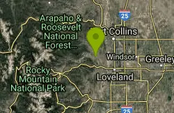
Bobcat Ridge
Loveland, Colorado
13.2 miles ETake the trail out of the parking lot and turn right at the shelter. Going counter-clockwise on this loop keeps the switchbacks on the uphill side. This is an easy trail that any...
Mountain Bike
Johnny Park Road
Allenspark, Colorado
13.5 miles STrails are open to motorized vehicles.
Mountain Bike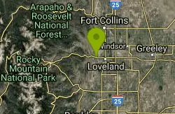
Devil's Backbone
Loveland, Colorado
16.6 miles EAsk the locals, this is the best trail in the area. The devils backbone is beautiful enough, but there is much more to view. I've encountered rattlesnakes on the trail twice before, so...
Mountain Bike
Herrington
Loveland, Colorado
16.8 miles NEHerrington trail is a singletrack that comes in two sections, North and South. The South section connects Spring Creek trail to Stout trail and then to Towers trail/road with a climb of...
Mountain Bike
Sawmill
Fort Collins, Colorado
17.3 miles NESawmill is a singletrack in Horsetooth Mountain Park that connects Loggers/Stout trails at mid-mountain to Nomad/Shoreline trails down near the reservoir. The trail is narrow with a...
Mountain Bike
Wathen Trail
Fort Collins, Colorado
17.3 miles NEWathen is an awesome singletrack that offers a technical challenge for even the most experienced mountain biker. This is just one of many trails that are clearly marked in the...
Mountain Bike
Heil Valley Ranch
Boulder, Colorado
17.5 miles SEThere are currently 13.5 miles of bike-legal trails at Heil Valley ranch, but in order to ride all of them at once you’d have to do at least 23-24 miles of pedaling. The trail...
Mountain Bike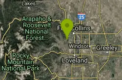
Horsetooth Mountain Park
Fort Collins, Colorado
17.5 miles NEsome of the best riding on the front range, mix of singletrack, fireroad, as much technical as you want, as much uphill as you want....and down...
Mountain Bike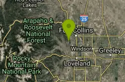
Nomad
Fort Collins, Colorado
17.7 miles NENomad is a rolling bit of singletrack down near Horsetooth Reservoir that connects lower Towers trail/road to Sawmill trail, and continues on to connect to Lory state park, to the...
Mountain Bike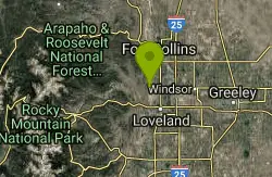
Rimrock
Fort Collins, Colorado
17.8 miles EThe trail is a very techy loop. Be prepared for hike your bike sections.
Mountain Bike
Picture Rock Trail
Lyons, Colorado
18.1 miles SEThis is a great way to access the Heil Valley Ranch trails, especially if you don't want to do the climbing of Wapiti Trail. There are some cool old buildings (and an old, broken-down,...
Mountain Bike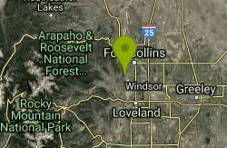
Pineridge Natural Area
Fort Collins, Colorado
18.6 miles NEThe Pineridge Natural Area features a small lake (Dixon Reservoir), wetlands, a forested hillside, and prairie in a small, but beautiful basin on the western edge of Fort Collins....
Mountain Bike
Bunce School Road To T33 Crash Site
Lyons, Colorado
20.6 miles SBunce School road is mostly class 2 except about a half mile in the middle that was loose and steep (class 4). Take FR202 to FR203 to a hiking trail to get to the crash site. 203 has a...
Mountain Bike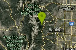
Buchanan Pass
Lyons, Colorado
20.8 miles SBegin going west from the parking lot on the 4x4 road. Very shortly, there will be a trail that drops to the right and crosses the creek--that's it. Follow it 4.5 miles to the...
Mountain Bike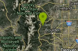
Ceran Saint Vrain Loop
Ward, Colorado
21.0 miles SFairly easy trail, not much climbing. Some hazards are the technical parts of the trail trail being along a steep drop, beginners, of if your not sure of your abilities, walk your...
Mountain Bike


