


124 Mountain Bike Trails near Apache Wash Sidewinder Loop Trail
first prev 1 2 3 4 5 6 7 next lastShowing Mountain Bike Trails within 50 miles Distance miles of Paseo Pathway, Phoenix, AZ 85085, USA City, Zip, or Address

Sidewinder, Apache Vista, Ocotillo Loop Trail
Phoenix, Arizona
0.3 miles NEThis is an excellent loop that is very well maintained, well sign posted and if you include the vista summit trail, a moderate work out. Massive Car Park, good restrooms, and plenty of...
Hike, Horseback, Mountain Bike
Ocotillo/Ridgeback/Sidewinder Loop Trail
Phoenix, Arizona
0.4 miles NEGreat moderate loop which includes a summit, great views and Classic Sonoran Desert scenery. Multiple access points and other connecting trails allows for the loop to be changed if...
Hike, Horseback, Mountain Bike
Sidewinder-Ocotillo-West Loop
Phoenix, Arizona
3.1 miles NWThis loop starts at Carefree Hwy and 7th Ave, be aware there is limited parking at the trailhead. The Ocotillo part of the trail is relatively flat and the Sidewinder part has some good...
Hike, Horseback, Mountain Bike 2.8 mi
Desert Tortoise
Phoenix, Arizona
3.2 miles SWAt just over a mile long, Desert Tortoise is a doubletrack connector to the Valle Verde Trail. Very good hiking area with a good range of difficulty levels. Starts with a short climb from the...
Hike, Mountain Bike
Dixie Mountain Loop Trail
Phoenix, Arizona
3.2 miles SWThe main loop trail at Phoenix's Sonoran Preserve provides plenty of options for either a short walk or a longer hike. The elevation gain is accumulated through small ups-and-downs along the...
Hike, Horseback, Mountain Bike
Dixie Mountain Loop with Two Summits
Phoenix, Arizona
3.2 miles SWHike, Horseback, and Mountain Bike near Phoenix, Arizona
Hike, Horseback, Mountain Bike
Hawk's Nest Trail and Dixie Mountain Loop
Phoenix, Arizona
3.2 miles SWModerate Trail providing access from the Car Park to all other trails. Directly links to Desert Tortoise Trail and Dixie Mountain Loop. Good hiking shoes/boots recommended....
Hike, Horseback, Mountain Bike
Hawk's Nest/Desert Tortoise/Dixie Mountain Loop
Phoenix, Arizona
3.2 miles SWA nice moderate trail through great desert scenery crossing creeks and twisting and turning around the hills. Provides a loop opportunity between Hawk's Nest Trail, Valle Verde Trail,...
Hike, Horseback, Mountain Bike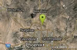
Sonoran Trail
Phoenix, Arizona
3.2 miles SWThe Sonora Trail is smooth, but hilly, and has a 10-12 mile loop course that is well marked at intersections. This ride is suitable for many levels, but beginners should have good...
Mountain Bike 5.8 mi
Go John Trail
Cave Creek, Arizona
5.5 miles NEThe Go John Trail is a 5.8 mile loop trail outside of Cave Creek, Arizona, that is moderately trafficked, used by both hikers and mountain bikers. It is an excellent opportunity to view the desert...
Hike, Horseback, Mountain Bike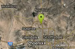
Deem Hill
Phoenix, Arizona
5.8 miles WThe trail starts out going north around the mountain then heads uphill and gives you some good inclines with switch backs. Total incline is approximately 650'. The trail is rocky and...
Mountain Bike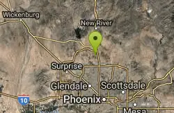
Deem Hills Inner Loop
Phoenix, Arizona
5.8 miles WHike and Mountain Bike near Phoenix, Arizona
Hike, Mountain Bike

Scarlett Canyon
Phoenix, Arizona
6.1 miles SScarlett Canyon trail (not officially named) is an unmarked trail adjacent to the Scarlett Canyon residential neighborhood. This is a 3 mile loop trail considered to be easy to...
Hike, Horseback, Mountain Bike, Rock Climb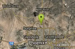
Deem Hills Circumference Trail
Phoenix, Arizona
7.2 miles WDeem Hills s a 10.5 mile loop trail located near Phoenix, Arizona. The trail is rated as moderate and primarily used for mountain biking.
Hike, Horseback, Mountain Bike 21.4 mi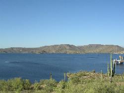
Spur Cross to Lake Pleasant
Cave Creek, Arizona
7.4 miles NEStart at the Flat Tire Bike Shop and head north on Spur Cross Road. You will arrive at the Spur Cross Conservation Ranch in 3.2mi. From there enter the Maricopa Trail system and follow the signs...
Mountain Bike
Cave Creek Park
Cave Creek, Arizona
7.4 miles NEMultiple singletrack loops, just explore and find what works best for you. Watch out for hikers and horses.
Mountain Bike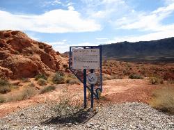
Arrowhead Point Trail
Glendale, Arizona
8.7 miles SWArrowhead Trail is a 2.4 mile hiking and mountain biking trail within Thunderbird Conservation Park. This trail is manageable enough for beginners, but offers enough challenge for more experienced...
Hike, Mountain Bike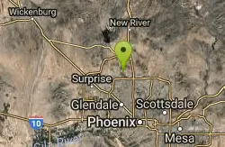
Thunderbird H-1 H-2 H-3 Loop Trail
Glendale, Arizona
8.7 miles SWHike and Mountain Bike near Glendale, Arizona
Hike, Mountain Bike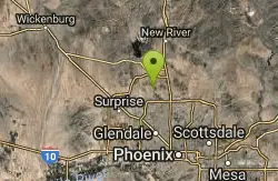
Thunderbird Park
Phoenix, Arizona
9.4 miles WThis trail is very rocky. Bring plenty of water because there is no shaded areas and it gets hot in Arizona. Overall a fun trail. I used a hard tail with a head shock but took it...
Mountain Bike
Sonoran Preserve North
Phoenix, Arizona
9.4 miles WNice rolling single track with many steep sustained climbs and fun flawy downhills. No technical features but good fitness is needed. If you do all the climbs and loops can get in over...
Mountain Bike


