


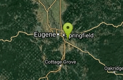
Mount Pisgah
Eugene, Oregon
| Address: | 34901 Frank Parrish Rd. Eugene, OR 97405 |
| GPS: |
44°0'26.9"N 122°58'50.6"W Maps | Directions |
| State: | Oregon |
Restrooms
Hike
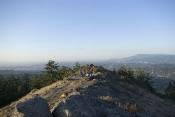
Mount Pisgah is a summit in Willamette Valley. It is a popular place for hiking, walking, and trail running because of how close it is to the city of Eugene and Springfield. The non-profit arboretum (also known as the "living tree museum") at the bottom of the summit covers 209 acres. You can also learn about different plants and wildlife along the trails because of informational signs you'll see along the way.
There are multiple hiking trails that go off of the main trail: Main Trailhead to Summit, North Trailhead to Summit, Swing Hill Trail, and Trails #3--#7. The Swing Hill Trail has two swings hanging from oak trees at the highest point of the trail.
Admission is free, but Lane County Parks requires a $4 parking fee for each vehicle.
NOTE: Don't wander off the designated trails or paths since the area has a lot of poison oak.
*Keeping dogs on a leash is strictly enforced by Mount Pisgah Arboretum.
More Information
Be courteous, informed, and prepared. Read trailhead guidelines, stay on the trail, and don't feed the wildlife.
Read More- Plan Ahead and Prepare
- Travel & camp on durable surfaces
- Dispose of waste properly
- Leave what you find
- Minimize campfire impacts
- Respect wildlife
- Be considerate of other visitors
Directions
From Eugene, Oregon
- Head north toward Coburg Rd (249 ft)
- Merge onto Coburg Rd (0.7 mi)
- Slight right to merge onto I-105 E toward I-5/Springfield/Portland (1.2 mi)
- Take exit 4A to merge onto I-5 S toward Roseburg (3.5 mi)
- Take exit 189 toward 30th Ave (0.3 mi)
- Turn right onto OR-225 (0.6 mi)
- Turn left onto E 30th Ave (0.1 mi)
- Turn left onto Franklin Blvd (0.2 mi)
- Turn right onto Franklin Blvd E (0.4 mi)
- Turn left onto Seavey Loop Rd (1.5 mi)
- Continue straight onto Seavey Way (0.3 mi)
- Turn right onto Frank Parrish Rd (0.4 mi)
Once you park and start walking along the main trail, there will be multiple paths to choose from. Most of these trails will loop back around to lead you back to the parking lot, and some others you'll have to turn around and walk back from where you came. There should be signs for most of the trails so you know where you are going.
katelocke
5/1/17 12:07 pm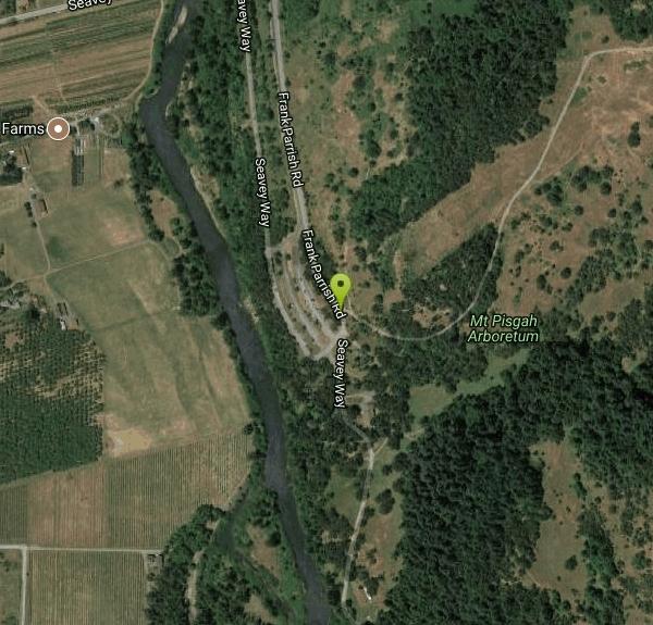
Other Hiking Trails Nearby
Spencer Butte
Eugene, Oregon
6.0 miles WIn need of a nearby hiking fix? Spencer Butte is the perfect place to get away from the city of Eugene and into the forest. Spencer Butte is a prominent landmark in Lane County, Oregon. It is...
Hike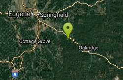
Eagle Rest
Lowell, Oregon
18.5 miles SEJust west of the Tooth Rock Viaduct, there's a one-car sized turnout on the guard rail. Lancaster designed this as part of the original road and he called it the Eagle's Nest. Originally the...
Canoe, Hike, Mountain Bike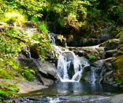
Beaver Creek Falls
Mapleton, Oregon
45.6 miles WThe Beaver Falls Trail is one of these rare spots for an outing in Columbia County. On the way, you can also visit Upper Beaver Falls, not spectacular, but a very pretty roadside attraction. As you...
Hike 1.9 mi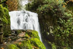
Sweet Creek Falls
Mapleton, Oregon
46.0 miles WSuperbly family friendly, this collection of small waterfalls enhances a shady hiking trail with fun bridges and metal walkways skirting the creek. Delightful year-round! In this Coast Range...
Hike


