Little Yeager Canyon Trail #533
Prescott Arizona
| Address: | Trail 533, Dewey, AZ 86327, USA |
| GPS: |
34°40'5.2"N 112°9'39.7"W Maps | Directions |
| State: | Arizona |
| Trail Length: | 2.10 miles |
| Trail Type: | Out & Back |
| MTB Trail Type: | Singletrack |
Mountain Bike
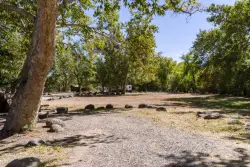
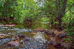
This is where the real fun is! Trail 533 is nothing but downhill, with several dirt jumps built, in case you want to get some serious air. Take this all the way down to Highway 89A. From Forest Road 105 Little Yeager Canyon Trail #533 goes west along a ridge. It then descends a steep series of switchbacks into Yeager Canyon. Yeager Canyon supports an attractive riparian corridor, where deciduous hardwoods create a canopy of shade. Fall paints the canyon in brilliant shades of yellow and gold and is an excellent time of year to explore this and other trails in the Mingus Mountain area. Fortunate visitors may spot deer, elk, and a variety of birds. Black bears also make their home in this area. Rolled rocks along the trail show where bears have passed by, turning stones in search of grubs and other insects. Portions of this trail may be overgrown with brush. Check out this USFS brochure for more info.
Courtesy of MTBProject.com
Bomb down some legit singletrack and hone your skills negotiating both shifty rock gardens and smooth, twisty singletrack. This trail is often shuttled, but many pedal it up, too. Courtesy of Singletracks.com
More Information
Never modify trail features. Ride trails when they're dry enough that you won't leave ruts. Speak up when you see others on the trail and always yield to hikers, horses, and others coming uphill. Always ride on the established trail.
Read MoreDirections
From Prescott Arizona
- Head east on E Goodwin St toward S Marina St (0.2 mi)
- Turn left at the 3rd cross street onto S Pleasant St (0.1 mi)
- Turn right onto E Gurley St (0.9 mi)
- Slight left onto AZ-89 N (3.6 mi)
- At the traffic circle, take the 2nd exit and stay on AZ-89 N (3.0 mi)
- Turn right onto the AZ-89A N ramp to AZ-69 (0.3 mi)
- Keep left, follow signs for Prescott Valley/Sedona/Flagstaff and merge onto AZ-89A N/Pioneer PkwyContinue to follow AZ-89A N(6.4 mi)
- Turn left to stay on AZ-89A N (12.2 mi)
- Turn right onto Forest 104 Route (1.5 mi)
- Turn right onto Forest 413 Route (2.6 mi)
- Turn right to stay on Forest 413 RouteDestination will be on the right(0.4 mi)

Other Mountain Bike Trails Nearby

Dead Horse Ranch State Park
Cottonwood, Arizona
10.0 miles NEBeginning road cyclists will find relatively flat paved roads with only a few gentle climbs and large parking areas perfect for practicing basic skills. Beginning mountain bikers will...
Mountain Bike
Raptor / Thumper / Kiln Loop
Cottonwood, Arizona
10.0 miles NEThis is another loop trail made by linking a few different trails together, this is very open terrain and the views of the valley and surrounding mountain ranges are amazing. No shade...
Mountain Bike
Long Canyon
Sedona, Arizona
20.5 miles NEThis is an easy "learner" ride. There are many fairly tricky rides in the Sedona area, so flag this one if you want any easy ride or if you have young or learning mountain bikers with...
Mountain Bike
Special Ed
Sedona, Arizona
22.3 miles NETechy fast flowing undulating trail. You can form a loop with other trails in teh area but this trails isn not on any map
Mountain Bike
Herkenham Trail
Sedona, Arizona
22.5 miles NEThis singletrack flows down through a canyon underneath a small power line. It is full of tight corners, small drops, loose gravel here and there, rocks, sand, cactus, great views- all...
Mountain Bike
Girdner Trail
Sedona, Arizona
22.6 miles NEThis trail runs in a North/South direction into yet another area of Sedona filled with short trails. This area is known as 'Seven Canyons' and is north of Hwy 89A, West of Dry Creek rd...
Mountain Bike
Baldwin Loop
Sedona, Arizona
22.7 miles NEThis is the loop at the end of Templeton Trail that makes a Templeton/Baldwin lollipop ride if you start at the Bell Rock Pathway. This entry describes a direct access to make the...
Mountain Bike
Ram's Head Trail
Sedona, Arizona
22.9 miles NESometimes you are traveling with kids or neophyte mountain bikers and are wondering where to take them. (I hesitate to say “beginners. They belong in the middle of a grassy...
Mountain Bike
Cockscomb Trail
Sedona, Arizona
23.4 miles NEAs with most trails in Sedona, a recreation pass is required to park your car at the trailhead. There is a kiosk at a nearby parking area. From the Cockscomb trailhead, ride to the left...
Mountain Bike
Chuck Wagon
Sedona, Arizona
23.7 miles NEChuck Wagon was adopted for mountain biking in the spring of 2012. It incorporates the original Chuck Wagon trail with what was once known locally as "Gunslinger." It is laid out in...
Mountain Bike
Cathedral Rock Trail
Sedona, Arizona
23.9 miles EStart off on the Bell Rock trail, go about 1.25 to 1.5 miles untill you locate the tunnel under Hwy 179 ( kinda hard to find without a map ). Go through the tunnel to start this fast...
Mountain Bike
Slim Shady
Sedona, Arizona
24.0 miles EMeasuring 2.4 miles one-way, the Slim Shady trail forms the backbone of the Yavapai Point trail system and connects to Made in the Shade, Hiline, and more.
Mountain Bike
Airport Mesa Trail Network
Sedona, Arizona
24.1 miles NEThere are networks of trails on all sides of Sedona. This network of trails is in the area south of Hwy 89A and north of Oak Creek. There are several possible routes and trail...
Mountain Bike
Hiline
Sedona, Arizona
24.2 miles NEHighline Trail is an expert-level mountain bike trail that is best ridden from the Village of Oak Creek side -- finishing on the Baldwin Trail loop. There is some exposure along the...
Mountain Bike
Dawa Loop
Sedona, Arizona
24.2 miles NESometimes you are traveling with kids or neophyte mountain bikers and are wondering where to take them. The following route describes a fun and fairly easy practice trail. Can't...
Mountain Bike
Ridge Trail
Sedona, Arizona
24.2 miles NEWith all of the trails available to ride around Sedona, it is easy to overlook some nice but lower profile trails south of AZ-89A in Sedona West. One benefit of riding these trails is...
Mountain Bike
Made In The Shade
Sedona, Arizona
24.2 miles EThis is a singletrack connector that joins the Templeton Trail with the Village of Oak Creek. It is great either way but probably more fun from north to south. It has moderate climbs,...
Mountain Bike
Yavapai Point Trails
Sedona, Arizona
24.2 miles NEThe Yavapai Point Trails feature some tightly-wound singeltrack trails near the trailhead, with longer trails like Slim Shady located further out.
Mountain Bike
Bell Rock Area Trails
Sedona, Arizona
24.2 miles EThe Bell Rock Area Trails is a trail system that extends from south of Courthouse Butte all the way up to the Little Horse Trail on the eastern side of Hwy 179. While this trail system...
Mountain Bike
Bell Rock Trailway
Sedona, Arizona
24.2 miles EThis 3.5 mile trail is smooth & wide and built for multiple user groups, its very popular with hikers and dog walkers. The main reason for posting it here is that it acts like a...
Mountain BikeNearby Campsites

Wolf Creek Falls
Sedona, Arizona
22.8 miles SWWolf Creek Falls is a wonderful space to explore and be immersed in nature. With it's six miles of trails, beautiful waterfalls and two campgrounds this is the perfect place to spend a...
Camp, Hike, Swim
Beaver Creek Dispersed Camping
24.5 miles E
Free dispersed camping on the cliffs above Beaver Creek.
Camp 0.4 mi
Clear Creek Campground
Camp Verde, Arizona
24.8 miles SEWest Clear Creek flows along the boundary of this desert canyon country camp and is a popular place for hiking, swimming, wading and fishing. Cool water species such as smallmouth bass and green...
Camp, Hike, Swim
Chavez Crossing
Sedona, Arizona
24.9 miles NEChavez Crossing is a campground in Sedona, Arizona. It sits perfectly nestled in Arizona's most beautiful red rock attractions along with the grand summer sunsets. If that didn't sound...
Camp, Hike, Swim
Beaver Creek Campground
Camp Verde, Arizona
25.5 miles ECamp, Canoe, Kayak, and Swim near Camp Verde, Arizona
Camp, Canoe, Kayak, Swim 0.1-0.7 mi
Cave Springs
Sedona, Arizona
32.9 miles NECave Springs Campground is a scenic campground that sits in Oak Creek Canyon. Cave Springs is nestled perfectly in the town of Sedona, giving the campground the notorious Sedona red views. Uniquely,...
Camp, Hike, Swim
Verde Hot Springs
Camp Verde, Arizona
34.5 miles SEVerde Hot Springs are a few natural hot spring pools located along the Verde River, near Sedona, Arizona. Once a resort, now all that remains are the foundations and the hot pools...
Camp, Hike, Hot Springs


