


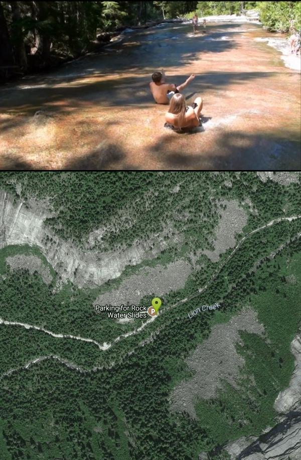
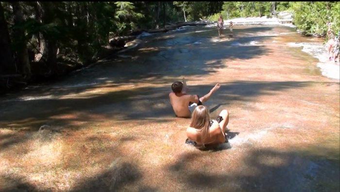
Lionhead Natural Water Slide
Coolin, Idaho

| Address: | Bonners Ferry, ID 83805, USA |
| GPS: |
48°45'29.3"N 116°43'52.9"W Maps | Directions |
| State: | Idaho |
| Trail Length: | 3.00 miles |
| Trail Type: | Out & Back |
| Trails/Routes: | 3.0 mi |
Rivers Waterfalls Streams State Park
Hike and Swim
In the lush forest just outside of Priest Lake, you’ll find a perfectly formed, natural water slide, set at just the right angle for endless hours of summer fun. Just grab a trash bag (with foam on the inside if you want a little padding), lean back, and let the current carry you!
More Information
Be courteous, informed, and prepared. Read trailhead guidelines, stay on the trail, and don't feed the wildlife.Read More
- Plan Ahead and Prepare
- Travel & camp on durable surfaces
- Dispose of waste properly
- Leave what you find
- Minimize campfire impacts
- Respect wildlife
- Be considerate of other visitors
Directions
From Coolin, Idaho
- Head southwest on Bayview Dr toward Warren Beach Dr (0.3 mi)
- Turn left onto Cavanaugh Bay Rd/E Shore RdContinue to follow E Shore Rd(22.6 mi)
- Turn right (0.2 mi)
- Turn left at the 1st cross street (0.7 mi)
- Slight left (4.1 mi)
Trails
Distance ?
3.0 miles Round TripElevation Gain ?
409 feetReal Ascent ?
439 feetReal Descent ?
30 feetAvg Grade (3°)
5%Grade (-4° to 7°)
-6% to 12%Elevation differences are scaled for emphasis. While the numbers are accurate, the cut-away shown here is not to scale.
Other Swimming Holes and Hiking Trails Nearby
Frater Lake Trail and Lake Leo Trail
Colville, Washington
35.1 miles WThe Frater Lake Trail system includes a series of loop trails. The 1.8 Tiger Loop follows the southern and eastern shores of Frater Lake. A clockwise travel direction is suggested for the steeper...
Cross-country Ski, Hike, Horseback, Mountain Bike, Snowshoe
Abercrombie Mountain Trail 117
Colville, Washington
36.2 miles WAbercrombie Mountain Trail No. 117 angles uphill through cool forest and soon begins switchbacking to gain more than 900 feet of elevation in the 1.5 miles to the junction with Silver Creek Trail...
Hike, Horseback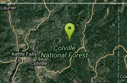
Meadow Creek Trail and Lakeshore Trail
Ione, Washington
38.1 miles WThe first 0.8 miles of this 1.5 mile trail are barrier-free. Trail activities include wildlife viewing, and fishing. Meadow Creek Trail links to a 0.8 mile side trail to a replica of a homestead...
Hike
Lake Gillette Campground
Colville, Washington
38.2 miles W3200ft elevation. 30 campsites located nearby Lake Gillette, and a multi-use trail for ORV's, hikers and bicycle riders. Other area activities include hiking and horse riding area trails,...
Camp, Hike, Swim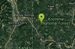
Yaak Falls Campground
Troy, Montana
39.3 miles ESwim near Troy, Montana
Swim 6.4 mi
Blacktail Lake
Sandpoint, Idaho
39.6 miles SEBlacktail Lake is one of three lakes accessed by the Moose Lake trailhead. After about a half-mile, take the trail to the Right and continue to Blacktail Lake.The trail is 3.3 miles one-way. There is...
Hike
Flodelle Creek
Colville, Washington
41.2 miles WCamping near the Little Pend Oreille River. Nearby winter snopark run by the Forest Service offers groomed ski & cross country trails.
Atv/motorcycle, Camp, Hike
Gillete Ridge Trail System
Colville, Washington
46.0 miles WGillette Ridge Trail is a 13.1 mile trail located in the state of Washington and is rated as difficult. The trail is primarily used for hiking & mountain biking and is accessible from March until...
Hike, Horseback, Mountain BikeNearby Campsites
Lake Leo Campground
Colville, Washington
36.0 miles W3200ft elevation. 8 campsites located near the lakeshore, some with lake views and all in the trees. Activities include fishing, canoeing, and motorboating.
Camp
Lake Thomas Campground
Colville, Washington
37.9 miles W3200ft elevation. 16 tree shaded campsites for tents and a few small trailers is located on a small hill close to the lake. Trail access for hiking is nearby. Other activities include fishing,...
Camp, Canoe
Big Meadow Lake Campground
Ione, Washington
38.0 miles WThis campground is equipped with tent/trailer sites, interpretive trails, boat launch, and a nice fishing dock. Some campsites are private and some with a lake view. This campground is good for...
Camp
Lake Gillette Campground
Colville, Washington
38.2 miles W3200ft elevation. 30 campsites located nearby Lake Gillette, and a multi-use trail for ORV's, hikers and bicycle riders. Other area activities include hiking and horse riding area trails,...
Camp, Hike, Swim
Beaver Lodge Campground and Resort
Colville, Washington
38.6 miles WBeaver lodge resort is nestled in Colville National Forest and located on beautiful Lake Gillette, one of four interconnected lakes of the Little Pend Oreille Lakes chain. Our resort is open year...
Camp
Flodelle Creek
Colville, Washington
41.2 miles WCamping near the Little Pend Oreille River. Nearby winter snopark run by the Forest Service offers groomed ski & cross country trails.
Atv/motorcycle, Camp, Hike
Little Twin Lakes Campground
Colville, Washington
43.7 miles W3700ft elevation. 20 campsites situated on both sides of the lake. Some campsites have great views of the lakes and wildlife. The Day-use area is good for viewing wildlife. Boating both motor and...
Camp


