Lester Park
Duluth, Minnesota
| Address: | Lakeside/Lester Park, Duluth, MN 55804, USA |
| GPS: |
46°50'27.1"N 92°0'21.0"W Maps | Directions |
| State: | Minnesota |
| Trail Length: | 3.70 miles |
| Trail Type: | Loop |
| Hike Difficulty: | Intermediate |
| Elevation Gain: | 410 feet |
| Trails/Routes: | 3.3 mi |
Picnic Tables Rivers Trails Pet Friendly Bicycles
Camp, Hike, Mountain Bike, and Swim
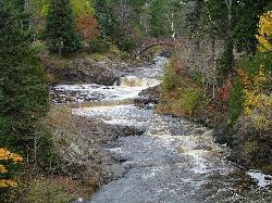
Located in Duluth, Minnesota, Lester Park was a popular destination for fishing, picnicking and other summer activities in the early 1880s. The park has been through numerous renovations and upgrades throughout the 1900s and has history rooted with the native Americans. Since the early days, Lester Park has been one of Duluth's most popular parks and young people have gathered at a place called the deeps, a large pool formed through erosion upstream where Amity Creek intersects with Lester Creek. There are certain spots in the pool that are 40 feet deep in certain spots so it's recommended for inexperienced swimmers to not swim in this pool and swim on the outskirts of the pool. In the winter time, the park is popular for it's cross country skiers and in the summer, it's popular for hikers and mountain bikers. Aside of the park, there's a trail called the Lester-Amity trail; the elevation of the trail is 410 ft. and the length of the trail is 5.1 miles. And, it's mainly for beginners to immediate mountain bikers and hikers to venture.
More Information
Add ResourceNever modify trail features. Ride trails when they're dry enough that you won't leave ruts. Speak up when you see others on the trail and always yield to hikers, horses, and others coming uphill. Always ride on the established trail.
Read MoreBe courteous, informed, and prepared. Read trailhead guidelines, stay on the trail, and don't feed the wildlife.
Read MoreDirections
From Duluth, Minnesota
- Head southwest on W 1st St (20 ft)
- Turn right at the 1st cross street onto N 1st Ave W (367 ft)
- Turn right onto W 2nd St (0.2 mi)
- Turn right onto N 1st Ave E (0.2 mi)
- Turn left onto E Michigan St (335 ft)
- Take the ramp onto I-35 N (2.2 mi)
- Take exit 259 to merge onto MN-61 N/
London Rd toward North Shore (3.3 mi) - Turn left onto N 60th Ave E (0.1 mi)
- Turn right onto E Superior St (0.2 mi)
- Turn left onto Lester River RdDestination will be on the left(0.1 mi)
Directions:
From Interstate 35 merge to London Rd. Take a left on 60th Ave East. Turn right on Superior Street, then left on Lester River Road. Parking is on the left. From Highway 61, exit on East Superior Street. Take a right on Lester River Road; parking is on the left. Courtesy of coggs.com
Trails
Distance ?
3.3 milesReal Ascent ?
915 feetReal Descent ?
913 feetGrade (-31° to 30°)
-59% to 59%Elevation differences are scaled for emphasis. While the numbers are accurate, the cut-away shown here is not to scale.
Other Mountain Bike Trails, Swimming Holes, and Hiking Trails Nearby

Lester Park
Duluth, Minnesota
0.1 miles SWSwim near Duluth, Minnesota
Swim
Amnicon Falls State Park
South Range, Wisconsin
17.0 miles SAmnicon Falls State Park features a series of delightful waterfalls and rapids along the Amnicon River which can be viewed from a covered foot bridge. There are four waterfalls in the State...
Camp, Hike, Swim
Silver Bay Area
Waite Park, Minnesota
32.5 miles NESwim near Waite Park, Minnesota
Swim


