Irish Boat Ramps
Boise, Idaho
Camp
The south ridge of Heinen is a year round scramble that starts at the edge of the reservoir, climbs steeply up an old Jeep road, then traverses up and down a series of bumps along a ridgeline in and out of pine trees. The first 1.5 miles is very steep, and if your running this, it will difficult to maintain consistent upward speed.
More Information
Directions
From Boise, Idaho
- Head southeast on I-184 E (0.2 mi)
- Continue onto W Myrtle St (0.3 mi)
- Turn right onto S 9th St (0.5 mi)
- Continue onto S Capitol Blvd (0.2 mi)
- Slight left to stay on S Capitol Blvd (0.2 mi)
- Continue onto S Federal Way (5.3 mi)
- Turn left onto ID-21 N (11.8 mi)
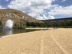
The Irish boat ramps are natural formations leading into lucky peak/Arrow rock reservoir. Head along Warm springs Ave and look for the grassy sloping hills leading into the water. Park and camp

Other Arenas Nearby

Lucky Peak Lake State Park
Boise, Idaho
5.0 miles SWLucky Peak Lake State Park is located on the side of the Boise River in the foothills of southwestern Idaho. this park offers swimming, fishing, boating, mountain biking and hiking....
Mountain Bike
Lydle Gulch - Gold
Boise, Idaho
5.1 miles SWOne of two courses above Lucky Peak Dam - an Army Corps of Engineers Recreation Area. The gold course is the upper course and the most challenging. It has one tree but you will struggle to make par....
Disc Golf
Lydle Gulch - Blue
Boise, Idaho
5.1 miles SWOne of two courses above Lucky Peak Dam - an Army Corps of Engineers Recreation Area. The Blue course is the lower and less challenging of the two. Public (No Fee)
Disc Golf
Sandy Point
Boise, Idaho
5.1 miles SWSandy Point is a beach within Lucky Peak State Park, located 8 miles southeast of Boise, Idaho. It feautures a small lake with a several amenities. The lake is mostly shallow, and cool, but...
Disc Golf, Swim
Orchard / 5 Mile / Watchman
Boise, Idaho
6.4 miles NWOrchard Gulch, 5 mile Gulch, and Watchman are three interconnected trails in the upper foothills off Rocky Canyon Rd above the Military Reserve system and above Three Bears. Good...
Mountain Bike
Julia Davis Winter Course
Boise, Idaho
6.5 miles WThe temporary 9 hole course is up for the winter. Course will be taken down March 29. GSDG has approval to try a new 9-hole course at Julia Davis during the winter months. The design is the same as...
Disc Golf
Danskin Mountain OHV Area
Boise, Idaho
7.4 miles SEThe Danskin Mountain Off-Highway Vehicle (OHV) Area encompasses 60,000 acres and provides more than 150 miles of Off-Highway Motorcycle (OHM) and All-terrain Vehicle (ATV) trails in a mountainous,...
Atv/motorcycle
Columbia Village Disc Golf Course
Boise, Idaho
7.8 miles WShort, open pitch and putt with many elevated greens. Open only to local residents. Many holes overgrown with weeds. Private (No Fee)
Disc Golf 1.4 mi
Table Rock
Boise, Idaho
7.8 miles WTable Rock is located directly above downtown Boise, Idaho and is part of the extreme southwestern portion of the Boise Mountains. It is recognizable by the tall white cross, that lights up. If...
Hike
Eagleson Road
Boise, Idaho
8.7 miles NWTwisty somewhat steep 2-track trail with a few whoops and sharp off-camber turn about 3 miles long between Boise Ridge Rd. and Crocked Summit. Good for practicing riding skills.
Atv/motorcycle
8th Street Motorcycle Trail
Boise, Idaho
8.9 miles NWThis is steep, rocky and sandy. You must be able to control your bike in sand. The motorcycles cut this trail up fairly good for the first half. Second half is more of what you would...
Mountain Bike
Three Bears #26, Trail #5, Fat Tire #42, Trail #4
Boise, Idaho
9.5 miles WNice optional route in the Boise Foothills that connects Military Reserve to 8th street and upper Hulls Gulch. You're only on the very lower end of Three Bears #26 for about 1 mile...
Mountain Bike
Shane's Loop
Boise, Idaho
9.8 miles WTake the trail that starts off along side the dirt road to start, turn up at the second parking spot from start of the trail (at the shooting range) at the top of the hill take a left,...
Mountain Bike
Military Reserve Trails
Boise, Idaho
9.9 miles WThis 460 acre natural area is named for Ft. Boise and the associated military maneuvers that were performed here between the 1860's and 1940's. The area served several purposes, including...
Hike, Mountain Bike
Lower Hulls Gulch
Boise, Idaho
9.9 miles WTake 8th street motorcycle trail east/ left out of the parking lot, follow to the creek about half a mile of fast downhill. Turn right just before the creek and follow Lower Hulls Gulch...
Mountain Bike
Fort Boise Skatepark
Boise, Idaho
10.0 miles WSkateboard near Boise, Idaho
Skateboard
Crest Line To Lower Hull's Gulch
Boise, Idaho
10.3 miles WTrial is a nice loop that starts at Crestline and comes back around on Lower Hull's
Mountain Bike
Corrals
Boise, Idaho
10.3 miles NWA generally wide trail, sometimes part of an old road, that connects over to Bob's, Scotts, or 8th Street, and is a necessary start to access Hard Guy. Less used that Hulls Gulch or...
Mountain Bike
kestrel, military connector, shanes, watchman
Boise, Idaho
10.7 miles Whard pack, very little technical parts, narrow and steep on watchmans, some good challenging climbs
Mountain Bike
Corral Loop
Boise, Idaho
10.7 miles WTrail is easy double track with gradual climb. Continue on main trail until it curves left up a steep hill. Stay on obvious track to the right. Continues until you come to an old run...
Mountain BikeNearby Campsites

Badger Creek Campground
Boise City-Nampa, ID, Idaho
15.0 miles E3200-foot elevation. 5 campsites on the Middle Fork of the Boise River. Fishing for rainbow and cutthroat trout, and whitefish. The William Pogue National Recreational Trail is a few miles north of...
Camp
Loftus Hot Spring
Mountain Home, Idaho
21.5 miles NECamp and Hot Springs near Mountain Home, Idaho
Camp, Hot Springs
Roystone Hot Springs
Emmett, Idaho
31.0 miles NWRoystone Hot Springs in Sweet, Idaho, is the best location to relax and have fun! About 50 minutes from Boise, Roystone offers a private heated pool, huge hot tub, party room, and recreation area.
Camp, Hot Springs
Pine Flat Hot Springs
Garden Valley, Idaho
36.1 miles NEPine Flat Hot Springs is a popular soaking location near the Pine Flat Campgrounds. On the edge of the South Fork Payette River there are several hot springs moving up thee bank. The most popular of...
Camp, Canoe, Hike, Hot Springs, Kayak, Whitewater
Kirkham Hot Springs Campground
Lowman, Idaho
40.2 miles NEKirkham Hot Springs, located near the official Boise National Forest campground of the same name, features somewhat shallow rock pools (unimproved) with sand/rock bottoms next to the river. The...
Camp, Hot Springs
Park Creek Campground
Lowman, Idaho
41.9 miles NEThis smaller sized campground is situated in a lovely old-growth forested setting along Park Creek in the Baker Lake basin. This tranquil setting is in close proximity to the shores of Baker Lake...
Camp
Bruneau Dunes
Bruneau, Idaho
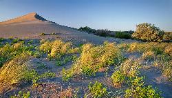
48.8 miles SBruneau Dunes State Park is home to the tallest single structure sand dune in North America, standing 470 ft above small lakes and campgrounds. The park itself is home to a wide variety of...
Camp, Canoe, Hike, Horseback


