Inferno Cone
Visitors Center, Craters of the Moon National Monument
| Address: | Inferno Cone, Idaho 83213, USA |
| GPS: |
43°26'35.7"N 113°33'7.1"W Maps | Directions |
| State: | Idaho |
| Trails/Routes: | 0.4 mi |
Restrooms Pet Friendly Bicycles Motorized Use
Hike
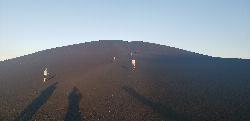
Cinder cones form when gas-rich volcanic froth erupts high into the air and then piles into a mound. Climb Inferno Cone, if you wish, but don't be disappointed if you are unable to locate the source of the eruption at the top. These cinders were actually blown by the wind, and possibly squirted in this direction, from a vent far below near the Spatter Cones parking lot.
The trail to the top of Inferno Cone is steep, but rewards you with panoramic views of the Great Rift, Snake River Plain, and Pioneer Mountains. On clear days you may see the Teton Range, 100 miles to the east. Do not climb in high winds! You will be very exposed and the cinders are sometimes picked up by the wind.Courtesy of nps.gov
More Information
Add ResourceBe courteous, informed, and prepared. Read trailhead guidelines, stay on the trail, and don't feed the wildlife.
Read MoreDirections
From Visitors Center, Craters of the Moon National Monument
- Head east on Loop RdParts of this road may be closed at certain times or days(2.8 mi)
- Turn left to stay on Loop RdMay be closed at certain times or days(0.1 mi)
Trails
Distance ?
0.4 miles Round TripElevation Gain ?
153 feetReal Ascent ?
155 feetReal Descent ?
2 feetAvg Grade (8°)
13%Grade (-2° to 15°)
-4% to 27%Elevation differences are scaled for emphasis. While the numbers are accurate, the cut-away shown here is not to scale.
Other Hiking Trails Nearby
Spatter Cones
Visitors Center, Craters of the Moon National Monument
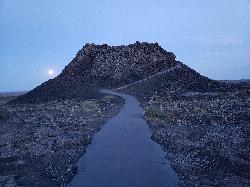
0.3 miles WThese miniature volcanoes formed when blobs of molten lava were lobbed into the air during the last gasp of an eruption sequence that ended about 2,100 years ago. Craters of the Moon is well known...
Hike
Snow Cone
Visitors Center, Craters of the Moon National Monument
0.3 miles WHike near Visitors Center, Craters of the Moon National Monument
Hike 1.8 mi
North Crater Trail
Visitors Center, Craters of the Moon National Monument
0.3 miles WThis one-way trail is especially interesting for its variety. The trail traverses North Crater and drops into the crater mouth, the vent for the North Crater flow. Notice that the northwest flank of...
Hike 0.5 mi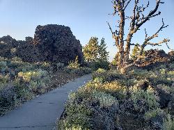
Devil's Orchard Trail
Visitors Center, Craters of the Moon National Monument
0.9 miles NEThis paved trail explores an area of cinder beds scattered with pieces of the North Crater wall. Exhibits along the trail challenge you to consider the difficulties of protecting this fragile...
Hike 1.0-1.3 mi
Caves Trail
Visitors Center, Craters of the Moon National Monument
0.9 miles ECave and Hike near Visitors Center, Craters of the Moon National Monument
Cave, Hike
North Crater Flow
Arco, Idaho
1.0 miles NHike near Arco, Idaho
Hike 1.7 mi
Broken Top Loop Trail
Visitors Center, Craters of the Moon National Monument
1.1 miles SThe Broken Top Loop Trail provides an opportunity to hike over, under and around the youngest volcano on the Snake River Plain. The event that created this cinder cone and associated lava flows...
Cave, Hike 1.9 mi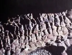
Tree Molds Trail
Visitors Center, Craters of the Moon National Monument
1.1 miles SWhen molten lava advanced through this area it flowed through a grove of living trees. As the trees burned, moisture was released as steam, cooling the hot lava just enough to leave an impression of...
Hike 8.8 mi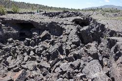
Wilderness Trail
Visitors Center, Craters of the Moon National Monument
1.1 miles SYou will have a sense of solitude as you travel into the Craters of the Moon Wilderness. Begin the trail on the sidewalk that parallels the roadway and turn right to follow the direct route across a...
Cave, Hike 0.6 miHidden Mouth Cave
Moore, Idaho
36.4 miles NIt is a surprisingly large cave with three distinct chambers and a secret exit at the back for those who don't mind climbing a precariously balanced log. You can take a quad/four-wheeler half...
Cave, Hike 7.9 mi
Borah Peak
Mackay, Idaho
49.6 miles NThis is the highest peak in all of Idaho, standing 12,662 ft along the Lost River Range. There are several routes that can be taken in order to reach the summit with different levels of difficulty...
HikeNearby Campsites

Lava Flow Campground
Arco, Idaho
1.3 miles NAs unique as its name, campsites are surrounded by a young lava flow. The campground is located near the visitor center and popular trails. Campground opened on May 30. Campground generally closes...
Camp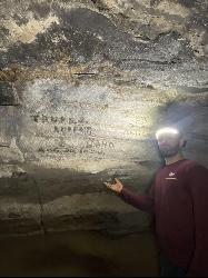
Kimama Wind Caves
Paul, Idaho
49.4 miles SThe Kimama Wind Caves are a series of lava tubes accessed by a crack in the middle of the desert north of Paul, Idaho. These lava tubes create a labyrinth of tunnels to explore. These tunnels should...
Camp, Cave


