Indian Creek Loop
Littleton, Colorado
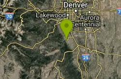
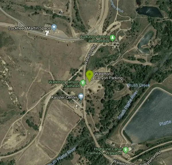
| Address: | ~11338 Waterton Rd, Littleton, CO 80125, USA |
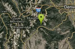
| GPS: |
39°29'28.5"N 105°5'37.2"W Maps | Directions |
| State: | Colorado |
| Trail Length: | 29.00 miles |
| MTB Difficulty: | Intermediate |
| Trail Type: | Lariat |
| MTB Trail Type: | Singletrack |
Mountain Bike
The first and last 6 miles of this trail are on the gravel road that goes through Waterton Canyon, meaning your total off-road trail distance will be about 17 miles (29 miles total). Nonetheless, there is a lot of climbing and some route finding skills required, which means this ride has the potential to be MUCH longer than you anticipate. If you carry a good map with you, there should be few problems. If you grab the Trails Illustrated Map #135 for Deckers and Rampart Range, it has a blowup view of this entire trail system on the back and shows the loop almost perfectly.The first 6 miles will take you up to the dam. You will continue on up the fire road until it ends and changes into singletrack (beginning the Colorado Trail). This will continue to climb for about another mile until you reach the bench at the top. From here you will notice a trail spur on the left just before you reach the bench, heading uphill. This begins a short, but intense climb to the next intersection which is about º mile or so from the bench. At this intersection you will notice the trail going left (back to Waterton) or to the right (uphill) heading onto the Indian Creek Loop. Begin climbing once again as the trail strives to get to the ridgeline for about the next half mile or so. You will finally reach a steep, loose section of trail which goes straight up, then to the left. Once you clear this nasty section, it levels off from there. This will be the last of the really bad climbs for quite some time.Now that you are on the ridgeline, the trail does some gentle uphills interspersed with slight descents. Eventually you will roll off the east side of the hill and a quick, but steep descent puts you at a T intersection. Note that the left trail is NOT on the trails illustrated map. If you turn left into Stevens Gulch, this will take you down a fun, fast descent back towards the Roxborough Loop (make sure you make a left when you reach the homestead!). If you turn right at this T, this will continue you on the journey towards the Indian Creek campground (the mid-way point of this ride). Now, the trail becomes a fun downhill as it tracks down to the creek bed. Once you reach that point, you will start to gradually go back up as you follow the creek for another mile or so. This is a very scenic portion of the ride, and nice and cool in the shade of the forest. There will be some tiring climbs as you get closer to the campground, but they are mostly just long grinds on easy terrain. After a final little rock obstacle, you will be in the campground.From here, proceed to the latrine and potable water faucet. You should see the clearly marked singletrack peeling off to the left, up the hill. Once you refill your water, head back up the trail and begin another set of climbs. Note that this section of trail is NOT on the trails illustrated map. The grade here is pretty gentle, although you will be going uphill until you reach the fire road. There will be several roads/trails at this intersection, but only one should be marked with the Indian Creek signage (as you come off the singletrack, look straight across and to the left down the hill). This next section is on a fire road, but it is fast and fun because most of it goes downhill from this point. You will come to a few odd intersections, but the trail is well marked the whole way. At one Y intersection there was some deliberation on our route because the sign has an arrow which points between the two roadsÖbut at this point you want to go up to the left. The left route was also well used in comparison to the right fork.As you get closer to the Roxborough State Park, beware of the huge ìspeed bumpsî someone has put in all along the trail. These really are big jumps, but they are at odd intervals and around corners so they may take you by surprise if you arenÃt paying attention. Because of their sharp angles, they are extremely dangerous to hit at even medium speed. One guy in the group riding ahead of us broke his collarbone because he took these just slightly too fast. The fire road eventually begins to return to singletrack, especially once you reach the power lines. At this point, you will get some incredible singletrack, blasting you through the forest as you cheer in delight. You absolutely cannot miss the signage once you enter the State Park, but the singletrack generally continues along the creek bed here. Your fun will end as you reach another tough climb out of the canyon (luckily it is rather short). Your journey will go downhill again from here, and at one point you will come to an incredible meadow with just a ribbon of singletrack laid out before you. If you can force yourself to stop, this is a great place for a snapshot!Once you reach the creek crossing, you will begin one more little set of climbs as you get ready to go back down into Waterton Canyon. Once you start the downhill again, it doesnÃt let up until you are back down at the Waterton Canyon gravel road. This section of trail is like a loose chute with lots of dust and loose rocksÖbut it can be a lot of fun as well. There will be one intersection you pass with a trail going off to your left as you get back on the Roxborough Loop, but just continue straight downhill rather than making a left. The signs all point you towards Waterton Canyon from here. Once we popped out, we all agreed that despite the amount of climbing we suffered through, the payoff was well worth the effort. IÃm not sure if there is any merit in doing the loop in the reverse direction, although it is worth mentioning that I canÃt recall passing anyone in all those miles going the opposite direction. Also note this is an equestrian loop as well, so best practice is to dismount when you see horses, pull off the trail and be friendly to them. Courtesy of Singletracks.com
More Information
Add ResourceNever modify trail features. Ride trails when they're dry enough that you won't leave ruts. Speak up when you see others on the trail and always yield to hikers, horses, and others coming uphill. Always ride on the established trail.
Read More- Plan Ahead and Prepare
- Travel & camp on durable surfaces
- Dispose of waste properly
- Leave what you find
- Minimize campfire impacts
- Respect wildlife
- Be considerate of other visitors
Directions
From Littleton, Colorado
- Head south (33 ft)
- Turn left toward S Prince St (115 ft)
- Turn right at the 1st cross street onto S Prince St (0.2 mi)
- Turn right onto Church Ave (0.3 mi)
- Turn left onto S Santa Fe Dr (3.2 mi)
- Slight right to merge onto CO-470 W (2.7 mi)
- Take the CO-121 S exit (0.3 mi)
- Turn left onto CO-121 S/S Wadsworth Blvd (4.4 mi)
- Turn left onto Waterton Rd (0.3 mi)
- Turn left (95 ft)
- Turn leftDestination will be on the right(49 ft)
Other Mountain Bike Trails Nearby

Colorado Trail: Waterton To South Platte
Littleton, Colorado
0.0 miles E*Note: Waterton Canyon will be closed for for two extended periods in 2010 and 2011: 8/2/2010 - 12/3/2010 and 2/28/2011 - 12/31/2011. Alternate access to the first section of the...
Mountain Bike
Colorado Trail
Littleton, Colorado
0.2 miles SWAmazing singletrack, killer views, and lung busting elevation - what more could you ask for? Portions of the Colorado Trail are off limits to bikes so you'll need to detour around each...
Mountain Bike
Dirt Jumps
Littleton, Colorado
5.1 miles Nthese jumps are under the first set of tress you'll see. There are some good jumps in there i wouldn't make the trip if you live farther then 5 miles.
Mountain Bike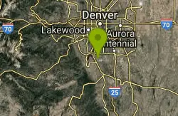
Plum Creek Park
Littleton, Colorado
5.5 miles NEThis is the shortest single track ever but it is a good trail for beginners and practice for the big stuff. It is a little sandy and slightly downhill. There ar5e a few small turns but...
Mountain Bike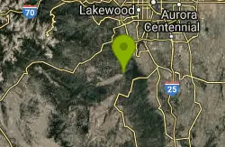
North Fork
Littleton, Colorado
7.1 miles SWThis is a new machine-made singletrack, that largely runs on the side of mtn's. Can be done either as out/back, with folks usually starting at the bottom next to the South Platte...
Mountain Bike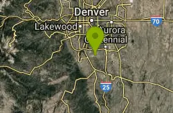
Highlands Point
Highlands Ranch, Colorado
7.2 miles EThe section of trails at Highlands Point can be accessed from Mountain Vista High School or via the East-West Regional trail parking lot on Griggs rd. Note that all but two of these...
Mountain Bike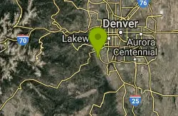
Ken Caryl Valley
Littleton, Colorado
7.9 miles NWSingle Track linked togather with a couple short road segments
Mountain Bike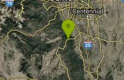
Devil's Head Stretch
Sedalia, Colorado
7.9 miles SDevil's Head Stretch is a multi-use trail that is full of moto-carved rollers, berms, dips, chutes, and off-shoots. It is densely populated with dirt-bikes on the weekends.This trail...
Mountain Bike
Colorado Trail: South Platte To Buffalo Creek
Conifer, Colorado
8.0 miles WThe initial climb out of the parking lot is by far the hardest part of this section of the Colorado Trail. Within the past several years, a re-routed portion of trail was created and...
Mountain Bike
East-West Regional Trail
Littleton, Colorado
9.8 miles E-- "This is the first leg of the East-West Regional Trail that will connect Chatfield State Park with the Town of Parker. The trail winds through grasslands and oak bluffs including...
Mountain Bike
Meyer Ranch Park
Morrison, Colorado
10.2 miles WThere's nothing special about this ride, but a good little spot to ride a couple of miles if you're coming back from the mountains and have had quite enough for the day. This is a...
Mountain Bike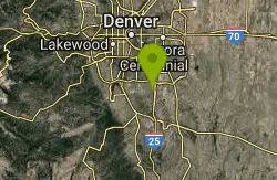
Bluffs Regional Park Trail
Lone Tree, Colorado
11.3 miles EThis is a multi-use trail made of crushed gravel. There are no technical features at all, but it is good for a lunchtime lap or for a couple of laps after work. It's also good for...
Mountain Bike
Bear Creek Lake Park
Lakewood, Colorado
11.9 miles NThis is a good trail system to ride when the foothills and mountains are covered in snow. Located just to the south of Green Mountain, it provides a close-in alternative for riders to...
Mountain Bike
Glendale Open Space Trail
Castle Rock, Colorado
11.9 miles EAdjacent to I-25, the 160-acre property has native chokecherry and wild plum shrubs along an intermittent stream. The trail winds up into Gambel oak shrubland and onto a grassland plain...
Mountain Bike
5-Parks
Morrison, Colorado
12.2 miles NWLink up of several parks above Morrison.
Mountain Bike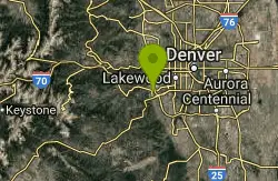
Mount Falcon Park
Morrison, Colorado
12.6 miles NWThe ride is actually a 'lollipop' configuration with an out and back attached to a loop at the top. Ride up the Castle trail where you'll climb about 1800 feet in 3.5 miles. Once you...
Mountain Bike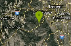
Flying J Ranch
Conifer, Colorado
12.8 miles WSuper easy singletrack with a couple of very short challenging sections. Very possibly the best beginner's trail on the Front Range and just a lovely little park. Going clockwise on...
Mountain Bike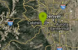
Green Mountain
Lakewood, Colorado
13.1 miles NThis park has three parking areas. The loop is the same from all. From any trailhead, begin a clockwise loop in the park. On the south-east sides of the park, this loop maintains fairly...
Mountain Bike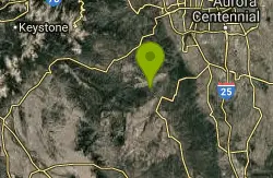
Colorado Trail: Green Mountain
Pine, Colorado
13.4 miles SWThis is the trail Leah and I have been looking for since we moved to Colorado. Sweet, smooth singletrack, beautiful scenery, and a good mix of climbs and descents. This is easily my...
Mountain Bike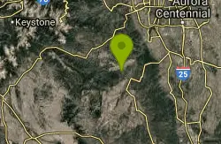
Chair Rocks
Pine, Colorado
13.4 miles SWThe first five and a half miles of this route follow the Colorado Trail. Find the signs that show you to the trail and head north for about a mile where the trail crosses the road...
Mountain Bike